Doe River | |
---|---|
Location | |
Country | United States |
State | Tennessee |
Region | Northeast Tennessee |
District | Carter County |
Municipality | Elizabethton |
Physical characteristics | |
Source | Roan Mountain (Roan Highlands) |
• location | Roan Mountain, Tennessee, Northeast Tennessee, United States |
• coordinates | 36°08′49″N82°08′39″W / 36.1470607°N 82.1442922°W |
Mouth | Watauga River |
• location | Elizabethton, Tennessee, Northeast Tennessee, United States |
• coordinates | 36°21′25″N82°12′48″W / 36.3570526°N 82.2134656°W Coordinates: 36°21′25″N82°12′48″W / 36.3570526°N 82.2134656°W |
Basin features | |
Tributaries | |
• left | McCathern Spring |
• right | Little Doe River |
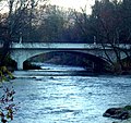
The Doe River is a tributary of the Watauga River in northeast Tennessee in the United States. [1] The river forms in Carter County near the North Carolina line, just south of Roan Mountain State Park, and flows to Elizabethton.
The Doe River flows from the northern slopes of Roan Mountain, through Roan Mountain State Park and the center of Roan Mountain, Tennessee, then continues to flow west and is paralleled by U.S. Route 19E. The stream then flows to the east of Fork Mountain; while the Little Doe River flows by Fork Mountain to the west.
Pushing through a mountain gap just north of Hampton, Tennessee, the volume of the Doe River is increased by the waters flowing from McCathern Spring. Below the confluence of both the Doe River and the Little Doe River at Hampton, the Doe River travels roughly in a northern direction through the Valley Forge community, and is rejoined by U.S. Route 19E outside of Elizabethton.
Flowing parallel with U.S. Highway 19-E, the Doe River flows underneath two 19-E bridges at the East Side community before heading in a northwest angle toward the Elizabethton downtown business district. The Elizabethton Covered Bridge is located in downtown Elizabethton, the county seat of Carter County. Connecting 3rd Street and Hattie Avenue, the historic 1882 covered bridge spans the river is adjacent to a city park and county government areas. The bridge is open to pedestrians and bicyclists, but is closed to motor vehicle traffic.
The Doe River spills over a weir dam immediately downstream of the covered bridge, and flows under two 1928 concrete arch bridges in Elizabethton, prior to its confluence with the Watauga River. The first concrete arch bridge is the Elk Avenue Bridge in downtown Elizabethton; the second is locally known as the Broad Street Bridge and carries traffic on Tennessee State Route 67.
Most of the Doe River section running between the Valley Forge put-in (LAT 36.310833 LONG -82.193055) and the take-out just before the Elizabethton confluence is classified on the International Scale of River Difficulty as Class/Grade I; however there are several brief segments of the Valley Forge-Charity Hill-East Side run that should be approached as Class/Grade II. It takes approximately three hours to float down the Doe River on inner tubes from the Valley Forge put-in to the take-out near the confluence of the Doe River into the Watauga River. Putting in at Hampton High School and taking out at Valley Forge Elementary involves running class 2/3 rapids and is more difficult that the section below Valley Forge school.
All river tubes and kayaks must portage around the weir dam that is located immediately downstream of the covered bridge in downtown Elizabethton.
There is a Class III/IV section of whitewater referred to as the Doe Gorge that begins at the bridge over the river on Bear Cage Rd. and ends at the take-out at Hampton High School. This sections drops between 100 and 160 feet per mile. The gorge is for advanced paddlers only. Paddling through Roan Mtn State Park has been done many times but is not as well documented as the popular gorge section downstream.
Unlike the Tennessee Valley Authority (TVA) regulated flow of the Watauga River, the water level of the Doe River often fluctuates with changes in rain fall or drought. Another significant difference between the two Carter County rivers is the variation of water temperatures: while the year round water temperature of the Watauga River is approximately 52-53 degrees Fahrenheit, the water temperature of the Doe River will vary along with the ambient air temperature. The Doe River is generally very comfortable for kayaking and river tubing during the summer months.
The Doe River valley is infrequently subject to severe flooding. The Doe River drains from a mountainous region that can be subject to seasonal heavy rains (May-early June) and snow melts, and the Doe River stream course is in many parts quite steep, allowing water levels to rise rapidly along the river banks. The last severe recent flooding of the Doe River occurred overnight from January 7 through January 8, 1998, with the sudden storms bringing down seven inches (178 mm) of rain in twelve hours and causing the deaths of seven people (including Kingsport rescue worker Carles "Junior" Godsey after his rescue boat overturned in the Doe River flood waters) in the Hampton area. The 1998 Doe River flood created approximately $20 million in Carter County property damages. [2]
Climate of Doe River in Elizabethton, Tennessee | |||||||||||||
Month | Jan | Feb | Mar | Apr | May | Jun | Jul | Aug | Sep | Oct | Nov | Dec | Annual |
---|---|---|---|---|---|---|---|---|---|---|---|---|---|
Avg °F(°C) | 34.0°F1.1°C | 37.4°F3.0°C | 47.2°F8.4°C | 55.2°F12.9°C | 63.4°F17.4°C | 71.1°F21.7°C | 74.4°F23.6°C | 73.6°F23.1°C | 67.9°F19.9°C | 56.7°F13.7°C | 47.0°F8.3°C | 38.2°F3.4°C | 55.5°F13.1°C |
Avg high °F(°C) | 43.7°F6.5°C | 48.0°F8.9°C | 58.9°F14.9°C | 67.4°F19.7°C | 75.2°F24.0°C | 82.2°F27.9°C | 84.6°F29.2°C | 84.1°F28.9°C | 79.1°F26.2°C | 69.1°F20.6°C | 58.2°F14.6°C | 48.1°F8.9°C | 66.6°F19.2°C |
Avg low °F(°C) | 24.3°F -4.3°C | 26.8°F -2.9°C | 35.4°F1.9°C | 43.0°F6.1°C | 51.6°F10.9°C | 59.9°F15.5°C | 64.1°F17.8°C | 63.1°F17.3°C | 56.6°F13.7°C | 44.2°F6.8°C | 35.9°F2.2°C | 28.2°F-2.1°C | 44.4°F6.9°C |
Rain (inches) | 3.2 in. | 3.4 in. | 3.7 in. | 3.3 in. | 3.8 in. | 3.5 in. | 4.3 in. | 3.2 in. | 3.3 in. | 2.6 in. | 2.9 in. | 3.4 in. | 40.7 in. |
Snow (inches) | 5.2 in. | 4.2 in. | 2.3 in. | 0.4 in. | 0.05 in. | 0.05 in. | 0.0 in. | 0.0 in. | 0.05 in. | 0.0 in. | 0.9 in. | 2.6 in. | 15.6 in. |
Sources for Doe River in Elizabethton (Bristol-Johnson City, Tennessee) climate statistics: climate-zone.com' [3] |
Carter County is a county located in the U.S. state of Tennessee. As of the 2010 census, the population was 57,424. Its county seat is Elizabethton. The county is named in honor of Landon Carter (1760-1800), an early settler active in the "Lost State of Franklin" 1784-1788 secession from the State of North Carolina. Carter County is part of the Johnson City, TN Metropolitan Statistical Area, which is a component of the Johnson City–Kingsport–Bristol, TN-VA Combined Statistical Area, located in northeastern Tennessee.
Elizabethton is a city in, and the county seat of Carter County, Tennessee, United States. Elizabethton is the historical site of the first independent American government located west of both the Eastern Continental Divide and the original Thirteen Colonies.
The Iron Mountains are a subrange of the Blue Ridge Mountains. These mountains are located around the common meeting point of Tennessee, Virginia, and North Carolina.
The French Broad River is a river in the U.S. states of North Carolina and Tennessee. It flows 218 miles (351 km) from near the town of Rosman in Transylvania County, North Carolina, into Tennessee, where its confluence with the Holston River at Knoxville forms the beginning of the Tennessee River. The river flows through the counties of Transylvania, Buncombe, Henderson, and Madison in North Carolina, and Cocke, Jefferson, Sevier, and Knox in Tennessee. It drains large portions of the Pisgah National Forest and the Cherokee National Forest.
The Watauga River is a large stream of western North Carolina and East Tennessee. It is 78.5 miles (126.3 km) long with its headwaters in Linville Gap to the South Fork Holston River at Boone Lake.
The Caney Fork River is a river that flows through central Tennessee in the United States, draining a substantial portion of the southwestern Cumberland Plateau and southeastern Highland Rim regions. It is a major tributary of the Cumberland River, and is part of the Cumberland, Ohio and Mississippi basins. The river is 143 miles (230 km) long, and its watershed covers 1,771 square miles (4,590 km2) in eleven counties. Monterey, Baxter, Sparta, Smithville, McMinnville, Altamont, Spencer and Gordonsville are among the towns that are at least partially drained by the river.
The Nolichucky River is a 115-mile (185 km) river that flows through Western North Carolina and East Tennessee, in the southeastern United States. Traversing the Pisgah National Forest and the Cherokee National Forest in the Blue Ridge Mountains, the river's watershed is home to some of the highest mountains in the Appalachians, including Mount Mitchell in North Carolina, the highest point in the eastern United States. The river is a tributary of the French Broad River, and is impounded by Nolichucky Dam near Greeneville, Tennessee.
The Cheat River is a 78.3-mile-long (126.0 km) tributary of the Monongahela River in eastern West Virginia and southwestern Pennsylvania in the United States. Via the Ohio River, the Cheat and Monongahela are part of the Mississippi River watershed. Owing to the ruggedness of the surrounding Allegheny Mountains, the Cheat remains largely remote with few settlements or developments along its banks. Its headwaters are in the Cheat-Potomac Ranger District of the Monongahela National Forest.
The Tennessee Valley is the drainage basin of the Tennessee River and is largely within the U.S. state of Tennessee. It stretches from southwest Kentucky to north Alabama and from northeast Mississippi to the mountains of Virginia and North Carolina. The border of the valley is known as the Tennessee Valley Divide. The Tennessee Valley contributes greatly to the formation of Tennessee's three legally recognized sectors.
The Elk River is a large stream in the North Carolina High Country and East Tennessee. The headwaters begin from the Northwestern slopes of Peak Mountain in Avery County, North Carolina and end at the Watauga River in Carter County, Tennessee.
The Sycamore Shoals of the Watauga River, usually shortened to Sycamore Shoals, is a rocky stretch of river rapids along the Watauga River in Elizabethton, Tennessee. Archeological excavations have found Native Americans lived near the shoals since prehistoric times, and Cherokees gathered there. As Europeans began settling the Trans-Appalachian frontier, the shoals proved strategic militarily, as well as shaped the economies of Tennessee and Kentucky. Today, the shoals are protected as a National Historic Landmark and are maintained as part of Sycamore Shoals State Historic Park.
Watauga Lake, located east of Elizabethton, Tennessee, is the local name of the Watauga Reservoir created by the Tennessee Valley Authority (TVA) with the 1948 completion of the TVA Watauga Dam.
The Bee Cliff is a prominent northeast Tennessee geological limestone feature with high caves that overlooks the Watauga River and the Siam community of Carter County, Tennessee.
The Elizabethton Covered Bridge is a 134-foot (41 m) covered bridge over the Doe River in Elizabethton, the county seat of Carter County, Tennessee.
Hampton is an unincorporated community and Census-designated place in Carter County, Tennessee, United States. Located a few miles southeast of Elizabethton and northwest of Roan Mountain, Hampton is surrounded on all sides by the Unaka Mountains. It is part of the Johnson City Metropolitan Statistical Area, which is a component of the Johnson City–Kingsport–Bristol, TN-VA Combined Statistical Area – commonly known as the "Tri-Cities" region.
State Route 67 is a state-maintained highway in northeastern Tennessee, including a four-lane divided highway segments in both Washington County and Carter County, and part of a significant two-lane segment passing over the Butler Bridge some 80 feet (24 m) above the TVA Watauga Reservoir near Butler in Johnson County, Tennessee.
Watauga Dam is a hydroelectric and flood control dam on the Watauga River in Carter County, in the U.S. state of Tennessee. It is owned and operated by the Tennessee Valley Authority, which built the dam in the 1940s as part of efforts to control flooding in the Tennessee River watershed. At 318 feet (97 m), Watauga is the second-highest dam in the TVA river and reservoir system, and at the time of its completion was one of the highest earth-and-rock dams in the United States. The dam impounds the TVA Watauga Reservoir of 6,430 acres (2,600 ha), and its tailwaters feed into Wilbur Lake.
Wilbur Dam is a hydroelectric dam on the Watauga River in Carter County, in the U.S. state of Tennessee. It is one of two dams on the river owned and operated by the Tennessee Valley Authority. The dam impounds Wilbur Lake, which extends for about 3 miles (4.8 km) up the Watauga to the base of Watauga Dam. Wilbur Dam was completed in 1912 making it the second oldest dam in the TVA system behind Ocoee Dam No. 1. Wilbur Dam was one of the first major hydroelectric projects in Tennessee, and remains one of the oldest dams in the TVA system.
State Route 91 is a state highway in the northeastern portion of the U.S. state of Tennessee, in the area known as the Tri-Cities region. The route connects Johnson City with Damascus, Virginia via Elizabethton, Hunter, and Mountain City.