Dog Run (Buffalo Creek tributary)

Last updated • a couple of secsFrom Wikipedia, The Free Encyclopedia
Dog Run
Tributary to Buffalo Creek
USA Pennsylvania relief location map.svg
Red pog.svg
Location of Dog Run mouth
Usa edcp relief location map.png
Red pog.svg
Dog Run (Buffalo Creek tributary) (the United States)
Location
Country United States
State Pennsylvania
County Washington
Physical characteristics
SourceNorth Prong Castleman Run divide
  locationabour 2 miles south of Dunsfort, Pennsylvania
  coordinates 40°10′02″N080°30′13″W / 40.16722°N 80.50361°W / 40.16722; -80.50361 [1]
  elevation1,170 ft (360 m) [2]
Mouth Buffalo Creek
  location
Dunsfort, Pennsylvania
  coordinates
40°11′19″N080°30′07″W / 40.18861°N 80.50194°W / 40.18861; -80.50194 Coordinates: 40°11′19″N080°30′07″W / 40.18861°N 80.50194°W / 40.18861; -80.50194 [1]
  elevation
843 ft (257 m) [3]
Length2.31 mi (3.72 km) [4]
Basin size1.33 square miles (3.4 km2) [5]
Discharge 
  location Buffalo Creek
  average1.66 cu ft/s (0.047 m3/s) at mouth with Buffalo Creek [5]
Basin features
Progression Buffalo CreekOhio RiverMississippi RiverGulf of Mexico
River system Ohio River
Tributaries 
  leftunnamed tributaries
  rightunnamed tributaries
BridgesDry Ridge Road

Dog Run is a 2.31 mi (3.72 km) long 1st order tributary to Buffalo Creek in Washington County, Pennsylvania.

Contents

Course

Dog Run rises about 2 miles south of Dunsfort, Pennsylvania, in Washington County and then flows north and northwest to join Buffalo Creek at Dunsfort. [3]

Watershed

Dog Run drains 1.33 square miles (3.4 km2) of area, receives about 40.2 in/year of precipitation, has a wetness index of 300.49, and is about 78% forested. [5]

See also

Related Research Articles

Buffalo Run (Sewickley Creek tributary) Stream in Pennsylvania, USA

Buffalo Run is a 3.89 mi (6.26 km) long 3rd order tributary to Sewickley Creek in Westmoreland County, Pennsylvania.

Robinson Run (Chartiers Creek tributary) Stream in Pennsylvania, USA

Robinson Run is a 15.90 mi (25.59 km) long 2nd order tributary to Chartiers Creek in Allegheny and Washington Counties, Pennsylvania.

Millers Run (Chartiers Creek tributary) Stream in Pennsylvania, USA

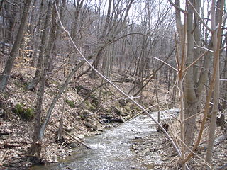
Millers Run is a 12.24 mi (19.70 km) long 3rd order tributary to Chartiers Creek in Allegheny and Washington Counties, Pennsylvania.

Coal Run (Chartiers Creek tributary) Stream in Pennsylvania, USA

Coal Run is a 4.37 mi (7.03 km) long 2nd order tributary to Chartiers Creek in Allegheny and Washington Counties, Pennsylvania.

Painters Run (Buffalo Creek tributary) Stream in West Virginia, USA

Painters Run is a 2.65 mi (4.26 km) long 1st order tributary to Buffalo Creek in Brooke County, West Virginia.

Greens Run (Buffalo Creek tributary) Stream in West Virginia, USA

Greens Run is a 2.01 mi (3.23 km) long 2nd order tributary to Buffalo Creek in Brooke County, West Virginia.

Titt Run Stream in West Virginia, USA

Titt Run is a 2.71 mi (4.36 km) long 1st order tributary to Buffalo Creek in Brooke County, West Virginia. This is the only stream of this name in the United States.

Hukill Run Stream in West Virginia, USA

Hukill Run is a 2.12 mi (3.41 km) long 1st order tributary to Buffalo Creek in Brooke County, West Virginia. It is likely named for the landowner that owns the confluence of this run and Buffalo Creek.

Georges Run (Chartiers Creek tributary) Stream in Pennsylvania, USA

Georges Run is a 5.11 mi (8.22 km) long 2nd order tributary to Chartiers Creek in Washington County, Pennsylvania.

Catfish Creek (Chartiers Creek tributary) Stream in Pennsylvania, USA

Catfish Creek is a 3.83 mi (6.16 km) long 2nd order tributary to Chartiers Creek in Washington County, Pennsylvania.

Hogtan Run Stream in West Virginia, USA

Hogtan Run is a 1.80 mi (2.90 km) long 1st order tributary to Buffalo Creek in Brooke County, West Virginia. This is the only stream of this name in the United States.

Stotts Run Stream in West Virginia, USA

Stotts Run is a 1.77 mi (2.85 km) long 2nd order tributary to Buffalo Creek in Brooke County, West Virginia. This is the only stream of this name in the United States.

Castleman Run Stream in West Virginia, USA

Castleman Run is a 7.54 mi (12.13 km) long 3rd order tributary to Buffalo Creek in Brooke County, West Virginia. This is the only stream of this name in the United States. Castleman Run Lake, an impoundment of this stream, is protected as Castleman Run Lake Wildlife Management Area by the State of West Virginia.

Camp Run (Buffalo Creek tributary) Stream in West Virginia, USA

Camp Run is a 3.15 mi (5.07 km) long 1st order tributary to Buffalo Creek in Brooke County, West Virginia.

Sugarcamp Run (Buffalo Creek tributary) Stream in West Virginia, USA

Sugarcamp Run is a 6.58 mi (10.59 km) long 3rd order tributary to Buffalo Creek in Brooke County, West Virginia.

Welch Run (Buffalo Creek tributary) Stream in Pennsylvania, USA

Welch Run is a 1.75 mi (2.82 km) long 1st order tributary to Buffalo Creek in Washington County, Pennsylvania.

Dutch Fork (Buffalo Creek tributary) Stream in Pennsylvania, USA

Dutch Fork is a 11.23 mi (18.07 km) long 3rd order tributary to Buffalo Creek in Washington County, Pennsylvania.

Bonar Creek (Dutch Fork tributary) Stream in Pennsylvania, USA

Bonar Creek is a 2.60 mi (4.18 km) long 1st order tributary to Dutch Fork in Washington County, Pennsylvania. This is the only stream of this name in the United States. There is a stream, called Bonar Creek, in the Province of Ontario.

Narigan Run Stream in Pennsylvania, USA

Narigan Run is a 2.20 mi (3.54 km) long 1st order tributary to Buffalo Creek in Washington County, Pennsylvania. This is the only stream of this name in the United States.

Brush Run (Buffalo Creek tributary) Stream in Pennsylvania, USA

Brush Run is a 8.64 mi (13.90 km) long 1st order tributary to Buffalo Creek in Washington County, Pennsylvania.

References

  1. 1 2 "GNIS Detail - Dog Run". geonames.usgs.gov. US Geological Survey. Retrieved 2 June 2021.
  2. "Get Maps". USGS Topoview. US Geological Survey. Retrieved 2 June 2021.
  3. 1 2 "Get Maps". USGS Topoview. US Geological Survey. Retrieved 2 June 2021.
  4. "ArcGIS Web Application". epa.maps.arcgis.com. US EPA. Retrieved 2 June 2021.
  5. 1 2 3 "Dog Run Watershed Report". US EPA Geoviewer. US EPA. Retrieved 2 June 2021.