The Jacques Cartier Strait is a strait in eastern Quebec, Canada, flowing between Anticosti Island and the Labrador Peninsula. It is one of the two outlets of the Saint Lawrence River into its estuary, the Gulf of Saint Lawrence. The other is the Honguedo Strait on the south side of Anticosti Island.

The Nzérékoré Region is a region in the southern part of Guinea. Its capital and largest city is Nzérékoré. It is one of the eight regions of Guinea. It is bordered by the countries of Sierra Leone, Liberia, and Ivory Coast, and the Guinean regions of Kankan and Faranah.

The Boké Region is located in western Guinea. It is bordered by the countries of Senegal and Guinea-Bissau and the Guinean regions of Kindia and Labé. Its capital is the city of Boké.

Nzérékoré is a prefecture located in the Nzérékoré Region of Guinea. The capital is Nzérékoré. The prefecture covers an area of 3,632 km.² and has an estimated population of 396,949.

Boffa is a prefecture located in the Boké Region of Guinea. The capital is Boffa. The prefecture covers an area of 5,050 km2 (1,950 sq mi) and has a population of 212,583.

Gaoual is a prefecture located in the Boké Region of Guinea. The capital is Gaoual. The prefecture covers an area of 7,758 km.² and has a population of 194,245.

Dinguiraye is a prefecture located in the Faranah Region of Guinea. The capital is Dinguiraye. The prefecture covers an area of 7,965 km.² and has a population of 195,662.

The Labé Region is located in north-central Guinea. It is bordered by the countries of Senegal and Mali and the Guinean regions of Faranah, Kindia, Mamou, and Boké.
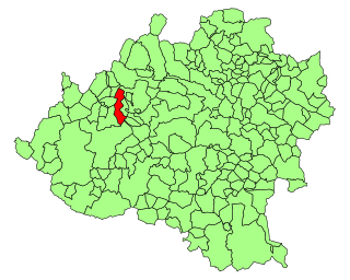
Talveila is a municipality located in the Spanish province of Soria, Castile and León. According to the 2004 census (INE), the municipality has a population of 186 inhabitants.

Boungbale is a town in the Bassar Prefecture in the Kara Region of Togo. Nearby towns and villages include Bongbon, Lidialabo (1.6 km [1.0 mi]), Demon (3.2 km [2.0 mi]), Diabirdo (3.2 km [2.0 mi]), and Tipakpane (3.5 km [2.2 mi]).

Druchowo is a village in the administrative district of Gmina Raciąż, within Płońsk County, Masovian Voivodeship, in east-central Poland. It lies approximately 11 kilometres (7 mi) west of Raciąż, 33 km (21 mi) north-west of Płońsk, and 95 km (59 mi) north-west of Warsaw.
Labuszewo is a village in the administrative district of Gmina Biskupiec, within Olsztyn County, Warmian-Masurian Voivodeship, in northern Poland. It lies approximately 8 kilometres (5 mi) south of Biskupiec and 31 km (19 mi) east of the regional capital Olsztyn.

Kankama is a town and sub-prefecture in the Dabola Prefecture in the Faranah Region of Guinea. As of 2014 it had a population of 13,262 people.
Gnaléah is a town and sub-prefecture in the Faranah Prefecture in the Faranah Region of Guinea. As of 2014 it had a population of 15,221 people.
Firawa is a town and sub-prefecture in the Kissidougou Prefecture in the Faranah Region of Guinea. As of 2014 it had a population of 11,407 people.
Termesse is a town and sub-prefecture in the Koundara Prefecture in the Boké Region of northern Guinea. As of 2014 it had a population of 15,264 people.
Sanguiana is a town and sub-prefecture in the Kouroussa Prefecture in the Kankan Region of eastern-central Guinea. As of 2014 it had a population of 23,809 people.
Niantania is a town and sub-prefecture in the Mandiana Prefecture in the Kankan Region of eastern Guinea near the border with Mali. As of 2014 it had a population of 14,884 people.
Kollet is a town and sub-prefecture in the Tougué Prefecture in the Labé Region of northern-central Guinea.
Tatau Island is an island of the Tabar Group of Papua New Guinea, located to the east of New Ireland and about a mile south of Simberi Island.

