Thane district is a district in the Konkan Division of Maharashtra, India. At the 2011 Census it was the most populated district in the country, with 11,060,148 inhabitants; however, in August 2014 the district was split into two with the creation of a new Palghar district, leaving the reduced Thane district with a 2011 Census population of 11,060,148. The headquarters of the district is the city of Thane. Other major cities in the district are Navi Mumbai, Kalyan-Dombivli, Mira-Bhayander, Bhiwandi, Ulhasnagar, Ambarnath, Badlapur, Murbad and Shahapur.

Niphad is the name both of the town and the Taluka headquartered there. It is within the Nashik District of Maharashtra, India. The Marathi name signifies "a place without mountains", and indeed the taluka's topography is fairly level, with hardly any hills. It is served by Niphad railway station. Niphad's latitude and longitude coordinates are 20°5′0″N74°7′0″E. Located northeast of Nashik city, the Taluka borders Sinnar, Nashik, Dindori, Chandwad, and Yeola Talukas and Ahmednagar District, and has no direct access to the sea. The Niphad Sub-Division is composed of Niphad, Sinnar and Yeola Talukas.

Larkana District is a district of the Sindh province of Pakistan. Its largest city is Larkana, which sits on the banks of the Indus River. It is the home district of the influential Bhutto family.

Bilagi is a panchayat town and taluka in the Bagalkot district of Karnataka, India. It is located at a distance of 30 km from the district headquarters of Bagalkote. The main occupation of people in this taluka is agriculture. Most of the farmers grow sugarcane.
Chinchani is a Census Town in the Dahanu Taluka of Palghar District of Maharashtra, India.
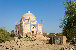
Bakrani is a town in Larkana District, Sindh province of Pakistan. This town is situated at a distance of 11 km south of Larkana city and a distance of 17km north of Mohan-Jo-Daro on the Larkana–Mohenjo-daro road. It has an altitude of 53 meters and is the headquarters of Bakrani Taluka. Bakrani was the taluka headquarters of Lab-e-Daryah taluka. More than 70% of peoples are farming and the main income source of the people of the area is agriculture, Dadu canal is the main source of irrigation in the area. Currently (2022-23) Assistant Commissioner is Mohsan Raza Dashti(PMS) Officer.
Dokri Tehsil is an administrative subdivision (tehsil) of Larkana District in the Sindh province of Pakistan, the city of Larkano is the capital.
The Zulfikar Ali Bhutto Agriculture College, Dokri, is an affiliated college of Sindh Agriculture University, Tandojam. This college is situated in Taluka Bakrani, district Larkana at an elevation of 164 ft. above mean sea level. Knowing the importance of agricultural education for the people of upper Sindh, Shaheed Mohtrama Benazir Bhutto announced the establishment of this college at a public gathering at Rice Research Institute Dokri in 1991. The college started functioning in September 1991, when some abandoned buildings of Rice Research Institute Dokri were renovated and handed over to Sindh Agriculture University.

For Sampagaon Taluka, see Bailhongal.
A tehsil is a local unit of administrative division in India and Pakistan. It is a subdistrict of the area within a district including the designated populated place that serves as its administrative centre, with possible additional towns, and usually a number of villages. The terms in India have replaced earlier terms, such as pargana (pergunnah) and thana.

Pondataluka is a subdivision of the district of South Goa, in the Indian state of Goa. Its administrative headquarters is the township of Ponda.
Gurlhosur is a village in Belgaum district in the southern state of Karnataka, India.

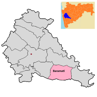
Baramati taluka is a taluka in Baramati subdivision of Pune district of state of Maharashtra in India.

Bhor taluka is a taluka in Haveli subdivision of Pune district of state of Maharashtra in India. There are 195 villages and 1 town in Bhor Taluka.

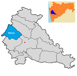
Maval taluka is a taluka in Mawal subdivision of Pune district of state of Maharashtra in India.

Purandar taluka is a taluka of Pune district of state of Maharashtra in India. There are 108 villages and 3 towns in Purandhar Taluka.

Shirur taluka, is a taluka in Haveli subdivision of Pune district of state of Maharashtra in India. The town is situated on the bank of river Ghod and hence it was also known as Ghodnadi in 20th Century. The town is on the border of Pune & Ahmed Nagar District and hence, main trading center for Shirur Taluka as well as Parner Taluka located in Ahmed Nagar District.

NA-195 Larkana-II is a newly-created constituency for the National Assembly of Pakistan. It mainly comprises the Dokri Taluka, Bakrani Taluka, and some areas of the Larkana Taluka, which includes a portion of the city of Larkana. It was created in the 2018 delimitation after the constituency overlapping between Qambar Shahdadkot District and Larkana District was ended.


