Lohardaga is a town and the district headquarters of Lohardaga district in the Indian state of Jharkhand, west of Ranchi, the state capital. Earlier Lohardaga was the commissionary headquarters for Chotanagpur. It was only later that the commissionary of Chotanagpur was shifted to Ranchi. The commissioner's office still exists and it houses the Lohardaga Municipality office.
Balaghat is a city and a municipality in Balaghat district, in the state of Madhya Pradesh, India. It is the administrative headquarters of Balaghat District. Wainganga River flows beside the town.

Khetri Nagar is the town in Neem Ka Thana district of Rajasthan in India. It is a part of the Shekhawati region. Khetri consists of two towns, "Khetri Town" founded by Raja Khet Singhji Nirwan and "Khetri Nagar" which is about 10 km away from Khetri. Khetri Nagar, well known for its Copper Project, was built by and is under the control of Hindustan Copper Limited, a public sector undertaking under the Government of India. Khetri Nagar is also known as 'Copper'. There are many attached villages near Khetri Nagar like Manota Khurd, the people of this village was employed in mines. Khetri is full of heritage and diversity. People of various religions live with mutual cooperation and harmony here. Today this adorable part of India is the backward region due to lack of development. Khetri is the town and Tehsil in Jhunjhunu district of Rajasthan state in India. Total number of villages in this Tehsil is 106. Khetri Tehsil sex ratio is 914 females per 1000 of males. Average literacy rate of Khetri Tehsil in 2011 were 72.51%, in which male and female literacy were 85.58% and 58.39% respectively.

Bagnan is a census town in Bagnan I CD Block of Uluberia subdivision in Howrah district in the state of West Bengal, India.
Beniganj is a town and nagar panchayat in Sandila tehsil of Hardoi district, Uttar Pradesh, India. It is located 21 miles southeast of Hardoi and 16 miles north of Sandila, on the road to Nimkhar and Sitapur. As of 2011, its population is 10,173 people, in 1,766 households.
Bhuban is a town and a NAC, located in the subdivision of Kamakhyanagar, Dhenkanal district in the state of Odisha, India.

Dinhata is a city and a municipality in Cooch Behar district in the state of West Bengal, India. It is the headquarters of the Dinhata subdivision. Dinhata is known for arranging one of the best Durga Puja in North Bengal. Dinhata is famous for Sastho Mela & Dinhata Utsav, Sanghati Mela, Janmastami Mela. Apart from the city area, Dinhata consists of 3 blocks.
Gora Bazar is a census town located in the community development block of Berhampore, Berhampore subdivision, Murshidabad district, West Bengal, India. It is situated at an elevation of 18 meters above sea level.

Kantilo is a census town in Nayagarh district in the Indian state of Odisha. Kantilo is 100 km from its state capital Bhubaneswar and 33 km from district headquarters Nayagarh. Kantilo is famous for bell metal utensil, but nowadays it is losing its sheen.
Kelamangalam is a panchayat town in Krishnagiri district in the Indian state of Tamil Nadu.
Manegaon is a census town in Balaghat district in the Indian state of Madhya Pradesh. Total papulation :2045 House hold 465
Naravarikuppam is a town in Thiruvallur district in the Indian state of Tamil Nadu.

Olavanna is a census town in Kozhikode district in the Indian state of Kerala. Olavanna is the most populous panchayat in kerala. It is located 10 km from Kozhikode City. Olavanna panchayath shares the border with Kozhikode corporation and Perumanna panchayath. At first it was a large agricultural area. Today there are many small and large scale industries. There are also small marketplaces such as the Pantheerankavu, Olavanna Chungam, Kodinattumukku, Mathara, Palazhi, Kunnathupalam, Iringallor. The railway station is around 10 kilometres away and the nearest airport is Calicut international Airport. HiLite Mall is located in Palazhi junction.
Ukwa is a census town in Balaghat district in the Indian state of Madhya Pradesh.

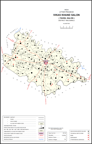
Salon is a town and nagar panchayat in Raebareli district in the Indian state of Uttar Pradesh. It serves as the headquarters of a tehsil as well as a community development block. Originally it was also the headquarters of the entire district, but they were moved after the Indian Rebellion of 1857. It is located a bit to the south of the Sai river, at the junction of the Raebareli-Pratapgarh and Jais-Khaga roads. Other roads lead to Dalmau, Manikpur, and Kunda. To the east is a large jhil.
See Deori (disambiguation) for disambiguation

Depalpur is a town of shri 24 avtaar mandir belong God Vishnu and a Nagar panchayat in Indore district in the state of Madhya Pradesh, India. Depalpur is around 41.7Km from Indore.
Sikandara is a town in Kanpur Dehat district in the Indian state of Uttar Pradesh. It is headquarters of tehsil Sikandara.

Kolazhy Grama Panchayat, also known as Kolazhy GP, is part of Puzhakkal block, in Thrissur taluk, in Thrissur district. It is located 6.8 kilometres (4.2 mi) north of Thrissur city.
Dongargaon, Agar Malwa is a town and a gram panchayat in the Agar Malwa district of Madhya Pradesh. It is located on the Indore–Kota National Highwayon the bank of Kali Sindh River.


