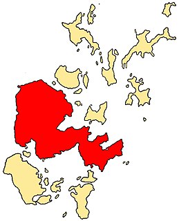
Shetland, also called the Shetland Islands and formerly Zetland, is a subarctic archipelago in the Northern Atlantic, between Great Britain, the Faroe Islands and Norway. It is the northernmost part of the United Kingdom, and lies 1° West of the Prime Meridian.

Lerwick is the main town and port of the Shetland archipelago, Scotland. Shetland's only burgh, Lerwick had a population of about 7,000 residents in 2010.
The Mainland, also known as Hrossey and Pomona, is the main island of Orkney, Scotland. Both of Orkney's burghs, Kirkwall and Stromness, lie on the island, which is also the heart of Orkney's ferry and air connections.

Bressay is a populated island in the Shetland archipelago of Scotland.
The Isle of Noss or Noss is a small, previously inhabited island in Shetland, Scotland. Noss is separated from the island of Bressay by the narrow Noss Sound. It has been run as a sheep farm since 1900, and has been a national nature reserve since 1955.

The Northern Isles are a pair of archipelagos off the north coast of mainland Scotland, comprising Orkney and Shetland. They are part of Scotland, as are the Hebrides. The climate is cool and temperate and much influenced by the surrounding seas. There are a total of 36 inhabited islands. The landscapes of the fertile agricultural islands of Orkney contrast with the more rugged Shetland islands to the north, where the economy is more dependent on fishing and on the oil wealth of the surrounding seas. Both island groups have a developing renewable energy industry. Both have a Pictish and Norse history. Both were part of the Kingdom of Norway until they were absorbed into the Kingdom of Scotland in the 15th century. They remained part of it until the 1707 formation of the Kingdom of Great Britain and the 1801 formation of the United Kingdom. And they both played a significant naval role during the world wars of the 20th century.
The Out Skerries are an archipelago of islets, some inhabited, in Shetland, Scotland, and are the easternmost part of Shetland. Locally, they are usually called Da Skerries or just Skerries.
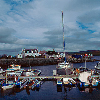
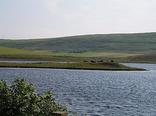
Aith,, is a village on the Northern coast of the West Shetland Mainland, Scotland at the southern end of Aith Voe, some 21 miles west of Lerwick.

The Ve Skerries or Vee Skerries are a group of low skerries three miles (4.8 km) north west of Papa Stour, on the west coast of Shetland, Scotland. They define the southwest perimeter of St Magnus Bay.

Dunrossness, is the southernmost parish of Shetland, Scotland. Historically the name Dunrossness has usually referred to the area on the Shetland mainland south of Quarff. However, in 2016 there were three separate Shetland Community Councils for a) Gulberwick, Quarff and Cunningsburgh; b) Sandwick; and c) Dunrossness. The 2011 census defined Dunrossness as including everybody within the British ZE2 postal code, which goes as far north as Gulberwick. It has the best and largest area of fertile farmland of any parish in Shetland. Dunrossness includes the island of Mousa, Levenwick, St Ninian's Isle, Bigton, Scousburgh, the Lochs of Spiggie and Brow, Boddam, Quendale, Virkie, Exnaboe, Grutness, Toab, Ness of Burgi, Clumlie Broch, Scatness, Sumburgh Airport, Sumburgh Head, West Voe, the islands of Lady's Holm, Little Holm, Horse Holm island and Fair Isle.
Sandsting is a parish in the West Mainland of Shetland, Scotland, forming a southern arm of the Walls Peninsula. After the parish of Aithsting was annexed into Sandsting in the sixteenth century, it became known as Sandsting and Aithsting parish.
Law Ting Holm is a small promontory at the north end of the freshwater Loch of Tingwall, Mainland Shetland, Scotland. It was once an islet entirely surrounded by water, joined to the shore by a stone causeway 1.7 metres (6 ft) wide and 42.7 metres (140 ft) long. In the 1850s the levels of the loch were lowered and the holm evolved to its present form. The Loch of Tingwall is west of the town of Lerwick and has one additional island - Holm of Setter.

St Magnus Bay is a large coastal feature in the north-west of Mainland Shetland, Scotland. Roughly circular in shape with a diameter of about 19 kilometres (12 mi), it is open to the North Atlantic Ocean to the west. The indented coastline to the north, south and east between Esha Ness in the north and the Ness of Melby in the south contains numerous bays, firths and voes and there are several islands around the perimeter. The waters of the bay are up to 165 metres (541 ft) deep and may have been the site of a substantial meteor impact.

Ronas Voe is a voe in Northmavine, Shetland. It divides the land between Ronas Hill, Shetland's tallest mountain, and the Tingon peninsula. It is the second largest voe in Shetland, the largest being Sullom Voe. The townships of Heylor, Voe and Swinister are located on its shores, and the township of Assater is under a kilometre away.

Heylor is a settlement situated on the south side of Ronas Voe in Northmavine, Shetland, Scotland. It lies directly opposite Ronas Hill, Shetland's tallest mountain.
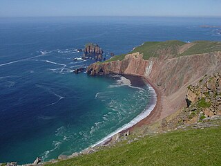
The Lang Ayre is a beach on the west side of Ronas Hill, Northmavine, Shetland. At 1 kilometre (0.6 mi) in length it is the archipelago's longest. It is accessed either by a long walk from the top of Collafirth Hill down the Burn of Monius, or by sea. The beach's sand is red, eroded from the up to 700 feet (210 m) high red granite cliffs towering above it.

The Drongs are a group of sea stacks off the coast of Hillswick Ness, Northmavine, Shetland, Scotland. They lie to the west of the Isle of Westerhouse in St Magnus Bay. They have been described as "a focus of interest from all surrounding parts, including Eshaness", from which they are the most readily viewed, and as such are considered an icon of Eshaness, along with the famous Dore Holm.

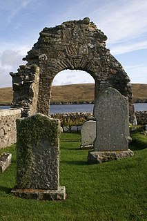
Fethaland or Fedeland is an abandoned settlement at the extreme north end of Mainland, Shetland. It was the site of the largest Haaf fishing station in Shetland.

