This article needs additional citations for verification . (May 2016) (Learn how and when to remove this template message) |
The Douro line (in Portuguese: Linha do Douro) is a railway in northern Portugal. For much of its route the line runs close to the Douro River, offering very scenic views of the river and valley. Trains on the line are operated by Comboios de Portugal (CP).
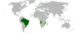
Portuguese is a Western Romance language originating in the Iberian Peninsula. It is the sole official language of Portugal, Brazil, Cape Verde, Guinea-Bissau, Mozambique, Angola, and São Tomé and Príncipe. It also has co-official language status in East Timor, Equatorial Guinea and Macau in China. As the result of expansion during colonial times, a cultural presence of Portuguese and Portuguese creole speakers are also found in Goa, Daman and Diu in India; in Batticaloa on the east coast of Sri Lanka; in the Indonesian island of Flores; in the Malacca state of Malaysia; and the ABC islands in the Caribbean where Papiamento is spoken, while Cape Verdean Creole is the most widely spoken Portuguese-based Creole. Reintegrationists maintain that Galician is not a separate language, but a dialect of Portuguese. A Portuguese-speaking person or nation is referred to as "Lusophone" (Lusófono).
Portugal, officially the Portuguese Republic, is a country located mostly on the Iberian Peninsula in southwestern Europe. It is the westernmost sovereign state of mainland Europe. It is bordered to the west and south by the Atlantic Ocean and to the north and east by Spain. Its territory also includes the Atlantic archipelagos of the Azores and Madeira, both autonomous regions with their own regional governments.
CP — Comboios de Portugal, EPE is a state-owned company which operates passenger trains in Portugal. Before June 2009, CP stood for Caminhos de Ferro Portugueses although the company has been using its current designation as a brand name since 2004.
Section between stations | Distance | Date of opening |
---|---|---|
Ermesinde – Penafiel | 30.311 km | 29 July 1875 |
Penafiel – Caíde | km | 7.32820 December 1875 |
Caíde – Juncal | 18.818 km | 15 September 1878 |
Juncal – Peso da Régua | 38.371 km | 15 July 1879 |
Peso da Régua – Ferrão | 15.813 km | 4 April 1880 |
Ferrão – Pinhão | km | 7.6111 June 1880 |
Pinhão – Tua | 12.993 km | 1 September 1883 |
Tua – Pocinho | 31.678 km | 10 January 1887 |
Pocinho – Côa | km | 9.0615 May 1887 |
Côa – Barca D’Alva - Spanish border | 18.882 km | 9 December 1887 |
From west to east, the line runs from the junction at Ermesinde to Pocinho. The line formerly continued east for a further 28 kilometres to the Spanish border. Until 1984, the track continued onwards into Spain, thus allowing through trains to/from Salamanca.
Pocinho is a village in northern Portugal, located in the Vila Nova de Foz Côa Municipality. The Pocinho Dam and the River Douro are nearby.
Spain, officially the Kingdom of Spain, is a country mostly located in Europe. Its continental European territory is situated on the Iberian Peninsula. Its territory also includes two archipelagoes: the Canary Islands off the coast of Africa, and the Balearic Islands in the Mediterranean Sea. The African enclaves of Ceuta, Melilla, and Peñón de Vélez de la Gomera make Spain the only European country to have a physical border with an African country (Morocco). Several small islands in the Alboran Sea are also part of Spanish territory. The country's mainland is bordered to the south and east by the Mediterranean Sea except for a small land boundary with Gibraltar; to the north and northeast by France, Andorra, and the Bay of Biscay; and to the west and northwest by Portugal and the Atlantic Ocean.
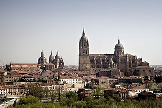
Salamanca is a city in western Spain that is the capital of the Province of Salamanca in the community of Castile and León. The city lies on several hills by the Tormes River. Its Old City was declared a UNESCO World Heritage Site in 1988. With a metropolitan population of 228,881 in 2012 according to the National Institute of Statistics (INE), Salamanca is the second most populated urban area in Castile and León, after Valladolid (414,000), and ahead of León (187,000) and Burgos (176,000).
Passenger trains normally run from São Bento station in Porto to Pocinho, with some not running as far as the eastern terminus. The line is built to the Iberian gauge of 1,668 mm (5 ft 5 21⁄32 in). The line is single track, apart from a double track section between Ermesinde and Valongo (the authorisation for the dualling work was given by CP in 1993). [1]
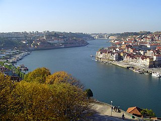
Porto is the second-largest city in Portugal after Lisbon and one of the major urban areas of the Iberian Peninsula. The city proper has a population of 287,591 and the metropolitan area of Porto, which extends beyond the administrative limits of the city, has a population of 2.3 million (2011) in an area of 2,395 km2 (925 sq mi), making it the second-largest urban area in Portugal. It is recognized as a gamma-level global city by the Globalization and World Cities (GaWC) Study Group, the only Portuguese city besides Lisbon to be recognised as a global city.
In 1984, the Spanish rail operator RENFE announced the closure of its connecting line from La Fuente de San Esteban to the Portuguese border. With the loss of international traffic, CP had to close its line east of Barca d'Alva to Spain. The service was cut back to Pocinho in 1988, which has since remained the eastern terminus of the Douro line. [2]
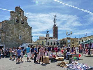
La Fuente de San Esteban is a village and large municipality in the province of Salamanca, western Spain, part of the autonomous community of Castile-Leon. It is located 54 kilometres (34 mi) from the provincial capital city of Salamanca and has a population of 1,358 people.
There were formerly five metre gauge branch lines connecting with the Douro line, but the last of these closed in 2009. Geographically, from west to east they were:
The Tâmega line(Linha do Tâmega) was a 1,000 mmmetre gauge railway line in northern Portugal. It closely followed the course of the Tâmega River. It closed in 2009.
The Douro is one of the major rivers of the Iberian Peninsula, flowing from its source near Duruelo de la Sierra in Soria Province across northern-central Spain and Portugal to its outlet at Porto.
REFER, Rede Ferroviária Nacional, EP was the Portuguese rail infrastructure manager. It was a state-owned company and was created to manage the Portuguese rail infrastructure, previously under control of CP, which became exclusively a train service operator.
The CP Urban Services network is the commuter train network of Metropolitan Lisbon and Metropolitan Porto, Portugal. It connects the city centers with the suburbs.
Ermesinde is a civil parish in the municipality (concelho) of Valongo, in continental Portugal, 9 kilometres (5.6 mi) northeast of Porto. The population in 2011 was 105,897, in an area of 7.65 km². It is the smallest by area, and the densest by population.
Linha do Vouga(the Vouga line) is the last surviving metre gauge railway line in Portugal still operated by Comboios de Portugal. The other remaining metre gauge lines all closed in 2009. The line is, however, also under the threat of closure.
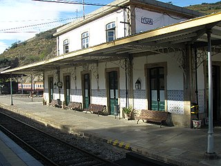
The Tua Railway Station (Portuguese: Estação Ferroviária do Tua is northern Portuguese railway station located in the civil parish of Castanheiro do Norte e Ribalonga, in the municipality of Carrazeda de Ansiães, close to the confluence of the Douro and the Tua. Although the station is still served by Comboios de Portugal main line trains on the Douro line to/from Porto.
Carviçais is a parish of the municipality of Torre de Moncorvo in the district of Bragança (Portugal). The population in 2011 was 757, in an area of 63.00 km². The parish is composed of 7 villages: Carviçais, Macieirinha, Martim Tirado, Quinta da Estrada, Quinta das Pereiras, Quinta das Peladinhas and Quinta da Nogueirinha.
The history of rail transport in Portugal dates from 28 October 1856, when Portugal's first railway line was opened between Lisbon and Carregado: the Companhia dos Caminhos de Ferro Portugueses.
The Tua line was a metre gauge railway line in northern Portugal, which connected Tua to Bragança. The line was opened in 1887 and closed in 2018. The section from Mirandela to Brunheda is planned to be reopened in 2019.
The Corgo line(Linha do Corgo) was a 1,000 mmmetre gauge railway line in northern Portugal. It closed in 2009. It ran north from Régua to Vila Real and Chaves. The line was latterly operated by Comboios de Portugal.
The Dão line was a metre gauge railway line in Portugal. It ran close to the Dão River, between Santa Comba Dão and Viseu.
Linha de Guimarães is a railway in Portugal operated by Comboios de Portugal. It runs between Oporto (Porto) and Guimarães; until 1986 it extended eastwards to Fafe. It was extensively modernised in the 2000s, including conversion from metre gauge to Iberian gauge track and electrification.
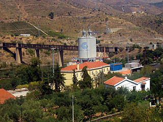
The Sabor line(Linha do Sabor) was a 1,000 mmmetre gauge railway in north-east Portugal. It ran for nearly 106 km between Pocinho and Duas Igrejas, near Miranda do Douro. It closed in 1988.
Portugal formerly had several hundred kilometres of narrow-gauge railways, but by 2010 only two lines were still in operation – the Vouga line and the Metro de Mirandela. The lines were operated by Comboios de Portugal and maintained by REFER.
The Barca d'Alva–La Fuente de San Esteban railway is a closed Iberian gauge line which connected Barca d'Alva on the Linha do Douro, in northeastern Portugal, to the Spanish railway network. Passenger and cargo trains ran from Porto to Salamanca until its closure in 1985.
Infraestruturas de Portugal, S.A. (IP) is a state-owned company which resulted from the merger of Rede Ferroviária Nacional (REFER) and Estradas de Portugal (EP). It manages the Portuguese rail and road infrastructure.
Ramal de Aveiro is a Portuguese metre gauge railway line operated by Comboios de Portugal. It connects Aveiro and Sernada, where it connects with Linha do Vouga.