Doylestown Central Park | |
---|---|
Type | Municipal park |
Location | Doylestown Township, Pennsylvania |
Coordinates | 40°17′15″N75°08′20″W / 40.28750°N 75.13889°W |
Area | 125.5 acres (50.8 hectares) |
Created | 1995 |
Doylestown Central Park is a 125.5-acre area of land currently owned by Doylestown Township in Pennsylvania. It is the largest park owned by Doylestown Township, 30 of these acres are being leased to the neighboring Delaware Valley College for farming use.
As part of the network of parks in the Doylestown Township and Borough, the purposes of the park are to help foster better health and wellness, serve as protection to the environment and maintain economic prosperity in the surrounding areas. [1] These goals are in line with both state and local Park and Recreation Plans including: Pennsylvania's Recreation Plan, Regional Land Use Plan for Delaware Valley, Bucks County Park and Recreation Plan and others. [1] This space is a dedicated green space consisting of basketball courts, tennis courts soccer fields and walking trails. Doylestown Central Park also includes some more unique features such as Kids Castle and a sensory trail for the differently abled.
Doylestown Central Park is open every day from dawn to dusk. Central Park contains both green space and recreation space including: 5 tennis courts, 2 basketball courts, 3 soccer fields, a bocce court, a golf link, an amphitheater, a toddler play area, Kids Castle and trails for hiking, walking or biking. Both the tennis and basketball courts have coin operated lighting to illuminate the play area. [2]
Central Park was dedicated and opened to the public on June 10, 1995. [3] The land was purchased for $3.7 million from a developer in 1991. [4] The land was originally owned by the local Delaware Valley University. [3] The park was planned under the guidance of the Central Park and Facilities Planning Committee, chaired by John T. Carson Jr. [4] The land was considered an ideal site for a park due to its proximity to a township building located next door on Wells road. This would allow for ease of connection to already existing municipal water, sewage, and electricity lines, decreasing both time and building costs. [4] Since its inception, planners wanted to ensure that the park had both passive and active areas while minimally changing the existing landscape. [5] In 1994, the township received a DCA grant of $100,000 for park development. [5] By 1994, the parking lots, tennis courts, basketball courts, and walking trail were completed. [5]
Kids Castle was inspired by the local castles built by the late Henry Chapman Mercer and opened on June 22, 1997. [6] The design of the playground was an effort by a team of local architects as well as students from the Central Bucks School District. [6] Bob Leathers was hired as architect to refine the design. [6] A group called Friends of Kids Castle formed in 2012, with the mission of protecting this playground. [6] The original structure was made of pressure treated wood, but due to heavy use and weathering Kids Castle underwent a renovation in March 2013 costing $150,000. [6] The renovation lasted just under 7 months. Although the main castle is currently open for public use, part of the renovation included removal of other older playground equipment. [7] The next phase of renovation includes the installation of new playground equipment as well as resurfacing to allow for inclusion of children of all abilities. [7] Completion of the next phases of renovation will require $600,000. [7]
The Doylestown Township and Borough identified in a 2007 Community Park, Recreation and Open Space Plan that building an amphitheater in Central Park would be a short term priority (accomplished between 2008-2010). This came in response to 66% of resident survey respondents stating an amphitheater would be a priority. [1] In the same document it was stressed that in the planning process, it would be critical for the amphitheater to be established as a park hub, not just another structure. [1] The cost for materials and building came to $136,000 all of which came directly from 20 years of fundraising. [8] The amphitheater includes a stage, with an area for storage as well as a changing room and bathroom. The Amphitheater hosts music concerts and free movies in the summer months. [9] Previous to the construction of the physical building, the hillside on which it is located was considered a natural amphitheater and hosted its first concert series in the summer of 1995. [3]
Doylestown Central Park is an end point to the 8.5 mile long US 202 Parkway Trail. The current trail is paved and continues alongside the U.S. Route 202 parkway to Pennsylvania Route 63 (Welsh Road) in Montgomeryville. [10] There are plans to extend the trail past Pennsylvania Route 63 into Norristown. [10] There is a parking lot located at the entrance on New Britain Road, allowing for easy access to the trail head.
Additionally, there are several connections around Central Park to the Doylestown Hike and Bike System. The first connection was between the park and the neighboring Klutz Elementary School. [3] Supported by both the Doylestown Township and Borough, the Hike and Bike System started its planning stages in 1992, and continues to expand. [3] The goal is to increase connectivity between schools, parks and other points around the township. [3]
Doylestown Central park has several fitness stations installed around the park along the walking trail. Weather permitting, outdoor boot camp classes are hosted on Monday and Wednesday evenings from 6:00-7:00pm. [11]
For adults 50 and older, a separate LifeTrail area is available for use. Each station has detailed diagrams depicting usage, as well as different levels of difficulty. A guidance video of equipment use can be viewed on YouTube. [12]
The Sensory Trail opened in October, 2016. [13] It is most readily accessible from the New Brittain road entrance. The sensory trail consists of 9 separate sections, called pods. [13] Some are located along the walking path, and others are within Hart's Woods along a boardwalk. 5 of the pods are wheelchair accessible. [14] Each pod highlights different sensory integration techniques, to help children of all needs (particularly on the autism spectrum) interact with the natural environment. [13] This sensory trail is thought to be one a kind in the state of Pennsylvania. [14] The sensory trail was created in response to the Park and Recreation board wanting to make Central Park more accessible to people of all abilities. [13] The sensory trail cost a total of $442,000 to build, with contributions from the Doylestown Township ($191,000), Foundations Community Partnership ($30,000), Doylestown Lions Club ($30,000), Village improvement Association ($30,000) and a grant from the Commonwealth of Pennsylvania, Commonwealth Financing Authority. [13] Foundations Community Partnership Grant, Boucher & James, Inc., Pickering Corts and Summerson as well as the Doylestown Township board of Supervisors helped with the design and construction of the sensory trail. Further expansion of the sensory trail may be added with more donations. [13]
Included as one of the park's passive green areas, the meadow is a portion of the park which remains unmowed. The meadow provides valuable habitat to a variety of species, including the native Blue Bird. The Bucks County Audubon Society as well as members of the Doylestown community sought to increase the native bird population by building and placing nesting boxes in and around the area, including in Central Park. [15] This effort has dramatically increased blue bird sightings from just 2 in 1992 to 100 or more hatchlings a year in 2015. [15] The meadow requires some maintenance by park staff to prevent the growth of shrubs and trees. The meadow habitat allows for different species including:
Adjacent to Kid's castle across the bridge, there is a storm water pond. This storm water pond is also across from the Edgar N. Putman Environmental Education Center. This pond collects excess precipitation runoff. Next to the walkway, a sign details the importance of keeping waterways clean and clear. This storm water pond is considered part of the passive features of Doylestown Central Park, allowing for species to inhabit it, and park visitors to enjoy access to wildlife.
A portion of Hart's Woods remains intact within Doylestown Central Park. The forest historically spread to past where US 202 currently The forest is part of a geological formation called Piedmont Physiographic Province, spanning from New Jersey through Pennsylvania and as far south as Alabama. [16] The clay soil here is known to be fertile and is able to support the growth of the mature Oak-Beech Hart's Woods. [16] The habitat of Hart's Woods allows for different species including:
In the interest of protecting these species, the Hart's Woods portion of the park is a designated wildlife area, and is off limits to dogs.
In 2004, Doylestown planned to acquire an additional 23 acres from the neighboring Doylestown Station Townhomes to become the new Environmental Education Area. [17] As with the construction of the original park space, the goal was to limit the changes made to the original land features. [17] The Environmental Education Area walking trail connects to the back of the Kid's Castle area, the adjacent neighborhood, as well as to the local Kutz Elementary School. [17] Funding from Pulte, DCNR, and PECO Green Region Open Space Program allowed for the opening of the Environmental Education Area to be dedicated and opened as an official part of central park in 2006. [17] A portion of the wetland education trail was completed in 2011. [17] The Edgar N. Putman Environmental Education Center was dedicated on May 13, 2011. [18] The invasive species trail was completed in January 2012. [17]
Beyond regular park visitors, the Environmental Education Area is used by activities from programs such as: No Child Left Inside, park and recreation programs, and Environmental Advisory Council with the outdoor classroom acting as a hub for hosting these programs. [17]
Doylestown Central Park hopes to educate visitors on the damaging effects invasive species can have on existing habitats. Posted signage describes management techniques such as early detection, manual removal and chemical application, while also providing tips for visitors to help and apply on an individual scale. The posted solutions are: education, not planting invasive species in gardens, removal of invasive species, minimal landscape disturbance, limiting fertilizer use and monitoring. The following plants are known invasive species in Pennsylvania:
A more comprehensive list of invasive species can be located on the invasive species fact sheet on the Pennsylvania Department of Conservation and Natural Resources webpage. [19]
Bucks County is a county located in the Commonwealth of Pennsylvania. As of the 2020 census, the population was 646,538; it is the fourth-most populous county in Pennsylvania. The county seat is Doylestown. The county is named after the English county of Buckinghamshire or more precisely, its abbreviation.
Doylestown is a borough and the county seat of Bucks County in the Commonwealth of Pennsylvania. It is located 27.9 miles (44.9 km) northwest of Trenton, 31.6 miles (50.9 km) southeast of Allentown, 40.3 miles (64.9 km) north of center city Philadelphia, and 81.7 miles (131.5 km) southwest of New York City.
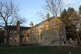
Doylestown Township is a township in Bucks County, Pennsylvania. The population was 17,565 at the 2010 census. Adjacent to the county seat, many county offices and the county correctional facility are located in this township. Doylestown Central Park is a park in the township.
Warminster Township is located in Bucks County, Pennsylvania. It was formally established in 1711. It is 13.7 miles north of Philadelphia and had a population of 32,682 according to the 2010 U.S. census.
Worlds End State Park is a 780-acre (316 ha) Pennsylvania state park in Sullivan County, Pennsylvania, in the United States. The park, nearly surrounded by Loyalsock State Forest, is in the Loyalsock Creek valley on Pennsylvania Route 154, in Forks and Shrewsbury Townships southeast of the borough of Forksville. The name Worlds End has been used since at least 1872, but its origins are uncertain. Although it was founded as Worlds End State Forest Park by Governor Gifford Pinchot in 1932, the park was officially known as Whirls End State Forest Park from 1936 to 1943.
Tyler State Park is a day-use Pennsylvania state park on 1,711 acres (692 ha) in Newtown and Northampton Townships, Bucks County, Pennsylvania in the United States.
Pennsylvania Route 313 is a mostly 2-lane, 18-mile-long (29 km) state highway entirely within Bucks County, Pennsylvania. The western end of PA 313 is at an intersection with PA 309 and PA 663 in Quakertown. The eastern end is at an intersection with PA 263 in the Doylestown Township community of Furlong. PA 313 is signed an east–west road, although it runs almost purely northwest–southeast through most of its course. It is a major arterial road in central and northern Bucks County as it connects several communities including Quakertown, Dublin, and Doylestown.
Rothrock State Forest is a Pennsylvania state forest in Pennsylvania Bureau of Forestry District #5. The main offices are located in Huntingdon in Huntingdon County, Pennsylvania in the United States.
Cherry Springs State Park is an 82-acre (33 ha) Pennsylvania state park in Potter County, Pennsylvania, United States. The park was created from land within the Susquehannock State Forest, and is on Pennsylvania Route 44 in West Branch Township. Cherry Springs, named for a large stand of Black Cherry trees in the park, is atop the dissected Allegheny Plateau at an elevation of 2,300 feet (701 m). It is popular with astronomers and stargazers for having "some of the darkest night skies on the east coast" of the United States, and was chosen by the Pennsylvania Department of Conservation and Natural Resources (DCNR) and its Bureau of Parks as one of "25 Must-See Pennsylvania State Parks".
The Pennsylvania Department of Conservation and Natural Resources (DCNR), established on July 1, 1995, is the agency in the U.S. State of Pennsylvania responsible for maintaining and preserving the state's 121 state parks and 20 state forests; providing information on the state's natural resources; and working with communities to benefit local recreation and natural areas. The agency has its headquarters in the Rachel Carson State Office Building in Harrisburg.
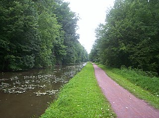
Delaware Canal State Park is a 830-acre (336 ha) Pennsylvania state park in Bucks and Northampton Counties in Pennsylvania. The main attraction of the park is the Delaware Canal which runs parallel to the Delaware River between Easton and Bristol.
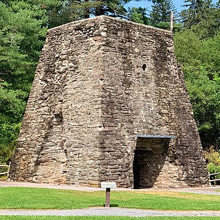
Pine Grove Furnace State Park is a protected Pennsylvania area that includes Laurel and Fuller Lakes in Cooke Township of Cumberland County. The Park accommodates various outdoor recreation activities, protects the remains of the Pine Grove Iron Works (1764), and was the site of Laurel Forge (1830), Pine Grove Park (1880s), and a brick plant (1892). The Park is 8 miles (13 km) from exit 37 of Interstate 81 on Pennsylvania Route 233.
Kenneth Hahn State Recreation Area, or Kenneth Hahn Park, is a state park unit of California in the Baldwin Hills Mountains of Los Angeles. The park is managed by the Los Angeles County Department of Parks and Recreation. As one of the largest urban parks and regional open spaces in the Greater Los Angeles Area, many have called it "L.A.'s Central Park". The 401-acre (1.62 km2) park was established in 1984.
The Delaware & Lehigh Canal National and State Heritage Corridor (D&L) is a 165-mile (266 km) National Heritage Area in eastern Pennsylvania in the United States. It stretches from north to south, across five counties and over one hundred municipalities. It follows the historic routes of the Lehigh and Susquehanna Railroad, Lehigh Valley Railroad, the Lehigh Navigation, Lehigh Canal, and the Delaware Canal, from Bristol to Wilkes-Barre in the northeastern part of the state. The backbone of the Corridor is the 165-mile (266 km) D&L Trail. The Corridor's mission is to preserve heritage and conserve green space for public use in Bucks, Northampton, Lehigh, Carbon, and Luzerne counties in Pennsylvania. It also operates Hugh Moore Historical Park & Museums, which includes the National Canal Museum.
U.S. Route 202 is a US Highway running from New Castle, Delaware, northeast to Bangor, Maine. The route runs through the southeastern part of the U.S. state of Pennsylvania, passing through the western and northern suburbs of Philadelphia. It follows a general southwest–northeast direction through the state, serving West Chester, King of Prussia, Bridgeport, Norristown, Montgomeryville, Doylestown, and New Hope. US 202 enters Pennsylvania from Delaware and heads north as a divided highway, where it becomes concurrent with US 322 at an intersection with US 1 in Painters Crossing. The two routes run north and become a freeway that bypasses West Chester to the east, with US 322 splitting from US 202. US 202 continues north and east along the freeway to King of Prussia, where it reverts to an at-grade divided highway following an interchange with Interstate 76 (I-76). The route becomes a one-way pair as it passes through Bridgeport and Norristown before both directions rejoin and the road continues northeast. US 202 follows an expressway-grade parkway between Montgomeryville and Doylestown prior to bypassing Doylestown to the south along a freeway. The route continues northeast as an at-grade road to New Hope, where it turns into a freeway again before it crosses the Delaware River on the New Hope–Lambertville Toll Bridge into New Jersey.
Moon Lake State Forest Recreation Area is a 942-acre (381 ha), recreation area within Pinchot State Forest in Plymouth Township, Luzerne County, Pennsylvania. It is open for mountain biking, hiking, fishing, bird watching, and nature study. The recreation area consists of open fields and woodlots surrounding Moon Lake, a 48-acre (19 ha), spring-fed lake. Moon Lake SFRA is in the Delaware and Lehigh National Heritage Corridor. It is located near Pennsylvania Route 29 on the western edge of the Scranton—Wilkes-Barre—Hazleton metropolitan statistical area.
Little Neshaminy Creek is a tributary of the Neshaminy Creek, part of the Delaware River Watershed rising near the intersection of U.S. Route 202 and Pennsylvania Route 309 near Montgomeryville, Pennsylvania and meets its confluence with Neshaminy Creek at the Neshaminy's 24.10 River mile.
The US 202 Parkway Trail is a multi-use trail in the U.S. state of Pennsylvania that follows the U.S. Route 202 parkway between Montgomery Township in Montgomery County and Doylestown Township in Bucks County. The trail has a length of 8.4 miles (13.5 km). Access to the US 202 Parkway Trail is provided through numerous trailheads along the route. The trail was constructed along with the US 202 parkway beginning in 2008 and was completed in 2012.
Northampton Municipal Park is a municipal park located in Churchville, Northampton Township, Bucks County, Pennsylvania. It is 89 acres large. There are recreation and picnic facilities at the park in addition to an amphitheater.