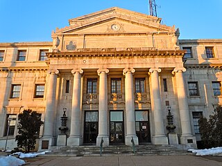
Delaware County, colloquially referred to as Delco, is a county in the Commonwealth of Pennsylvania. With a population of 576,830 as of the 2020 census, it is the fifth-most populous county in Pennsylvania and the third-smallest in area. The county was created on September 26, 1789, from part of Chester County and named for the Delaware River. The county is part of the Southeast Pennsylvania region of the state.

Bucks County is a county in the Commonwealth of Pennsylvania. As of the 2020 census, the population was 646,538, making it the fourth-most populous county in Pennsylvania. Its county seat is Doylestown. The county is named after the English county of Buckinghamshire. The county is part of the Southeast Pennsylvania region of the state.
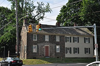
Lower Makefield Township is a township in Bucks County, Pennsylvania, United States. Lower Makefield Township is located in the Delaware Valley and borders the Delaware River and New Jersey to its north and east. Most addresses in the township have a Yardley address; the township surrounds the borough of Yardley on its north, south, and west.

Morrisville is a borough in Bucks County, Pennsylvania, United States. It is located just below the falls of the Delaware River opposite Trenton, New Jersey. The population was 9,809 in the 2020 Census.
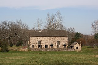
Solebury Township is a township in Bucks County, Pennsylvania, United States. The population was 8,709 at the 2020 census.
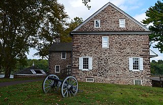
Upper Makefield Township is a township in Bucks County, Pennsylvania. The population was 8,190 at the 2010 census. It has the eighth-highest per capita income among all townships in Pennsylvania.

Warminster Township, also referred to as Warminster, is located in Bucks County, Pennsylvania, United States. It was formally established in 1711. The township is 13.7 miles north of Philadelphia and had a population of 33,603 according to the 2020 U.S. census.

Yardley is a borough in Bucks County, Pennsylvania, United States. Yardley borders the Delaware River and Ewing, New Jersey to its east and Lower Makefield Township to its north, west, and south. The United States Post Office assigns many addresses in Lower Makefield Township the preferred city of "Yardley", although they are outside the borough. The population was 2,434 at the 2010 census. Yardley is part of the Delaware Valley metropolitan area.

Lower Pottsgrove Township is a township in Montgomery County, Pennsylvania, United States, approximately 30 miles northwest of Philadelphia and 18 miles southeast of Reading, along the Schuylkill River. The population was 12,059 at the 2010 census.

Titusville is an unincorporated community and census-designated place (CDP) in Hopewell Township, Mercer County, in the U.S. state of New Jersey. As of the 2020 census, the population was 633. The area includes a post office with its own ZIP Code (08560), several restaurants, gas stations, a firehouse, and a small cluster of homes. Washington Crossing State Park, dedicated to George Washington's crossing of the Delaware River in 1776, is adjacent to the community.

Washington Crossing Historic Park is a 500-acre (2 km2) state park operated by the Pennsylvania Department of Conservation and Natural Resources in partnership with the Friends of Washington Crossing Park. The park is divided into two sections. One section of the park, the "lower park," is headquartered in the village of Washington Crossing located in Upper Makefield Township in Bucks County, Pennsylvania. It marks the location of George Washington's crossing of the Delaware River during the American Revolutionary War.

Pennsylvania Route 32 is a scenic two-lane highway that runs along the west side of the Delaware River in Bucks County, Pennsylvania. Signed north-south, it runs from U.S. Route 1 in Falls Township outside of Morrisville northwest to PA 611 in the village of Kintnersville in Nockamixon Township. PA 32 passes through Washington Crossing Historic Park, a Revolutionary War-themed historical park on the site of George Washington's crossing on the night of December 25–26, 1776. It also passes through the boroughs of Morrisville, Yardley, and New Hope.

Pennsylvania Route 532 is a 19.1-mile-long (30.7 km) state route located in the Philadelphia, Pennsylvania area. The route runs from an intersection with U.S. Route 1 in Northeast Philadelphia north to an intersection with PA 32 in Washington Crossing near the Washington Crossing Bridge over the Delaware River. The route passes through developed areas in Northeast Philadelphia before heading north through suburban Bucks County, serving Feasterville, Holland, and Newtown before coming to Washington Crossing.

Bucktail State Park Natural Area is a 16,433-acre (6,650 ha) Pennsylvania state park in Cameron and Clinton Counties in Pennsylvania in the United States. The park follows Pennsylvania Route 120 for 75 miles (121 km) between Emporium and Lock Haven. Bucktail State Park Natural Area park runs along Sinnemahoning Creek and the West Branch Susquehanna River and also passes through Renovo. The park is named for the Civil War Pennsylvania Bucktails Regiment and is primarily dedicated to wildlife viewing, especially elk.
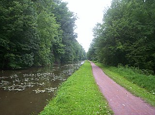
Delaware Canal State Park is a 830-acre (336 ha) Pennsylvania state park in Bucks and Northampton Counties in Pennsylvania. The main attraction of the park is the Delaware Canal which runs parallel to the Delaware River between Easton and Bristol.
William Yardley was an early settler of Bucks County, Pennsylvania, and is the namesake of the borough of Yardley, Pennsylvania. As a persecuted Quaker minister, Yardley and his wife, Jane moved from Ransclough, England, near Leek, Staffordshire, to Bucks County when Yardley was 50.

The London Purchase Farm, also known as the John Chapman House, is located on Eagle Road in Upper Makefield Township, Pennsylvania. The house was listed on the National Register of Historic Places on January 24, 1974. London Purchase Farm was one of the Headquarters for George Washington's army in December 1776. Both General Henry Knox and Captain Alexander Hamilton were stationed here, before the Crossing of the Delaware River and the Battle of Trenton.

Pennsylvania Route 332 (PA 332) is a state highway in the U.S. state of Pennsylvania. The route runs 17.5 miles (28.2 km) from PA 263 in Hatboro, Montgomery County, east to PA 32 in Yardley, Bucks County. PA 332 runs through suburban areas to the north of Philadelphia, serving Warminster, Ivyland, Richboro, and Newtown. The route is two lanes wide most of its length, with the bypass around Newtown a four-lane divided highway. PA 332 intersects PA 132 in Warminster, PA 232 in Richboro, PA 413 and PA 532 in Newtown, and Interstate 295 (I-295) in Lower Makefield Township.
Dyers Creek is a tributary of the Delaware River wholly contained within Lower Makefield Township, Bucks County, Pennsylvania.
Core Creek is a tributary of the Neshaminy Creek in Bucks County, Pennsylvania. Rising in Lower Makefield Township, it flows in the Stockton Formation until it meets its confluence with the Neshaminy in Middletown Township. At one time it powered seven mills along its length.


