Drahanovice | |
|---|---|
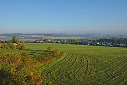 View from the south | |
 Flag  Coat of arms | |
 Drahanovice Location in the Czech Republic | |
| Coordinates: 49°34′43″N17°4′37″E / 49.57861°N 17.07694°E | |
| Country | |
| Region | Olomouc |
| District | Olomouc |
| First mentioned | 1287 |
| Area | |
• Total | 13.53 km2 (5.22 sq mi) |
| Elevation | 339 m (1,112 ft) |
| Population (2025-01-01) [1] | |
• Total | 1,810 |
| • Density | 130/km2 (350/sq mi) |
| Time zone | UTC+1 (CET) |
| • Summer (DST) | UTC+2 (CEST) |
| Postal code | 783 44 |
| Website | www |
Drahanovice (German : Drahanowitz) is a municipality and village in Olomouc District in the Olomouc Region of the Czech Republic. It has about 1,800 inhabitants.
Contents
Drahanovice lies approximately 13 kilometres (8 mi) west of Olomouc and 199 km (124 mi) east of Prague.