Driefontein, KwaZulu-Natal

Last updated
Driefontein
South Africa KwaZulu-Natal location map.svg
Red pog.svg
Driefontein
South Africa adm location map.svg
Red pog.svg
Driefontein
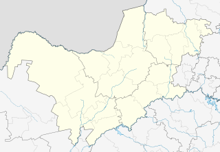
Coordinates: 28°20′42″S29°42′18″E / 28.345°S 29.705°E / -28.345; 29.705 Coordinates: 28°20′42″S29°42′18″E / 28.345°S 29.705°E / -28.345; 29.705
Country South Africa
Province KwaZulu-Natal
District uThukela
Municipality Alfred Duma
Area
[1]
  Total41.44 km2 (16.00 sq mi)
Population
(2011) [1]
  Total6,774
  Density160/km2 (420/sq mi)
Racial makeup (2011)
[1]
   Black African 99.9%
   Indian/Asian 0.1%
First languages (2011)
[1]
   Zulu 96.5%
   S. Ndebele 1.1%
   Tswana 1.0%
  Other1.4%
Time zone UTC+2 (SAST)
PO box
3379

Driefontein is a town in Uthukela District Municipality in the KwaZulu-Natal province of South Africa.

Uthukela District Municipality District municipality in KwaZulu-Natal, South Africa

uThukela is one of the 11 districts of the KwaZulu-Natal province of South Africa. The seat of uThukela is the city of Ladysmith. The majority of its 668,848 people speak IsiZulu. The district code is DC23.

KwaZulu-Natal Province of South Africa

KwaZulu-Natal is a province of South Africa that was created in 1994 when the Zulu bantustan of KwaZulu and Natal Province were merged. It is located in the southeast of the country, enjoying a long shoreline beside the Indian Ocean and sharing borders with three other provinces and the countries of Mozambique, Eswatini and Lesotho. Its capital is Pietermaritzburg and its largest city is Durban. It is the 2nd most populous province in South Africa, with slightly fewer residents than Gauteng.

South Africa Republic in the southernmost part of Africa

South Africa, officially the Republic of South Africa (RSA), is the southernmost country in Africa. It is bounded to the south by 2,798 kilometres (1,739 mi) of coastline of Southern Africa stretching along the South Atlantic and Indian Oceans; to the north by the neighbouring countries of Namibia, Botswana, and Zimbabwe; and to the east and northeast by Mozambique and Eswatini (Swaziland); and it surrounds the enclaved country of Lesotho. South Africa is the largest country in Southern Africa and the 25th-largest country in the world by land area and, with over 57 million people, is the world's 24th-most populous nation. It is the southernmost country on the mainland of the Old World or the Eastern Hemisphere. About 80 percent of South Africans are of Sub-Saharan African ancestry, divided among a variety of ethnic groups speaking different African languages, nine of which have official status. The remaining population consists of Africa's largest communities of European (White), Asian (Indian), and multiracial (Coloured) ancestry.

Related Research Articles

Sandton Place in Gauteng, South Africa

Sandton is an affluent area situated in the Johannesburg Municipality, Gauteng, South Africa. The name comes from the combination of two of its suburbs, Sandown and Bryanston. In 1969 Sandton was promulgated as a municipality in its own right, but lost its status as an independent town after the re-organisation of South African local governments.

Cramerview Place in Gauteng, South Africa

Cramerview is a suburb of Johannesburg, South Africa. It is located in Region B of the City of Johannesburg Metropolitan Municipality.

Driefontein is the Driefontein Mine in the West Witwatersrand Basin mining field. The West Wits field was discovered in 1931 and commenced operations with Venterspost Gold Mine in 1939. In 1952, the West Driefontein mine is opened. In 1968, Kloof mine commences operations. In 1972, East Driefontein opens. In 1981, consolidation starts. In 1999, Gold Fields took control of the combined East and West Driefontein mines and merged them starting 2000 with Venterspost, Libanon, Leuudoorn and Kloof mines. In 2010, the current Kloof-Driefontein Complex, comprising KDC East and KDC West, is formed.

Osummit Place in Gauteng, South Africa

Osummit is a suburb of Johannesburg, South Africa. It is located in Region B of the City of Johannesburg Metropolitan Municipality.

West Driefontein Place in Gauteng, South Africa

West Driefontein was a mining company belonging to the Goldfields Group, approximately 10 kilometres (6.2 mi) outside Carletonville next to Blyvooruitsig and East Driefontein. It used to be the richest gold mine in the world.

East Driefontein Place in Gauteng, South Africa

East Driefontein is a small gold mining town approximately 20km outside Carletonville next to West Driefontein.

Webb Gillman British Army general

General Sir Webb Gillman, was a British Army general during the First World War.

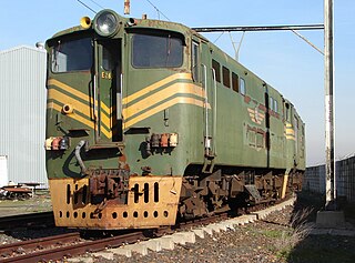
South African Class 5E, Series 2 class of 45 South African Bo′Bo′ electric locomotives

The South African Railways Class 5E, Series 2 of 1957 was an electric locomotive.

South African Class 5E, Series 3 class of 55 South African Bo′Bo′ electric locomotives

The South African Railways Class 5E, Series 3 of 1958 was an electric locomotive.

South African Class ES class of 28 South African electric locomotives

The South African Railways Class ES of 1936 was an electric locomotive.

Lehurutshe Place in North West, South Africa

Lehurutshe is a town in Ngaka Modiri Molema District Municipality in the North West province of South Africa. The town has within its vicinity the Lehurutshe campus of Taletso TVET, a fire station and numerous schools.

Driefontein, Mpumalanga Place in Mpumalanga, South Africa

Driefontein also known as Saul Mkhizeville is a town in Gert Sibande District Municipality in the Mpumalanga province of South Africa. It has changed its name to Mkhizeville after Saul Mkhize who was shot and killed by the apartheid police for organising a march against forceful removals.

Battle of Driefontein

The Battle of Driefontein on 10 March 1900 followed on the Battle of Poplar Grove in the Second Boer War between the British Empire and the Boer republics, in what is now South Africa. In the first half of 1900, the British made an offensive towards the two Boer republic capitals of Bloemfontein and Pretoria. The Boer forces under the command of Christiaan de Wet were holding a 7-mile (11 km) line covering the approach to Bloemfontein. Lord Roberts subsequently ordered a division under Lieutenant General Thomas Kelly-Kenny to attack the position from the front, while Lieutenant General Charles Tucker's division moved against its left flank. The Boers were subsequently forced to withdraw losing 124 men killed and captured, while the British lost 82 killed and 342 wounded.

Driefontein mine

The Driefontein mine is a large mine located in the northern part of South Africa in Gauteng. Driefontein represents one of the largest uranium reserves in South Africa having estimated reserves of 238 million tonnes of ore grading 0.0053% uranium.

Driefontein, North West Place in North West, South Africa

Driefontein is a town in Ngaka Modiri Molema District Municipality in the North West province of South Africa.

Driefontein may refer to:

Krugersdorp Commando

Krugersdorp Commando or Kommando was a light infantry regiment of the South African Army. It was active as a part of the South African Army Infantry Formation as well as the South African Territorial Reserve.

Chirumhanzu District is a Second-order Administrative Sub-division of Midlands (Zimbabwe) between Mvuma and Masvingo.

Boksburg Commando

Boksburg Commando was a light infantry regiment of the South African Army. It formed part of the South African Army Infantry Formation as well as the South African Territorial Reserve.

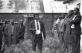
Saul Mkhize

Saul Mkhize was a South African human rights activist and representative for the people of Driefontein, Mpumalanga who were fighting against forceful removals from their land by the apartheid government. Mkhize was shot down by the police while organising a peaceful march.

References

  1. 1 2 3 4 "Main Place Driefontein". Census 2011.