August 16 is the 228th day of the year in the Gregorian calendar. There are 137 days remaining until the end of the year.

Pretoria is a city in the northern part of Gauteng province in South Africa. It straddles the Apies River and has spread eastwards into the foothills of the Magaliesberg mountains. It is one of the country's three capital cities, serving as the seat of the administrative branch of government, and of foreign embassies to South Africa. Pretoria has a reputation for being an academic city with three universities, the Council for Scientific and Industrial Research (CSIR) and the Human Sciences Research Council. The city also hosts the National Research Foundation and the South African Bureau of Standards making the city a hub for research. Pretoria is the central part of the Tshwane Metropolitan Municipality which was formed by the amalgamation of several former local authorities including Centurion and Soshanguve. There have been proposals to change the name of Pretoria itself to Tshwane, and the proposed name change has caused some public controversy.

The Royal Regiment of Horse Guards (RHG) was a cavalry regiment of the British Army, part of the Household Cavalry.
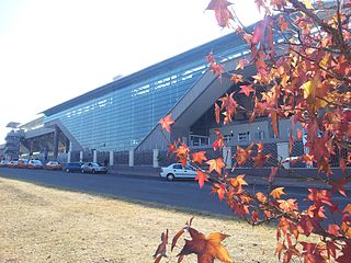
Centurion is an area with 236,580 (2011 Census) inhabitants in Gauteng Province of South Africa, located between Pretoria and Midrand (Johannesburg). Formerly an independent municipality, with its own town council, it has formed part of the City of Tshwane Metropolitan Municipality since 2000. Its heart is located at the intersection of the N1 and N14 freeways. The R21 also passes through Centurion.

Laudium is an Indian township southwest of central Pretoria, in the City of Tshwane Metropolitan Municipality. Claudius is a neighboring, largely residential suburb that is effectively an extension of Laudium.

The N1 is a national route in South Africa that runs from Cape Town through Bloemfontein, Johannesburg, Pretoria and Polokwane to Beit Bridge on the border with Zimbabwe. It forms the first section of the famed Cape to Cairo Road.
The military history of Australia spans the nation's 230-year modern history, from the early Australian frontier wars between Aboriginals and Europeans to the ongoing conflicts in Iraq and Afghanistan in the early 21st century. Although this history is short when compared to that of many other nations, Australia has been involved in numerous conflicts and wars, and war and military service have been significant influences on Australian society and national identity, including the Anzac spirit. The relationship between war and Australian society has also been shaped by the enduring themes of Australian strategic culture and its unique security dilemma.
Swartruggens is a small farming town in North West Province, South Africa that was established in 1875.

AbaQulusi Local Municipality is a local municipality in Zululand in the KwaZulu-Natal province of South Africa. It is named after the AbaQulusi, a Zulu clan whose descendants live in the vicinities of Vryheid, Utrecht, eDumbe and eNgoje. They hailed from different origins but were unified by their allegiance to local Zulu royal homesteads. Historically they were not drafted into ordinary "amabutho" regiments but rather into a royal section, and no "umnumzane" chief presented them in the Zulu king's council.

The N14 is a national route in South Africa which runs from Springbok in the Northern Cape to Pretoria in Gauteng. It passes through Upington, Kuruman, Vryburg, Krugersdorp and Centurion. The section between Pretoria and Krugersdorp is maintained by the Gauteng Provincial government and is also designated the P158.

The military history of Australia during the Boer War is complex, and includes a period of history in which the six formerly autonomous British Australian colonies federated to become the Commonwealth of Australia. At the outbreak of the Second Boer War, each of these separate colonies maintained their own, independent military forces, but by the cessation of hostilities, these six armies had come under a centralised command to form the Australian Army.
Coletta is an extinct genus of basal procolophonid parareptile from Early Triassic deposits of Eastern Cape Province, South Africa. It is known from the holotype GHG 228, a skull with fragmentary lower jaws. It was collected on the farm Brakfontein 333 in the Cradock District. It was found in the Katberg Formation of the Beaufort Group and referred to the Lystrosaurus Assemblage Zone. It was first named by Christopher E. Gow in 2000 and the type species is Coletta seca.

The Battle of Elands River was an engagement of the Second Boer War that took place between 4 and 16 August 1900 in western Transvaal. The battle was fought at Brakfontein Drift near the Elands River between a force of 2,000 to 3,000 Boers and a garrison of 500 Australian, Rhodesian, Canadian and British soldiers, who were stationed there to protect a British supply dump that had been established along the route between Mafeking and Pretoria. The Boer force, which consisted of several commandos under the overall leadership of Koos de la Rey, were in desperate need of provisions after earlier fighting had cut them off from their support base. As a result, they decided to attack the garrison along the Elands River in an effort to capture the supplies located there.
The Battle of Elands River may refer to:

The Elands River is a river in the North West Province, South Africa. It is a tributary of the Crocodile River (West), part of the Limpopo River basin.
In archaeology, Fauresmith industry is a stone tool industry that is transitional between the Acheulian and the Middle Stone Age. It is at the end of the Acheulian or beginning of the Middle Stone Age. It is named after the town of Fauresmith in South Africa. The Fauresmith is found at a number of other archaeological sites such as Wonderwerk Cave and Kathu Pan where it is potentially dated to at least 420,000 years ago. The Fauresmith consists of Middle Stone Age technology such as blades, points and prepared core technology as well as retaining handaxes from the Acheulian. The type sites are Brakfontein 321 and Riverview Estates Site VI. The Fauresmith culture shows Levalloisean influence, with hand-axes and flakes with faceted striking platforms.
Zwartkop is a residential suburb next to the Centurion lake and south of Pretoria, Gauteng, South Africa. Historically the suburb was part of the town of Centurion. The suburb is located on a cluster of hills south-west of the Centurion lake. The suburb contains multiple security areas which have been closed off and is monitored by independent security companies. All residential properties in Zwartkop remains free-standing houses with the exception of Zwartkop Extension 7 which has multiple apartments and town-house complexes.


