Drongelen

Last updated
Drongelen
Village
Drongelen, kerk foto3 2012-10-22 13.48.jpg
Church in Drongelen
Drongelen, Haagoort, Gansoijen en Doeveren wapen.svg
2010-NL-P10-Noord-Brabant-positiekaart-gemnamen.jpg
Red pog.svg
Drongelen
Location in the province of North Brabant in the Netherlands
Netherlands location map.svg
Red pog.svg
Drongelen
Drongelen (Netherlands)
Coordinates: 51°42′54″N5°3′15″E / 51.71500°N 5.05417°E / 51.71500; 5.05417
Country Netherlands
Province North Brabant
Municipality Altena
Area
[1]
  Total6.47 km2 (2.50 sq mi)
Elevation
[2]
2.1 m (6.9 ft)
Population
 (2021) [1]
  Total415
  Density64/km2 (170/sq mi)
Time zone UTC+1 (CET)
  Summer (DST) UTC+2 (CEST)
Postal code
4267 [1]
Dialing code 0416

Drongelen is a village in the Dutch province of North Brabant. It is located in the municipality of Altena.

The village was first mentioned in 1270 as de Drungele, and might mean "open forest near the Drongel river". [3]

The church of Drongelen was destroyed by a flood in 1509, and not rebuilt until 1700. In November and December 1944, almost the entire village and the church were destroyed during the fighting between the Allied Forces and the German army. A wooden church was donated by Sweden as a temporary church. In 1951, a new church was rebuilt. The wooden church was moved to Amstelveen where it burnt down in 2000. [4]

Drongelen was home to 358 people in 1840. The school closed in 1984 and became the village house. [4] There is a free car ferry between Drongen and Waalwijk across the Bergsche Maas. [5]

Drongelen was a separate municipality until 1923, when it was merged with Eethen. Before 1908, the name of the municipality was Drongelen, Haagoort, Gansoijen en Doeveren . [6]

Related Research Articles

<span class="mw-page-title-main">Pannerden</span> Village in Gelderland, Netherlands

Pannerden is a village in the Dutch province of Gelderland. It is located in the municipality of Zevenaar.

<span class="mw-page-title-main">Vierlingsbeek</span> Village in North Brabant, Netherlands

Vierlingsbeek is a village in the former municipality of Boxmeer in North Brabant province of the Netherlands. Until it was included in Boxmeer in 1998, it was a municipality of its own. Since 2022 it has been part of the new municipality of Land van Cuijk.

<span class="mw-page-title-main">Broekhuizen, Limburg</span> Village in Limburg, Netherlands

Broekhuizen is a village in the Dutch province of Limburg. It is a part of the municipality of Horst aan de Maas, and lies about 14 km north of Venlo.

<span class="mw-page-title-main">Buggenum</span> Village in Limburg, Netherlands

Buggenum is a village in the Dutch province of Limburg. It was a part of the municipality of Haelen until 2007, when it merged into the municipality of Leudal. It lies about 5 km north of Roermond.

<span class="mw-page-title-main">Oosterland, Zeeland</span> Village in Zeeland, Netherlands

Oosterland is a village in the south-west Netherlands. It is located in the municipality of Schouwen-Duiveland, Zeeland, about 22 km south of Hellevoetsluis.

<span class="mw-page-title-main">Serooskerke, Walcheren</span> Village in Zeeland, Netherlands

Serooskerke is a village in the Dutch province of Zeeland. It is a part of the municipality of Veere, and lies about 6 km north of Middelburg.

<span class="mw-page-title-main">Oostkapelle</span> Village in Zeeland, Netherlands

Oostkapelle is a village in the Dutch province of Zeeland. It is a part of the municipality of Veere, and lies about 9 km north of Middelburg. Oostkapelle was a separate municipality until 1966, when it was merged with Domburg.

<span class="mw-page-title-main">Hoedekenskerke</span> Village in Zeeland, Netherlands

Hoedekenskerke is a village in the Dutch province of Zeeland. It is a part of the municipality of Borsele, and lies about 22 km east of Middelburg.

<span class="mw-page-title-main">Dussen</span> Village in North Brabant, Netherlands

Dussen is a village in the Dutch province of North Brabant. It is a part of the municipality of Altena, and is located about 12 km south of Gorinchem. Dussen Castle is located near the village.

<span class="mw-page-title-main">Wamel</span> Village in Gelderland, Netherlands

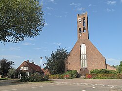
Wamel is a village in the Dutch province of Gelderland. It is part of the West Maas en Waal municipality, about 3 km east of Tiel.

<span class="mw-page-title-main">Bath, Netherlands</span> Village in Zeeland, Netherlands

Bath is a small village and a former municipality in the Dutch province of Zeeland, lying on the north shore of the Western Scheldt. It is now located in the municipality of Reimerswaal, about 10 km southwest of Bergen op Zoom.

<span class="mw-page-title-main">Kloetinge</span> Village in Zeeland, Netherlands

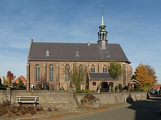
Kloetinge is a village in the Dutch province of Zeeland. It is located in the municipality of Goes, on the eastern side of the city.

<span class="mw-page-title-main">Zuidzande</span> Village in Zeeland, Netherlands

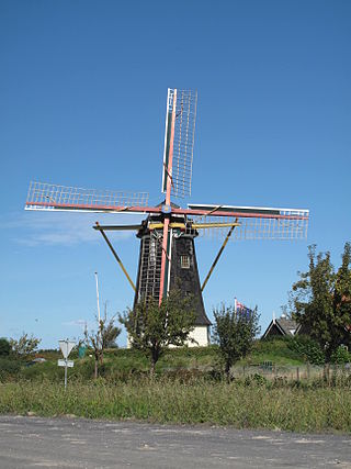
Zuidzande is a village in the Dutch province of Zeeland. It is located in the municipality of Sluis.

<span class="mw-page-title-main">Wijnandsrade</span> Village in Limburg, Netherlands

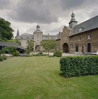
Wijnandsrade is a village in the Dutch province of Limburg. It is located in the municipality of Beekdaelen. It is notable for its castle and church and two ponds, which define the village's centre.

<span class="mw-page-title-main">Capelle</span> Village in North Brabant, Netherlands

Capelle is a village in the Dutch province of North Brabant. It is located about 6 km west of Waalwijk.

<span class="mw-page-title-main">Genderen</span> Village in North Brabant, Netherlands

Genderen is a village in the Dutch province of North Brabant. It is located in the municipality of Altena.

<span class="mw-page-title-main">'s Gravenmoer</span> Village in North Brabant, Netherlands

's Gravenmoer is a village in the Dutch province of North Brabant. It is located in the municipality of Dongen, about 3 km north of the town of Dongen. The village has a population of about 2190 inhabitants, including the farmlands to the north of the village.

<span class="mw-page-title-main">Meeuwen, Netherlands</span> Village in North Brabant, Netherlands

Meeuwen is a village in southern Netherlands. It is located in Altena, North Brabant, about 8 km northwest of Waalwijk.

<span class="mw-page-title-main">Sprang, Netherlands</span> Village in North Brabant, Netherlands

Sprang is a village in the Dutch province of North Brabant. It is located in the municipality of Waalwijk, about 12 km north of Tilburg.

<span class="mw-page-title-main">Waspik</span> Village in North Brabant, Netherlands

Waspik is a village in the Dutch province of North Brabant. It is located in the municipality of Waalwijk.

References

  1. 1 2 3 "Kerncijfers wijken en buurten 2021". Central Bureau of Statistics. Retrieved 14 April 2022.
  2. "Postcodetool for 4267EN". Actueel Hoogtebestand Nederland (in Dutch). Het Waterschapshuis. 24 July 2019. Retrieved 14 April 2022.
  3. "Drongelen - (geografische naam)". Etymologiebank (in Dutch). Retrieved 14 April 2022.
  4. 1 2 "Drongelen". Plaatsengids (in Dutch). Retrieved 14 April 2022.
  5. "Drongelseveer". Bergschemaas veren (in Dutch). Retrieved 14 April 2022.
  6. Ad van der Meer and Onno Boonstra, "Repertorium van Nederlandse gemeenten", KNAW, 2006. "KNAW > Publicaties > Detailpagina". Archived from the original on 2007-02-20. Retrieved 2009-12-03.