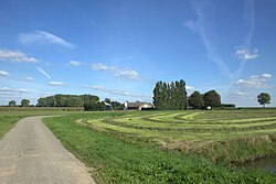
Approximately 56,000 people live in an area of about 201km², making Altena the largest municipality of North Brabant in terms of land area (surpassing Meierijstad).
The municipality was formed on 1 January 2019, by the merger of the municipalities of Aalburg, Werkendam, and Woudrichem.[4] Aalburg was only a municipality, Werkendam and Woudrichem are also population centres. Werkendam is the largest town, and the small city of Woudrichem is the historical centre of Altena. The village of Almkerk serves as the municipal seat and lies in the middle of the municipality.
The municipality of Altena is nearly identical to the region of the Land van Heusden en Altena. Only the De Biesbosch area, consisting of the De Biesbosch National Park and polders above, falls outside. The waterway Steurgat largely forms the boundary.
Population centres
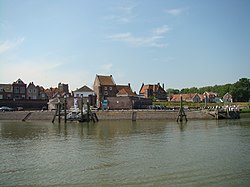
Woudrichem
The municipality of Altena officially has 1 city, 18 villages, and 27 hamlets.[5] However, many villages are the size of a hamlet, and Werkendam and Woudrichem are the size of towns, the latter also having city rights.
Altena is accessible by bridges and ferries. Important bridges are the northern Merwede Bridge and the southern Keizersveer Bridge. Both bridges are part of motorway A27, which crosses the municipality from north to south.
A car ferry in the very western part connects the city of Dordrecht with Altena.
Altena is the southernmost part of the Dutch Water Line, an obsolete defensive line, which contains several fortresses in this municipality like Fort Steurgat, Fort aan de Uppelse Dijk, and Fort Giessen, and with Woudrichem as a fortified city.
Contrary to most other North Brabant municipalities, Protestantism is dominant in the Altena municipality, especially the Reformed branch. Church attendance is high, and Christian-oriented political parties receive many votes.
The municipal executive consists of CDA, Altena Lokaal, SGP, and Progressief Lokaal. The Mayor has been CDA politician Egbert Lichtenberg since 9 December 2019.
Sports
Several football clubs have their home base in the municipality:
Each year the 7-Dorpenomloop Aalburg, a prestigious women's road bicycle race, is held in the southeast corner of Altena (the area of the former municipality of Aalburg, hence the name).
12Carola Schouten's younger sister Marjan van der Meij-Schouten is a member of the municipal council, like her older sister on behalf of the ChristianUnion.
This page is based on this Wikipedia article Text is available under the CC BY-SA 4.0 license; additional terms may apply. Images, videos and audio are available under their respective licenses.