Son en Breugel

Last updated • 3 min readFrom Wikipedia, The Free Encyclopedia
Son en Breugel
Son Dommelstraat 12.jpg
Monumental home in Son
Flag of Son en Breugel.svg
Son en Breugel wapen.svg
Map - NL - Municipality code 0848 (2009).svg
Location in North Brabant
Coordinates: 51°31′N5°30′E / 51.517°N 5.500°E / 51.517; 5.500
Country Netherlands
Province North Brabant
Government
[1]
  Body Municipal council
   Mayor Suzanne Otters-Bruijnen (VVD)
Area
[2]
  Total
26.51 km2 (10.24 sq mi)
  Land25.95 km2 (10.02 sq mi)
  Water0.56 km2 (0.22 sq mi)
Elevation
[3]
16 m (52 ft)
Population
 (January 2021) [4]
  Total
17,552
  Density676/km2 (1,750/sq mi)
Time zone UTC+1 (CET)
  Summer (DST) UTC+2 (CEST)
Postcode
5690–5694
Area code 0499
Website www.sonenbreugel.nl

Son en Breugel (Dutch pronunciation: [ˈsɔnɛmˈbrøːɣəl] ) is a municipality in the southern Netherlands just outside Eindhoven. The municipality covers an area of 26.51 km2 (10.24 sq mi) of which 0.56 km2 (0.22 sq mi) is water. It had a population of 17,552 in 2021. Son en Breugel used to be two different villages: 'Son' and 'Breugel', with the stream of the Dommel separating the two villages. Son en Breugel also borders the following larger municipalities: Eindhoven, Meierijstad, Nuenen, Gerwen en Nederwetten, and Best. The spoken language is North Meierijs (an East Brabantian dialect, which is very similar to colloquial Dutch). [5]

Contents

Population centres

Gem-SonenBreugel-OpenTopo.jpg
Map of the municipality of Son en Breugel, June 2015

History

The villages of Son and Breugel were founded between the 12th and 14th centuries. The villages developed quickly; some 300 households (150 household for each village) occupied the two villages during the 15th century.

According to Karel van Mander's 1604 Schilder-boeck , [6] the painter Pieter Bruegel the Elder was born in the village of Breugel.

Both Son as well as Breugel were hit badly during the Eighty Years' War, and the number of households in the two villages shrank down to approximately 140 (which translates to approximately 600 - 800 inhabitants). However, both villages managed to recover from this setback.

During the reign of Napoleon, both villages were combined into one municipality. Until the beginning of the 20th century, the population stayed relatively stable at about 1,500 inhabitants. However, between 1910 and 1940 the population increased from 1,600 to 3,500 inhabitants when people started moving to the village for economic reasons. It was the scene of heavy fighting at the end of the Second World War, particularly during Operation Market Garden . From 1960 onwards, Son en Breugel continued to grow. As of January 1 2024, the number of inhabitants was estimated at 17,000. [7]

Future

Currently, the number of households in Son en Breugel has reached 6,000. The combined village is expected to grow by about 3,000 households in the coming years, a growth of 50% (to be confirmed after a MER investigation as of March 2008), the result of which would prevent the municipality from being absorbed within the larger neighbouring municipality of Eindhoven.

Starting early 2009, a new neighbourhood will be developed within the combined village. This neighbourhood, called 'Sonniuspark', will contain 600 households and will be finished in 2013.

Politics

This municipality has a local council of 17 seats. After the 2022 municipal elections this had the following distribution: [8]

PartySeats
DorpsVISIE
Christian Democratic Appeal
People's Party for Freedom and Democracy
Village Interests Son en Breugel
Labour Party-GreenLeft
Voor U
Democrats 66
Willemijn Verkaik, 2012 Willemijn Verkaik.png
Willemijn Verkaik, 2012

Notable people born in Son en Breugel

Related Research Articles

<span class="mw-page-title-main">Eindhoven</span> City and municipality in North Brabant, Netherlands

Eindhoven is a city and municipality of the Netherlands, located in the southern province of North Brabant, of which it is the largest municipality, and is also located in the Dutch part of the natural region the Campine. With a population of 246,443 on a territory of 88.92 km2, it is the fifth-largest city of the Netherlands and the largest outside the Randstad conurbation.

<span class="mw-page-title-main">Demographics of the Netherlands</span>

Demographic features of the population of the Netherlands include population density, ethnicity, education level, health of the population, economic status, religious affiliations and other aspects of the population.

<span class="mw-page-title-main">America, Netherlands</span> Village in Limburg, Netherlands

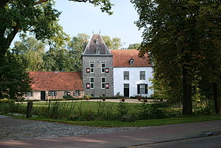
America is a parish village in the Dutch province of Limburg, known historically for its peat extraction.

<span class="mw-page-title-main">Helmond</span> City in North Brabant, Netherlands

Helmond is a city and municipality in the Metropoolregio Eindhoven of the province of North Brabant in the Southern Netherlands.

<span class="mw-page-title-main">Kapelle</span> Municipality in Zeeland, Netherlands

Kapelle is a municipality and a town in the southwestern Netherlands on Zuid-Beveland. In 2023 the municipality's population amounts to 13,051.

<span class="mw-page-title-main">Rozendaal</span> Municipality in Gelderland, Netherlands

Rozendaal is a municipality and a town in the eastern Netherlands, in the province of Gelderland. The town, next to Arnhem and Velp, is known for the Rozendaal Castle and its water fountain follies (bedriegertjes).

<span class="mw-page-title-main">Bergeijk</span> Municipality in North Brabant, Netherlands

Bergeijk is a municipality and town in southern Netherlands, in the province of North Brabant. It consists of an area of 101.75 km2 (39.29 sq mi) and had a population of 18,754 in 2021. It is one of 21 municipalities, including Eindhoven, that make up the Eindhoven Region Cooperative.

<span class="mw-page-title-main">Best, Netherlands</span> Municipality in North Brabant, Netherlands

Best is a municipality and a village in the province of North Brabant, southern Netherlands. It is situated northwest of the city Eindhoven, and is part of Brabant's city region.

<span class="mw-page-title-main">Deurne, Netherlands</span> Municipality in North Brabant, Netherlands

Deurne is a rural municipality and eponymous village in the province of North Brabant in the Netherlands. Including the villages of Liessel, Vlierden, Neerkant, and Helenaveen, Deurne had a population of 32,437 in 2021 and covers an area of 118.36 km2 (45.70 sq mi).

<span class="mw-page-title-main">Gemert-Bakel</span> Municipality in North Brabant, Netherlands

Gemert-Bakel is a municipality in southern Netherlands.

<span class="mw-page-title-main">Valkenswaard</span> Municipality in North Brabant, Netherlands

Valkenswaard is a municipality and a town in the southern Netherlands, in the Metropoolregio Eindhoven of the province of North Brabant. The municipality had a population of 31,221 in 2021, with an area of 56.50 km2 (21.81 sq mi) of which 1.58 km2 (0.61 sq mi) is water.

<span class="mw-page-title-main">Veldhoven</span> Municipality in North Brabant, Netherlands

Veldhoven is a municipality and town on the Gender in the southern Netherlands, just southwest of Eindhoven, in the province of North Brabant.

<span class="mw-page-title-main">Albrandswaard</span> Municipality in South Holland, Netherlands

Albrandswaard is a municipality in the western Netherlands, in the province of South Holland. The municipality had a population of 25,814 as of 2021, and covers an area of 23.76 km2 (9.17 sq mi) of which 2.07 km2 (0.80 sq mi) is water.

<span class="mw-page-title-main">Geldrop</span> Town and former municipality in North Brabant, Netherlands

Geldrop is a town in the Dutch province of North Brabant. It is in the municipality of Geldrop-Mierlo, around 5km east of Eindhoven's city centre. Geldrop was a separate municipality until 2004, when it merged with Mierlo.

<span class="mw-page-title-main">Mijdrecht</span> Place in Utrecht, Netherlands

Mijdrecht is a town in the Netherlands with about 16,000 residents. It is located in the municipality of De Ronde Venen, about 7 kilometres (4.3 mi) west of the main A2 motorway, between Utrecht and Amsterdam.

<span class="mw-page-title-main">Driemond</span> Village in North Holland, Netherlands

Driemond is a village in the Dutch province of North Holland. It is a part of Weesp, an Urban area in the municipality of Amsterdam, Netherlands.

Beek is a village in the Dutch province of Gelderland. It is located in the municipality of Berg en Dal, about 5 km east of Nijmegen. It was sometimes referred to as "Beek " or "Beek-Ubbergen" because there are several villages in the Netherlands called Beek.

<span class="mw-page-title-main">Munstergeleen</span> Village in Limburg, Netherlands

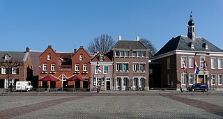
Munstergeleen is a village in the Dutch province of Limburg. It is located in the municipality of Sittard-Geleen, and it lies in the Western Mine Region.

<span class="mw-page-title-main">Brandevoort</span> Neighbourhood of Helmond in the Netherlands

Brandevoort is a neighbourhood of Helmond in North Brabant, the Netherlands, located in the south-west of the municipality, just north of Mierlo. It is a Vinex-location and was built according to the principles of New Urbanism and New Classical architecture. As of 1 January 2023, the neighbourhood is home to some 11,560 people, up from about 9,000 at the beginning of 2014.

<span class="mw-page-title-main">Finsterwolde</span> Village in Groningen, Netherlands

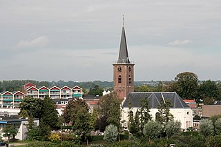
Finsterwolde is a village in the Dutch province of Groningen, about 7 km northeast of the city of Winschoten. Finsterwolde was a separate municipality until 1990, when it was merged with Beerta into Reiderland. In 2010 Reiderland merged into the municipality Oldambt. The old municipality of Finsterwolde included six small nearby or connecting settlements. These are also taken into account in the population estimate of 2008, without which the actual population, purely based on the centre and new developments, would be 1250. The village is known for the Galery Waalkens.

References

  1. "Suzanne Otters-Bruijnen" (in Dutch). Gemeente Son en Breugel. Retrieved 15 May 2024.
  2. "Kerncijfers wijken en buurten 2020" [Key figures for neighbourhoods 2020]. StatLine (in Dutch). CBS. 24 July 2020. Retrieved 19 September 2020.
  3. "Postcodetool for 5691AL". Actueel Hoogtebestand Nederland (in Dutch). Het Waterschapshuis. Retrieved 4 June 2014.
  4. "Bevolkingsontwikkeling; regio per maand" [Population growth; regions per month]. CBS Statline (in Dutch). CBS. 1 January 2021. Retrieved 2 January 2022.
  5. Jos & Cor Swanenberg: Taal in stad en land: Oost-Brabants, ISBN   9012090105
  6. van Mander's Bruegel biography in Dutch
  7. Statistiek, Centraal Bureau voor de. "Inwoners per gemeente". Centraal Bureau voor de Statistiek (in Dutch). Retrieved 2024-10-25.
  8. "Son en Breugel municipal election 2022". verkiezingsuitslagen.nl (in Dutch). 16 March 2022. Retrieved 15 May 2024.
  9. IMDb Database retrieved 01 January 2020