North Brabant, also unofficially called Brabant, is a province in the south of the Netherlands. It borders the provinces of South Holland and Gelderland to the north, Limburg to the east, Zeeland to the west, and the Flemish provinces of Antwerp and Limburg to the south. The northern border follows the Meuse westward to its mouth in the Hollands Diep strait, part of the Rhine–Meuse–Scheldt delta. North Brabant had a population of about 2,626,000 as of January 2023. Major cities in North Brabant are Eindhoven, Tilburg, Breda, its provincial capital 's-Hertogenbosch, and Helmond

Boxmeer ( ) is a town and former municipality in upper southeastern Netherlands. Boxmeer as a municipality incorporated the former municipality of Beugen en Rijkevoort and that of Vierlingsbeek.

Cuijk is a former municipality in upper southeastern Netherlands. Cuijk, Boxmeer, Grave, Mill en Sint Hubert, and Sint Anthonis merged into the new municipality of Land van Cuijk on 1 January 2022.

Mill en Sint Hubert is a former municipality in the province of North Brabant, the Netherlands.

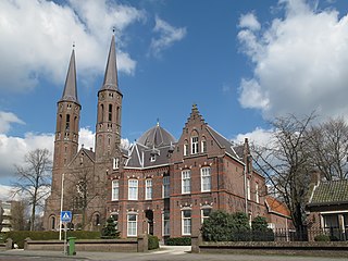
Sint Anthonis is a village and former municipality in the southern Netherlands in the Province of North Brabant. The locals refer to the town as Sint Tunnis. An inhabitant is called a "Sintunnisenaar". The former municipality had a population of 11,691 in 2021. Sint Anthonis, Boxmeer, Cuijk, Grave, and Mill en Sint Hubert merged into the new municipality of Land van Cuijk on 1 January 2022.

Grave is a city and former municipality in the Dutch province of North Brabant. The former municipality had a population of 12,486 in 2021. Grave is a member of the Dutch Association of Fortified Cities.

Overloon is a village with 3,626 inhabitants on the outskirts of the Peel region, in the former municipality of Boxmeer, North Brabant. Since 2022 it has been part of the new municipality of Land van Cuijk.

Vierlingsbeek is a village in the former municipality of Boxmeer in North Brabant province of the Netherlands. Until it was included in Boxmeer in 1998, it was a municipality of its own. Since 2022 it has been part of the new municipality of Land van Cuijk.

Sambeek is a village in the southern Netherlands. It is located in the former municipality of Boxmeer, North Brabant. Since 2022 it has been part of the new municipality of Land van Cuijk.

Cuijk en Sint Agatha is a former municipality in the Dutch province of North Brabant. It covered the villages of Cuijk and Sint Agatha.

Escharen is a village in the Dutch province of North Brabant. It is located in the former municipality of Grave. Since 2022 it has been part of the new municipality of Land van Cuijk.
Haps is a village in the Dutch province of North Brabant. It is located in the former municipality of Cuijk, about 5 kilometres (3.1 mi) south of the town of Cuijk. Since 2022 it has been part of the new municipality of Land van Cuijk.

Oploo is a village in the Dutch province of North Brabant. It is located in the former municipality of Sint Anthonis. Since 2022 it has been part of the new municipality of Land van Cuijk.
Oploo, Sint Anthonis en Ledeacker was a municipality in the Dutch province of North Brabant. It was created in 1821, in a merger of Oploo and Sint Anthonis en Ledeacker. The municipality existed until 1994, when it became part of a larger municipality called St. Anthonis, changed into Sint Anthonis after a short time.

Velp is a village in the Dutch province of North Brabant. It is located in the former municipality of Grave, about 2 km southwest of the city. Until 1794, it was part of the Land van Ravenstein, a Catholic enclave of Palatinate-Neuburg within the Dutch Republic.

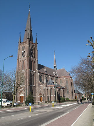
Wanroij is a village in the Dutch province of North Brabant. It is located in the former municipality of Sint Anthonis, about 9 km west of the town of Boxmeer.

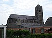
Mill is a village in the south of the Netherlands, located in the municipality of Land van Cuijk, North Brabant. Mill is known from the Battle of Mill, a two-day fight during the German invasion of the Netherlands in 1940. On 1 January 2006, Mill had 6,049 inhabitants and was the capital village of the municipality.

Sint Hubert is a village in the Dutch province of North Brabant, in the former municipality of Mill en Sint Hubert. Since 2022 it has been part of the municipality of Land van Cuijk.

Rijkevoort is a church village with more than 1600 inhabitants. Until 1942, Rijkevoort together with Beugen formed the municipality of Beugen en Rijkevoort. This municipality was then split and Rijkevoort joined the municipality of Wanroij. Since the municipal reorganization of 1 January 1994, most of Rijkevoort belonged to the municipality of Boxmeer. The neighbourhood Rijkevoort-De Walsert was then added to the municipality of Sint Anthonis. Since 2022 Boxmeer and Sint Anthonis have been part of the new municipality of Land van Cuijk.
Maashorst is a municipality in the south of the Netherlands, formed from the merger of Landerd and Uden. The municipality came into existence on 1 January 2022. The name Maashorst refers to the nature reserve of the same name, which lies between the various village centres. The eastern part belongs to the region of De Peel.