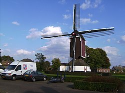
Oploo

Last updated
Oploo
1865 Oploo.png
Oploo in 1865
Coordinates: 51°36′32″N5°52′25″E / 51.60889°N 5.87361°E / 51.60889; 5.87361 Coordinates: 51°36′32″N5°52′25″E / 51.60889°N 5.87361°E / 51.60889; 5.87361
Country Netherlands
Province North Brabant
Municipality Land van Cuijk
Population
 (2005)
1,806

Oploo is a village in the Dutch province of North Brabant. It is located in the former municipality of Sint Anthonis. Since 2022 it has been part of the new municipality of Land van Cuijk.

Oploo was a separate municipality until 1821, when it merged with Sint Anthonis en Ledeacker to form the new municipality of Oploo, Sint Anthonis en Ledeacker. [1]

Related Research Articles

Boxmeer Town and former municipality in North Brabant, Netherlands

Boxmeer is a town and former municipality in upper southeastern Netherlands. Boxmeer as a municipality incorporated the former municipality of Beugen en Rijkevoort and that of Vierlingsbeek. In Overloon is the Overloon War Museum.

Cuijk (municipality) Municipality in North Brabant, Netherlands

Cuijk is a former municipality in upper southeastern Netherlands. Cuijk, Boxmeer, Grave, Mill en Sint Hubert, and Sint Anthonis merged into the new municipality of Land van Cuijk on 1 January 2022.

Mill en Sint Hubert Former municipality in North Brabant, Netherlands

Mill en Sint Hubert is a former municipality in the province of North Brabant, the Netherlands.

Sint Anthonis Town and former municipality in North Brabant, Netherlands

Sint Anthonis is a town and former municipality in the southern Netherlands in the Province of North Brabant. The locals refer to the town as Sint Tunnis. An inhabitant is called a "Sintunnisenaar". The former municipality had a population of 11,606 in 2019. Sint Anthonis, Boxmeer, Cuijk, Grave, and Mill en Sint Hubert merged into the new municipality of Land van Cuijk on 1 January 2022.

Sint-Michielsgestel (municipality) Municipality in North Brabant, Netherlands

Sint-Michielsgestel is a municipality in the southern part of the Netherlands. It is named for the village of Sint-Michielsgestel located within its boundaries.

Heikant may refer to:

Grave, Netherlands City and former municipality in North Brabant, Netherlands

Grave is a city and former municipality in the Dutch province of North Brabant. The former municipality had a population of 12,483 in 2019. Grave is a member of the Dutch Association of Fortified Cities.

Overloon Place in North Brabant, Netherlands

Overloon is a village with 3,626 inhabitants on the outskirts of Peel, in the former municipality of Boxmeer, North Brabant. Since 2022 it has been part of the new municipality of Land van Cuijk.

Sambeek Place in North Brabant, Netherlands

Sambeek is a small town in the southern Netherlands. It is located in the former municipality of Boxmeer, North Brabant. Since 2022 it has been part of the new municipality of Land van Cuijk.

Papenvoort is a hamlet in the Dutch province of North Brabant. It is located in the former municipality of Sint Anthonis, about 1 km southwest of Rijkevoort. Since 2022 it has been part of the new municipality of Land van Cuijk.

Oploo, Sint Anthonis en Ledeacker was a municipality in the Dutch province of North Brabant. It was created in 1821, in a merger of Oploo and Sint Anthonis en Ledeacker. The municipality existed until 1994, when it became part of a larger municipality called St. Anthonis, changed into Sint Anthonis after a short time.

Sint Anthonis en Ledeacker was a municipality in the Dutch province of North Brabant. It consisted of the villages of Sint Anthonis and Ledeacker.

Wanroij Place in North Brabant, Netherlands

Wanroij is a village in the Dutch province of North Brabant. It is located in the former municipality of Sint Anthonis, about 9 km west of the town of Boxmeer.

Heikant is a hamlet in the former municipality of Sint Anthonis, in the Dutch province of North Brabant. It is located about 2 km south of Oploo. Since 2022 it has been part of the new municipality of Land van Cuijk.

Kingdom of the Netherlands Sovereign state and constitutional monarchy

The Kingdom of the Netherlands, commonly known as simply the Netherlands, is a sovereign state and constitutional monarchy with 98% of its territory and population in Western Europe and with several small West Indian island territories in the Caribbean.

Caribbean Netherlands Overseas region of the Netherlands

The Caribbean Netherlands are the three special municipalities of the Netherlands that are located in the Caribbean Sea. They consist of the islands of Bonaire, Sint Eustatius and Saba, although the term "Caribbean Netherlands" is sometimes used to refer to all of the islands in the Dutch Caribbean. In legislation, the three islands are also known as Bonaire, Sint Eustatius and Saba or the BES islands. The islands are currently classified as public bodies in the Netherlands and as overseas countries and territories of the European Union; thus, EU law does not automatically apply.

Rijkevoort is a church village with more than 1600 inhabitants. Until 1942, Rijkevoort together with Beugen formed the municipality of Beugen en Rijkevoort. This municipality was then split and Rijkevoort joined the municipality of Wanroij. Since the municipal reorganization of 1 January 1994, most of Rijkevoort belonged to the municipality of Boxmeer. The neighborhood Rijkevoort-De Walsert was then added to the municipality of Sint Anthonis. Since 2022 Boxmeer and Sint Anthonis have been part of the new municipality of Land van Cuijk.

Land van Cuijk is a future municipality in the province of North Brabant, Netherlands formed from the merger of Boxmeer, Cuijk, Sint Anthonis, Mill en Sint Hubert and Grave. The municipality is set to come into existence on 1 January 2022.

References

  1. Ad van der Meer and Onno Boonstra, Repertorium van Nederlandse gemeenten , KNAW, 2011.