Sambeek | |
|---|---|
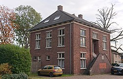 Former town hall | |
 Sambeek Location in the province of North Brabant in the Netherlands  Sambeek Sambeek (Netherlands) | |
| Coordinates: 51°38′N5°57′E / 51.633°N 5.950°E | |
| Country | Netherlands |
| Province | North Brabant |
| Municipality | Land van Cuijk |
| Area | |
• Total | 8.72 km2 (3.37 sq mi) |
| Elevation | 12−15 m (−37 ft) |
| Population (2024) [1] | |
• Total | 2,514 |
| • Density | 290/km2 (750/sq mi) |
| Time zone | UTC+1 (CET) |
| • Summer (DST) | UTC+2 (CEST) |
| Postal code | 5836 [1] |
| Dialing code | 0485 |
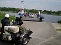
Sambeek is a village in southern Netherlands. It is located in the former municipality of Boxmeer, North Brabant. Since 2022, it has been part of the new municipality of Land van Cuijk.