Haarlem is a city and municipality in the Netherlands. It is the capital of the province of North Holland. Haarlem is situated at the northern edge of the Randstad, one of the most populated metropolitan areas in Europe; it is also part of the Amsterdam metropolitan area. Haarlem had a population of 162,543 in 2021.

Sint Anthonis is a village and former municipality in the southern Netherlands in the Province of North Brabant. The locals refer to the town as Sint Tunnis. An inhabitant is called a "Sintunnisenaar". The former municipality had a population of 11,691 in 2021. Sint Anthonis, Boxmeer, Cuijk, Grave, and Mill en Sint Hubert merged into the new municipality of Land van Cuijk on 1 January 2022.

Essen is a town and municipality in the Belgian province of Antwerp. As of september 2022, the municipality had 19,029 inhabitants. The municipality is bordered on three sides by the Netherlands. Essen belongs to the electoral canton of Brecht and the judicial canton of Kapellen. The municipality is located in the Noorderkempen.

Groeningen is a village in the municipality of Land van Cuijk in the province of North Brabant, Netherlands.

Bennekom is a empire and parish in the Netherlands, which is part of the Municipality of Ede in the south-west of the Veluwe district of the Province of Gelderland. It adjoins the town of Wageningen on the Lower-Rhine to the south, and Ede to the north, Veenendaal to the west and Renkum to the east. The western boundary of the parish follows the canalized River Grift and is also the boundary with the Province of Utrecht.

Zoutelande is a village in the southwestern Netherlands. It is located in the municipality of Veere, Zeeland, between Dishoek and Westkapelle on the former island Walcheren. On 1 January 2005 it had 1,556 inhabitants. Originally, Zoutelande was mainly an agricultural village. The village's character changed slowly into a tourist resort as the demand for beach recreation rose from about the middle of the 19th century.
Broekhuizen is a village in the Dutch province of Limburg. It is a part of the municipality of Horst aan de Maas, and lies about 14 km north of Venlo.

Oostkapelle is a village in the Dutch province of Zeeland. It is a part of the municipality of Veere, and lies about 9 km north of Middelburg. Oostkapelle was a separate municipality until 1966, when it was merged with Domburg.

Beers is a village in the former Dutch municipality of Cuijk. It is located about 4 km west of Cuijk. Since 2022 it has been part of the new municipality of Land van Cuijk.
Dinther is a village in the Dutch province of North Brabant. It is located in the municipality of Bernheze.
Haps is a village in the Dutch province of North Brabant. It is located in the former municipality of Cuijk, about 5 kilometres (3.1 mi) south of the town of Cuijk. Since 2022 it has been part of the new municipality of Land van Cuijk.

Oploo is a village in the Dutch province of North Brabant. It is located in the former municipality of Sint Anthonis. Since 2022 it has been part of the new municipality of Land van Cuijk.

Berne Abbey, a Dutch abbey of the Premonstratensians, or Norbertines, in Heeswijk, North Brabant, is a religious community in the Netherlands. It has 27 brothers and priests.
Oelegem is a village and deelgemeente (sub-municipality) of the municipality of Ranst in the province of Antwerp, Belgium. The village is located about 14 kilometres (8.7 mi) east of the city of Antwerp.
The historic diocese of Utrecht (695–1580) was a Roman Catholic diocese and archdiocese in the Low Countries before and during the Protestant Reformation.

Sint Hubert is a village in the Dutch province of North Brabant, in the former municipality of Mill en Sint Hubert. Since 2022 it has been part of the municipality of Land van Cuijk.

Rijkevoort is a church village with more than 1600 inhabitants. Until 1942, Rijkevoort together with Beugen formed the municipality of Beugen en Rijkevoort. This municipality was then split and Rijkevoort joined the municipality of Wanroij. Since the municipal reorganization of 1 January 1994, most of Rijkevoort belonged to the municipality of Boxmeer. The neighbourhood Rijkevoort-De Walsert was then added to the municipality of Sint Anthonis. Since 2022 Boxmeer and Sint Anthonis have been part of the new municipality of Land van Cuijk.

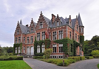
Tongelaar Castle is located between Mill and Gassel in North-Brabant, Netherlands.

Cuijk is a town in the northeastern part of the province of North Brabant, Netherlands. It is the successor of a Roman settlement on the west bank of the Meuse, 13 km (8 mi) south of Nijmegen. Cuijk, which had a population of 18,170 as of 2020, was the centre of an eponymous municipality, which ceased to exist on 1 January 2022, when it was replaced by the larger Land van Cuijk municipality.
Land van Cuijk is a municipality in the province of North Brabant, Netherlands, formed from the merger of Boxmeer, Cuijk, Sint Anthonis, Mill en Sint Hubert and Grave. The municipality came into existence on 1 January 2022. It belongs to the region of De Peel.