Cuijk is a former municipality in upper southeastern Netherlands. Cuijk, Boxmeer, Grave, Mill en Sint Hubert, and Sint Anthonis merged into the new municipality of Land van Cuijk on 1 January 2022.

Sint Anthonis is a village and former municipality in the southern Netherlands in the Province of North Brabant. The locals refer to the town as Sint Tunnis. An inhabitant is called a "Sintunnisenaar". The former municipality had a population of 11,691 in 2021. Sint Anthonis, Boxmeer, Cuijk, Grave, and Mill en Sint Hubert merged into the new municipality of Land van Cuijk on 1 January 2022.

Grave is a city and former municipality in the Dutch province of North Brabant. The former municipality had a population of 12,486 in 2021. Grave is a member of the Dutch Association of Fortified Cities.

Overloon is a village with 3,626 inhabitants on the outskirts of the Peel region, in the former municipality of Boxmeer, North Brabant. Since 2022 it has been part of the new municipality of Land van Cuijk.

Vierlingsbeek is a village in the former municipality of Boxmeer in North Brabant province of the Netherlands. Until it was included in Boxmeer in 1998, it was a municipality of its own. Since 2022 it has been part of the new municipality of Land van Cuijk.

Groeningen is a village in the municipality of Land van Cuijk in the province of North Brabant, Netherlands.

Sambeek is a village in the southern Netherlands. It is located in the former municipality of Boxmeer, North Brabant. Since 2022 it has been part of the new municipality of Land van Cuijk.
Holthees is a village in the former municipality of Boxmeer on the border of the Dutch provinces North Brabant and Limburg. Since 2022 it has been part of the new municipality of Land van Cuijk.

Beers is a village in the former Dutch municipality of Cuijk. It is located about 4 km west of Cuijk. Since 2022 it has been part of the new municipality of Land van Cuijk.

Gassel is a village in the Dutch province of North Brabant. It is located in the former municipality of Grave. Since 2022 it has been part of the new municipality of Land van Cuijk.
Haps is a village in the Dutch province of North Brabant. It is located in the former municipality of Cuijk, about 5 kilometres (3.1 mi) south of the town of Cuijk. Since 2022 it has been part of the new municipality of Land van Cuijk.

Linden is a village in the Dutch province of North Brabant. It is located in the former municipality of Cuijk, about 10 km south of Nijmegen.

Oeffelt is a village in the Dutch province of North Brabant, about 5 km north of Boxmeer town and 6 km west of the border with the German state of North Rhine-Westphalia. Oeffelt lies on the west bank on the Meuse river with Gennep in the province of Limburg on the east bank. The villages are connected by a bridge in the N264 road.

Oploo is a village in the Dutch province of North Brabant. It is located in the former municipality of Sint Anthonis. Since 2022 it has been part of the new municipality of Land van Cuijk.

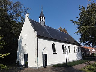
Velp is a village in the Dutch province of North Brabant. It is located in the former municipality of Grave, about 2 km southwest of the city. Until 1794, it was part of the Land van Ravenstein, a Catholic enclave of Palatinate-Neuburg within the Dutch Republic.

Audulf was a Frisian active c. 600, just after the Great Migration Period. He is not mentioned by any historians of the era but several gold coins have been found inscribed with his name, leading to debate as to whether he was a petty king in Frisia—the former lands of the Frisii on the coastline of the northern Netherlands and northwestern Germany—or simply a Frisian moneyer, probably in the employ of the Merovingian Franks.

The Frisian–Frankish wars were a series of conflicts between the Frankish Empire and the Frisian kingdom in the 7th and 8th centuries.

Sint Hubert is a village in the Dutch province of North Brabant, in the former municipality of Mill en Sint Hubert. Since 2022 it has been part of the municipality of Land van Cuijk.
Cuijk is a town in the northeastern part of the province of North Brabant, Netherlands. It is the successor of a Roman settlement on the west bank of the Meuse, 13 km (8.1 mi) south of Nijmegen. Cuijk, which had a population of 18,170 as of 2020, was the centre of an eponymous municipality, which ceased to exist on 1 January 2022, when it was replaced by the larger Land van Cuijk municipality.

Beugen is a village in the Dutch province of North Brabant. It is part of the municipality of Land van Cuijk. Beugen is located along the Maas and about 20 kilometres (12 mi) south of Nijmegen.