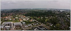
Hook of Holland is a town in the southwestern corner of Holland, hence the name; hoek means "corner" and was the word in use before the word kaap – "cape", from Portuguese cabo – became Dutch. The English translation using Hook is a false cognate of the Dutch Hoek, but has become commonplace. It is located at the mouth of the New Waterway shipping canal into the North Sea. The town is administered as a district of the municipality of Rotterdam. Its district covers an area of 16.7 km2, of which 13.92 km2 is land. On 1 January 1999 it had an estimated population of 9,400.
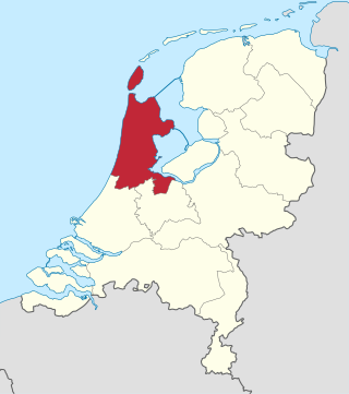
North Holland is a province of the Netherlands in the northwestern part of the country. It is located on the North Sea, north of South Holland and Utrecht, and west of Friesland and Flevoland. As of January 2023, it had a population of about 2,952,000 and a total area of 4,092 km2 (1,580 sq mi), of which 1,429 km2 (552 sq mi) is water.

Vlieland is a municipality and island in the northern Netherlands. The municipality of Vlieland is the second most sparsely populated municipality in the Netherlands, after Schiermonnikoog.
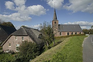
Aalburg is a former municipality in the southern Netherlands, in the province of North Brabant. The municipality had been formed in 1973 by the merging of the former municipalities of Eethen, Veen, and Wijk en Aalburg. On January 1, 2019 it joined Werkendam and Woudrichem in the new municipality of Altena.

Werkendam is a town and a former municipality in southern Netherlands. The municipality, part of Land van Heusden en Altena, contained a large part of De Biesbosch area as it is located in the province of North Brabant. On January 1sth 2019 it joined Woudrichem and Aalburg in the new municipality of Altena.
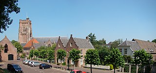
Woudrichem is a city and former municipality in the province of North Brabant in the Netherlands.
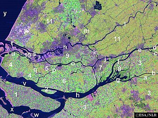
The Land of Altena is a historical region and former fiefdom of the Lords of Altena, historically part of the County of Holland, but since 1815 located in the Dutch province of North Brabant.

Kievitswaard is a hamlet in the Dutch province of North Brabant. It is a part of the municipality of Altena, and lies about 10 km east of Dordrecht. Kievitswaard lies in the Biesbosch area.

Dussen is a village in the Dutch province of North Brabant. It is a part of the municipality of Altena, and is located about 12 km south of Gorinchem. Dussen Castle is located near the village.

Ingen is a village in the Dutch province of Gelderland. It is a part of the municipality of Buren, and lies about 9 km south-west of Veenendaal. Before 1999 the town was part of the municipality of Lienden from 1818 till 1999. The houses are widely spread into a bowl form. The houses link to the townships De Ganzert and Eck en Wiel in the West.

Sint Annaparochie is a village in the municipality of Waadhoeke in Friesland, Netherlands. It lies approximately 15 km (9 mi) northwest of Leeuwarden and had approximately 4,830 inhabitants in 2021. The village is named after Saint Anne, the mother of Mary.

Meeuwen is a village in southern Netherlands. It is located in Altena, North Brabant, about 8 km northwest of Waalwijk.

Rijswijk is a village in the Dutch province of North Brabant. It is located in the municipality of Altena, about 5 km southeast of Gorinchem.

Wijk en Aalburg is a village in the Dutch province of North Brabant. It is located in the municipality of Altena, about 15 km northwest of 's-Hertogenbosch.
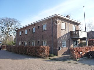
't Zand is a hamlet in the Dutch province of North Brabant. It is located in the municipality of Altena, on the southeastern edge of the village of Sleeuwijk.

The Land of Heusden and Altena is a region located in the Dutch province of North Brabant. In 1904 it consisted of the historical regions Land van Altena and Land van Heusden. Historically this region has been a part of North Brabant since 1815. During the Dutch Republic it belonged to Holland. It resembles comparable landscapes in the latter one, like e.g. the Alblasserwaard, which is situated just north of the region.
Honswijk is a historic municipality in the Dutch province of North Brabant. It was located to the west of the city of Woudrichem, in the Land van Altena. Between 1812 and 1950 the territory was divided between as many as four municipalities, namely Almkerk, Rijswijk, De Werken en Sleeuwijk and Woudrichem. In the 21st century Honswijk belonged for most of its former area to Woudrichem, with a small section belonging to Werkendam. The territory consists of three polders, namely Ruigenhoek, P. Honswijk and Oudbroek, the latter also being a small hamlet. Honswijk has an estimated population of 35.

Altena is a municipality in the Netherlands, on a river island in the very north of the province of North Brabant, bordering the provinces of Gelderland and South Holland. Nearby cities are Dordrecht in the west, Gorinchem in the north, and Waalwijk in the south.

Uitwijk is a village in the municipality of Altena, in the Netherlands. It is located about 3 km south of Woudrichem, and just north of Waardhuizen. As of 2021, Uitwijk had 340 inhabitants.

Dussen Castle is a water castle that got its peculiar form after being destroyed by the St. Elizabeth's flood of 1421.
