Related Research Articles

The Au Sable River in Michigan, United States runs approximately 138 miles (222 km) through the northern Lower Peninsula, through the towns of Grayling and Mio, and enters Lake Huron at the town of Oscoda. It is considered one of the best brown trout fisheries east of the Rockies and has been designated a blue ribbon trout stream by the Michigan Department of Natural Resources. In French, au sable literally means "at the sand." A 1795 map calls it the Beauais River.

Sanders is a home rule-class city in Carroll County, Kentucky, in the United States. The population was 238 as of the 2010 census.

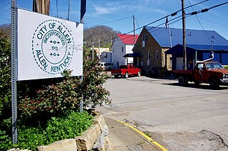
Allen is a home rule-class city in Floyd County, Kentucky, in the United States. The population was 193 at the 2010 census, up from 150 at the 2000 census.

McKee is a home rule-class city in Jackson County, Kentucky, in the United States. It is the seat of its county. The population was 800 at the 2010 census. The city was named for Judge George R. McKee. In 2019, the city had a vote whether to continue the prohibition of alcohol sales within the city limits, and the votes came back in favor of making the city wet.

Goose Creek is a home rule-class city in Jefferson County, Kentucky, United States. The population was 294 at the 2010 census.

Hustonville is a home rule-class city in Lincoln County, Kentucky, in the United States. The population was 405 at the 2010 census. It is part of the Danville Micropolitan Statistical Area.

Jellico is a city in Campbell County, Tennessee, United States, on the state border with Kentucky, 58 miles (93 km) by road north of Knoxville. The population was 2,355 at the 2010 census.

Sparta is a home rule-class city in Gallatin and Owen counties in the U.S. state of Kentucky. The population was 231 at the 2010 census.

The Big South Fork of the Cumberland River is a 76-mile-long (122 km) river in the U.S. states of Tennessee and Kentucky. It is a major drainage feature of the Cumberland Plateau, a major tributary of the Cumberland River system, and the major feature of the Big South Fork National River and Recreation Area.

The Chippewa River is a stream in Michigan, United States, that runs 91.8 miles (147.7 km) through the central Lower Peninsula. The Chippewa is a tributary of the Tittabawassee River and is thus part of the Saginaw River drainage basin. The river is named after the Chippewa people.

Silver Creek is a large creek that flows for approximately 40 miles (64 km) through Madison County, Kentucky, in the United States.

The Licking River is a partly navigable, 303-mile-long (488 km) tributary of the Ohio River in northeastern Kentucky in the United States. The river and its tributaries drain much of the region of northeastern Kentucky between the watersheds of the Kentucky River to the west and the Big Sandy River to the east. The North Fork Licking River, in Pendleton County, Kentucky is one of its tributaries.

Cedar Creek Township is one of twenty townships in Allen County, Indiana, United States. As of the 2010 census, its population was 12,570.
Dreaming Creek is a stream in Madison County, Kentucky, in the United States.
Sinking Creek is a stream in Jessamine County, Kentucky, in the United States.
Dry Creek is a stream in Boone and Kenton counties, Kentucky, in the United States. It is a tributary of the Ohio River.
Pup Creek is a stream in Daviess County, Kentucky, in the United States. It is a tributary of the Ohio River.
Taylor Creek is a stream in Boone County, Kentucky, United States. It is a tributary of the Ohio River.
Woolper Creek is a stream in Boone County, Kentucky, United States. It is a tributary of the Ohio River.

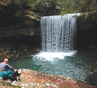
Dog Slaughter Falls is a 15 feet (4.6 m) to 20 feet (6.1 m) tall waterfall at the confluence of the Cumberland River and Dog Slaughter Creek, in the London Ranger District of the Daniel Boone National Forest in Whitley County, Kentucky. It is accessible via the Sheltowee Trace Trail, traveling downstream of Cumberland Falls, or via the Dog Slaughter Trail. The falls is rumored to be named for the drowning of unwanted pets, or the loss of hunting dogs to predatory wildlife.
References
- ↑ "Drowning Creek". Geographic Names Information System . United States Geological Survey . Retrieved 23 November 2020.
- ↑ Rennick, Robert M. "Kentucky Geographic Names Alphabetical Finding List". USGS Topographic Division. Retrieved 1 October 2020.
- ↑ "Drowning Creek". Kentucky River Basin Assessment Report. Retrieved 1 October 2020.
Coordinates: 37°44′55″N84°04′52″W / 37.74870°N 84.08114°W
| This Estill County, Kentucky state location article is a stub. You can help Wikipedia by expanding it. |
