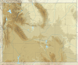
Grand Teton National Park is an American national park in northwestern Wyoming. At approximately 310,000 acres (1,300 km2), the park includes the major peaks of the 40-mile-long (64 km) Teton Range as well as most of the northern sections of the valley known as Jackson Hole. Grand Teton National Park is only 10 miles (16 km) south of Yellowstone National Park, to which it is connected by the National Park Service–managed John D. Rockefeller Jr. Memorial Parkway. Along with surrounding national forests, these three protected areas constitute the almost 18-million-acre (73,000-square-kilometer) Greater Yellowstone Ecosystem, one of the world's largest intact mid-latitude temperate ecosystems.

Schoolroom Glacier is a small glacier in Grand Teton National Park in the U.S. state of Wyoming. This Teton Range glacier lies adjacent to the south Cascade Canyon trail at an altitude of 10,400 ft (3,200 m), approximately 12 mi (19 km) from the trailhead at Jenny Lake. The glacier has many of the classic textbook details of a glacier, namely, well defined terminal and lateral moraines, crevasses, a proglacial lake and related features which led to the naming schoolroom.
Rolling Thunder Mountain is in the northern Teton Range, Grand Teton National Park, Wyoming. The peak is located northwest of Moran Bay on Jackson Lake and access to the peak involves navigating through several miles of backcountry areas of Snowshoe Canyon where there are no maintained trails.

Ranger Peak is in the northern Teton Range, Grand Teton National Park, Wyoming. The peak is located slightly northwest of and across Jackson Lake from Colter Bay Village. Colter Canyon is to the north while Waterfalls Canyon is immediately southeast of the peak, but there are no maintained trails in the area. Access to the summit involves off trail hiking and scrambling. The top of the mountain is more than 4,500 feet (1,400 m) above Jackson Lake.
Doane Peak is in the northern Teton Range, Grand Teton National Park, Wyoming. The peak is located west of and across Jackson Lake from Colter Bay Village. The scenic Waterfalls Canyon is immediately northeast of the peak, but there are no maintained trails in the area. Access to the summit involves off trail hiking and scrambling as the top of the mountain is more than 4,500 feet (1,400 m) above Jackson Lake. The peak is named for Lt. Gustavus Cheyney Doane.

Eagles Rest Peak is in the northern Teton Range, Grand Teton National Park, Wyoming. The peak is located west of and across Jackson Lake from Colter Bay Village. The peak rises dramatically almost 4,500 feet (1,400 m) above Jackson Lake in less than 1 mile (1.6 km). Waterfalls Canyon is to the north of the peak and Snowshoe Canyon lies to the south.

Bivouac Peak is in the northern Teton Range, Grand Teton National Park, Wyoming. The peak is located immediately to the west of Moran Bay on Jackson Lake, and rises more than 4,000 ft (1,200 m) in less than 0.5 mi (0.80 km) from the lakeshore. Moran Canyon is situated to the south of the mountain and Snowshoe Canyon lies to the north.

Traverse Peak is in the northern Teton Range, Grand Teton National Park, Wyoming. The mountain rises abruptly above Moran Canyon to the south and the south fork of Snowshoe Canyon to the north. From Moran Bay on Jackson Lake, the south slopes of the mountain can be seen behind Bivouac Peak rising above Moran Canyon.
Raynolds Peak is in the northern Teton Range, Grand Teton National Park, Wyoming. The mountain rises to the north of Moran Canyon and has numerous deep cirques on its north face above Snowshoe Canyon. There are no maintained trails in the region and the summit is 5 miles (8 km) west of Moran Bay on Jackson Lake. The peak is named after William F. Raynolds who was in charge of the 1859-1860 Raynolds Expedition to the region.

Symmetry Spire is located in the Teton Range, Grand Teton National Park in the U.S. state of Wyoming. The mountain, first climbed via the east ridge route on August 20, 1929, by Fritiof Fryxell and Phil Smith, towers above the northwest shore of Jenny Lake and Cascade Canyon. The scenic Lake of the Crags, a cirque lake or tarn, is located northwest of the summit and is accessed by way of Hanging Canyon. Popular with mountaineers, the spire has numerous challenging cliffs.

Mount Wister is located in the Teton Range, Grand Teton National Park, in the U.S. state of Wyoming. The peak is located 5 miles (8.0 km) west of Taggart Lake and to the south of Avalanche Canyon.

The canyons of the Teton Range lie almost entirely within Grand Teton National Park in the U.S. state of Wyoming. Ranging from 9 miles (14 km) to less than 1 mile (1.6 km) in length and up to 6,000 feet (1,800 m) deep, the canyons were carved primarily by glaciers over the past 250,000 years. The canyons in the Teton Range descend in altitude generally west to east and many have lakes at their outlets. The lakes were created by terminal moraines left behind by the now retreated glaciers. A few of the canyons have small glaciers that were created mostly during the Little Ice Age (1550-1850). Fast retreating Schoolroom Glacier is a tiny glacier located at the head of the South Cascade Canyon. Most of the canyons have streams from which rain and snowmelt flow towards Jackson Hole valley, and due to the sometimes rapid altitude descent, waterfalls are common. The canyons offer the easiest hiking access into the Teton Range.
Snowshoe Canyon is located in Grand Teton National Park, in the U. S. state of Wyoming. The canyon was formed by glaciers which retreated at the end of the last glacial maximum approximately 15,000 years ago, leaving behind a U-shaped valley. Snowshoe Canyon splits into an upper and lower canyon. The source of the upper canyon is near Talus Lake while the south canyon is situated between Rolling Thunder Mountain to the north and Raynolds, Traverse and Bivouac Peaks to the south. Near the fork of north and south Snowshoe Canyon lies Dudley Lake. The canyon terminus is at Moran Bay on the southwest side of Jackson Lake, below Eagles Rest Peak.
Rock of Ages is located in the Teton Range, Grand Teton National Park in the U.S. state of Wyoming. Rock of Ages is .50 miles (0.80 km) ESE of The Jaw and on the south side of Hanging Canyon.
Forget-me-not Lakes is a high elevation ecosystem located in Grand Teton National Park, in the U. S. state of Wyoming. It is located 8.8 miles (14.2 km) from Moose Wilson Road, in Teton County, and situated 1 mile (1.6 km) west of Rimrock Lake and Prospectors Mountain. The lakes consist of several small bodies of water, the largest 150 yd (140 m) long and 180 yd (160 m) wide. Death Creek has 24 tributary streams, several of which originate from Death Shelf springs; two tributaries originate from Forget-Me-Not Lakes, elevation 9,600 feet (2,900 m) and Rimrock Lake 9,915 feet (3,022 m) and are located in a remote area near the head of Death Canyon on the slopes of Prospectors Mountain.
Coyote Lake is located in Grand Teton National Park, in the U. S. state of Wyoming. Situated .70 miles (1.13 km) north-northwest of Mount Hunt.

The Teton Crest Trail is a 40-mile (64 km) long hiking trail in the U.S. state of Wyoming that extends from Phillips Pass, on the border of Bridger Teton and Caribou-Targhee National Forests, to String Lake in Grand Teton National Park. Backpacker Magazine calls the Trail one of the "Best Hikes Ever," with "mesmerizing and constant views of jagged peaks."
The following articles relate to the history, geography, geology, flora, fauna, structures and recreation in Grand Teton National Park.

There are 44 named and countless unnamed lakes in Grand Teton National Park. The largest of these is Jackson Lake, a natural glacial lake that has been enlarged with the construction of the Jackson Lake Dam. The lakes range in size as well as ease of access. In addition to mountain tarns, there are several large peidmont lakes. Nearly all the lakes are glacial in origin, formed by glacial action that carved out the valleys and left moraine behind that acted as dams to lock in water.