Dukinfield Junction

Last updated

Dukinfield Junction
Portland Basin.jpg
The Portland Basin warehouse
Specifications
StatusOpen
Navigation authorityCanal & River Trust
History
Date completed1800
Date closed1962
Date restored1974

Dukinfield Junction (grid reference SJ933984 ) is the name of the canal junction where the Peak Forest Canal, the Ashton Canal and the Huddersfield Narrow Canal meet near Ashton-under-Lyne, Greater Manchester, England. The area has been designated by Tameside Metropolitan Borough Council as a conservation area. [1]

Contents

It is adjacent to Portland Basin, and the names are often used as synonyms by boaters, whilst locals refer only to Portland Basin. Strictly speaking, Portland Basin is the wide area on the main line of the canal. The arm under the junction bridge and the aqueduct over the River Tame were built by the Ashton Canal, and the junction with the Peak Forest canal was historically at the southern end of the aqueduct.

History

The towpath bridge crosses the Peak Forest Canal. The Huddersfield Narrow Canal is ahead, and the Ashton Canal is behind the photographer. Junction of the Peak Forest, Ashton and Huddersfield Narrow Canals. - geograph.org.uk - 90470.jpg
The towpath bridge crosses the Peak Forest Canal. The Huddersfield Narrow Canal is ahead, and the Ashton Canal is behind the photographer.

The Ashton Canal was authorised by an Act of Parliament obtained in 1792, to connect the coal mining area around Oldham and the textile mills of Ashton-under-Lyne to Manchester. It was heavily-locked, with 18 locks in 6.5 miles (10.5 km). [2] During construction, the company obtained a second Act to allow them to build the Hollinwood Branch Canal, the Stockport Canal and the Beat Bank Branch Canal. The line to Ashton and the branch to Hollinwood were both opened in December 1796, and the Stockport Branch opened in January 1797, but the Beat Bank Branch was never completed. [3]

The Peak Forest Canal was authorised two years after the Ashton Canal, to access limestone reserves at Doveholes, near Whaley Bridge. The final 6.5 miles (10.5 km) were built as a tramway, as the quarries were too high to make access by canal economic, and the limestone was transhipped to barges at Bugsworth Basin. The canal is on two levels separated by a flight of locks at Marple which had not been completed when most of the canal opened in 1800. A temporary tramway bypassed the locks until they were completed four years later. [2] The Ashton Canal built a short section of canal southwards from the junction, which included an aqueduct over the River Tame, and the Peak Forest Canal officially started at the southern end of the aqueduct. [4]

The Huddersfield Narrow Canal was also authorised in 1794, and is one of three which cross the Pennines. It was a huge undertaking, with 74 locks and the longest canal tunnel in Britain at Standedge. Sections were opened at both ends as they were completed, with that from Ashton to Greenfield opening in 1798. The canal was not fully opened until 1811, with the completion of the tunnel. It joins the Ashton Canal end-on at the junction. [5]

Restoration

The Huddersfield Narrow Canal was abandoned in 1944. [5] The Peak Forest Canal had ceased to be used by the start of the Second World War in 1939, and the Ashton Canal was unnavigable by 1962. However, the Peak Forest Canal Society was formed, and working with the British Waterways Board, the local councils through which the canals ran, and the Inland Waterways Association, the Ashton Canal and the lower Peak Forest Canal were reopened in 1974, bringing the junction back into use. [2] A campaign for the restoration of the Huddersfield Narrow Canal began in the same year, but was not completed until 2001, helped by public funding from the Millennium Commission. [6]

Ashton Canal Warehouse

The restored waterwheel Portland Basin waterwheel- 5187.JPG
The restored waterwheel

The Ashton Canal Warehouse was built at the Portland Basin in 1834 by the canal company replacing the early warehouse to the east. It is a three-storey warehouse 200 feet (61 m) by 72 feet (22 m), brick built in English garden wall bond. The wooden floors are supported by cast iron columns. The southern elevation which opened to the canal was 3 storeys high and it had three shipping holes. The northern elevation which opens to the road is two storeys high, trap doors allowed split loading and unloading between the road and the 3 canal arms. The roof was flat allowing increased storage. The building we see today is the result of a 1998 restoration. [7]

Portland Basin water wheel

The internal hoist system was powered by an external waterwheel. The head race was taken from the canal, and the tailrace fed down to the River Tame 33 feet (10 m) below. The high breastshot waterwheel was constructed in 1841 to a suspension design introduced by Thomas Hewes and William Fairburn and had rim gearing. It cost £1078. It was 24 feet (7.3 m) in diameter and 3 feet (0.9 m) in width and produced 15 hp (11 kW). Power was transmitted by a line shaft. [8] Using a suspension system, akin to the spokes on a bicycle, allowed the wheel to be lighter than the wooden one it replaced. Taking the power train off the rim rather than from axle reduces the stress and gears up the line-shaft leading to less power loss.

Portland Basin Museum

Portland Basin is the location of the Portland Basin Museum, housed within the restored nineteenth century Ashton Canal Warehouse, covering the area's industrial heritage. [9] The warehouse was built in 1834, and interprets aspects of local history, industry and trades. Exhibits include a 1920s period street with shops, period room displays and historic machines. [10]

Wooden Canal Boat Society

Forget me not (1927), at the basin in September 2010 Portland Basin-Forget me not 5203.JPG
Forget me not (1927), at the basin in September 2010

The Portland Basin hosts the Wooden Canal Boat Society which has restored and works six traditional narrowboats. The Society was formed as a charitable company limited by guarantee in 1996, and took over the assets of the former Wooden Canal Boat Trust in 1997. It became a registered charity in 1998, and the first boat was moved to Portland Basin Museum in 1996. [11]

Location

The junction is located on the southern edge of Ashton-under-Lyne, and the Ashton Canal approaches it from the south-east. The canal is level for 2.5 miles (4.0 km) to Fairfield Junction, where the Hollinwood Branch turned north, and the Fairfield locks begin the descent to Manchester. [12] The Peak Forest Canal heads south, and is level for 7 miles (11 km) to the first of the sixteen Marple Locks. [13] It passes through two short tunnels at Woodley and Hyde Bank, the second of which is slightly too narrow to allow two boats to pass. [14] The Huddersfield Narrow Canal heads to the north-east, and passes through a tunnel under an Asda supermarket to reach the first of 32 locks that ascend to Standedge Tunnel, 0.4 miles (0.64 km) from the junction. [15]

Huddersfield canal seen from the Basin.jpg

A slender bridge carries the towpath over the line to the aqueduct and the Peak Forest Canal. It carries the date 1835, and is a grade II listed structure. [16] Nearby is Cavendish Mill, a former cotton spinning mill built in 1884-5, and one of the first to use steel girders and lintel plates to support concrete floors, rather than using brick arches. The construction method was pioneered by Edward Potts, who failed to obtain a patent for the design in 1884. [17] The junction is the location for the Tameside Canals Festival, held in mid-July each year. [10]

Dukinfield Canal leading from the basin.jpg

See also

Bibliography

Related Research Articles

Calder and Hebble Navigation inland waterway in West Yorkshire, England

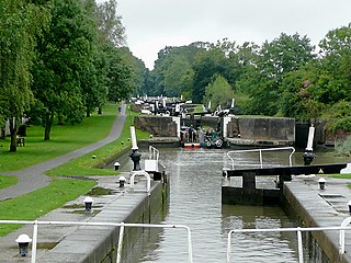
The Calder and Hebble Navigation is a broad inland waterway, with locks and bridgeholes that are suitable for 14-foot-wide (4.3 m) boats, in West Yorkshire, England. Construction to improve the River Calder and the River Hebble began in 1759, and the initial scheme, which included 5.7 miles (9.2 km) of new cuts, was completed in 1770 and has remained navigable since it was opened. Significant improvements were made, including the Salterhebble branch to Halifax, opened in 1828, and ever-longer cuts to bypass river sections. Trade was assisted by the opening of the Rochdale Canal in 1804, which provided a through route from Sowerby Bridge to Manchester. There were plans to abandon the river sections completely in the 1830s, but these were modified as the needs of mill owners and other riparian landowners were recognised.

Tameside Metropolitan borough in England

The Metropolitan Borough of Tameside is a metropolitan borough of Greater Manchester in North West England. It is named after the River Tame, which flows through the borough and spans the towns of Ashton-under-Lyne, Audenshaw, Denton, Droylsden, Dukinfield, Hyde, Mossley and Stalybridge plus Longdendale. Its western border is approximately 4 miles (6.4 km) east of Manchester city centre. It borders High Peak in Derbyshire to the east, the Metropolitan Borough of Oldham to the north, the Metropolitan Borough of Stockport to the south, and the City of Manchester to the west. As of 2011 the overall population was 219,324.

Ashton-under-Lyne Market town in the Metropolitan Borough of Tameside, Greater Manchester, England

Ashton-under-Lyne is a market town in Tameside, Greater Manchester, England. The population was 45,198 at the 2011 census. Historically in Lancashire, it is on the north bank of the River Tame, in the foothills of the Pennines, 6.2 miles (10.0 km) east of Manchester.

Ashton Canal canal in north west England

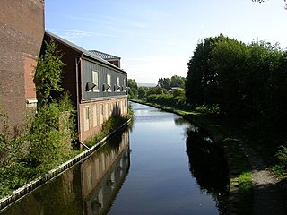
The Ashton Canal is a canal in Greater Manchester, England.

Huddersfield Narrow Canal canal in northern England

The Huddersfield Narrow Canal is an inland waterway in northern England. It runs just under 20 miles (32 km) from Lock 1E at the rear of the University of Huddersfield campus, near Aspley Basin in Huddersfield, to the junction with the Ashton Canal at Whitelands Basin in Ashton-under-Lyne. It crosses the Pennines by means of 74 locks and the Standedge Tunnel.

Huddersfield Broad Canal canal in Northern England

The Huddersfield Broad Canal or Sir John Ramsden's Canal, is a wide-locked navigable canal in West Yorkshire in northern England. The waterway is 3.75 miles (6 km) long and has 9 wide locks. It follows the valley of the River Colne and connects the Calder and Hebble Navigation at Cooper Bridge junction with the Huddersfield Narrow Canal near Aspley Basin in Huddersfield.

Peak Forest Canal canal in north west England

The Peak Forest Canal is a narrow locked artificial waterway in northern England. It is 14.8 miles (23.8 km) long and forms part of the connected English/Welsh inland waterway network.

Warwickshire ring

The Warwickshire ring is a connected series of canals forming a circuit around the West Midlands area of England. The ring is formed from the Coventry Canal, the Oxford Canal, the Grand Union Canal, the Stratford-upon-Avon Canal and the Birmingham and Fazeley Canal. It is a popular route with tourists due to its circular route and mixture of urban and rural landscapes.

Rochdale Canal canal in the United Kingdom

The Rochdale Canal is in Northern England, between Manchester and Sowerby Bridge, part of the connected system of the canals of Great Britain. Its name refers to the town of Rochdale through which it passes.

Macclesfield Canal canal in north west England

The Macclesfield Canal is a canal in east Cheshire, England. There were various proposals for a canal to connect the town of Macclesfield to the national network from 1765 onwards, but it was not until 1824 that a scheme came to fruition. There were already suggestions by that date that a railway would be better, but the committee that had been formed elected for a canal, and the engineer Thomas Telford endorsed the decision. The canal as built was a typical Telford canal, constructed using cut and fill, with numerous cuttings and embankments to enable it to follow as straight a course as possible, although Telford had little to do with its construction, which was managed by William Crosley.

Shrewsbury Canal

The Shrewsbury Canal was a canal in Shropshire, England. Authorised in 1793, the main line from Trench to Shrewsbury was fully open by 1797, but it remained isolated from the rest of the canal network until 1835, when the Birmingham and Liverpool Junction Canal built the Newport Branch from Norbury Junction to a new junction with the Shrewsbury Canal at Wappenshall. After ownership passed to a series of railway companies, the canal was officially abandoned in 1944; many sections have disappeared, though some bridges and other structures can still be found. There is an active campaign to preserve the remnants of the canal and to restore the Norbury to Shrewsbury line to navigation.

Stockport Branch Canal former canal in Manchester, England

The Stockport Branch Canal was a 5-mile (8 km) branch of the Ashton Canal from Clayton to Stockport.

Hollinwood Branch Canal

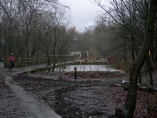
The Hollinwood Branch Canal was a canal near Hollinwood, in Oldham, England. It left the main line of the Ashton Canal at Fairfield Junction immediately above lock 18. It was just over 4.5 miles (7.2 km) long and went through Droylsden and Waterhouses to terminate at Hollinwood Basin. It rose through four locks at Waterhouses (19–22) and another four at Hollinwood (23–26). Immediately above lock 22 at Waterhouses was Fairbottom Junction where the Fairbottom Branch Canal started. Beyond Hollinwood Basin there was a lock free private branch, known as the Werneth Branch Canal, to Old Lane Colliery, which opened in 1797. It is a biological Site of Special Scientific Interest and a Local Nature Reserve.

Manchester and Salford Junction Canal

The Manchester and Salford Junction Canal was a canal in the city of Manchester. It was originally built to provide a direct waterway between the Mersey and Irwell Navigation and the Rochdale Canal. The canal opened in 1839 and was abandoned in 1922.

Aston Junction

Aston Junction is the name of the canal junction where the Digbeth Branch Canal terminates and meets the Birmingham and Fazeley Canal near to Aston, Birmingham, England.

South Pennine Ring English canal ring

The South Pennine Ring is an English canal ring which crosses the Pennines between Manchester and Huddersfield. It covers parts of five canals, and includes passage through the longest canal tunnel in Britain. It has only been possible to cruise it since 2002, when restoration of the Huddersfield Narrow Canal provided the return route across the Pennines.

North Pennine Ring

The North Pennine Ring is a canal ring which crosses the Pennines between Manchester, Leeds and Castleford. It follows parts of five canals, and shares much of its route with the Outer Pennine Ring, which uses a different route for the southern crossing of the Pennines.

Outer Pennine Ring

The Outer Pennine Ring is an English canal ring which crosses the Pennines between Manchester, Leeds and Castleford. Its route follows parts of eight canals, and includes the longest canal tunnel in England. The ring was completed in 2001, with the opening of the Huddersfield Narrow Canal. Much of the route is shared with the North Pennine Ring, which crosses the Pennines by a different route on the southern leg.

Marple Junction

Marple Junction is the name of the canal junction where the Macclesfield Canal terminates and meets the Peak Forest Canal at Marple, Greater Manchester, England.

The Wooden Canal Boat Society (WCBS) is a waterway society and a registered charity in England, UK, based at Ashton-under-Lyne, Greater Manchester. The Society started as the Wooden Canal Craft Trust in 1987, and by 1995 the Trust owned six boats; it was wound up in 1997, and its assets were handed over to the WCBS.

References

  1. Tameside Metropolitan Borough Council. "Appendix 6: Conservation Areas and Scheduled Ancient Monuments (Policies C11 and C30)". Tameside.gov.uk. Archived from the original on 2 May 2009. Retrieved 2 February 2008.
  2. 1 2 3 Nicholson 2006 , p. 151
  3. Hadfield & Biddle 1970 , pp. 294–295
  4. Hadfield & Biddle 1970 , p. 296
  5. 1 2 Nicholson 2006 , pp. 50–51
  6. Cumberlidge 2009 , p. 150
  7. McNeil & Nevell 2000 , p. 59
  8. Nevell & Walker 2001 , p. 18
  9. "Portland Basin Museum". Borough of Tameside. Retrieved 7 May 2009.
  10. 1 2 Nicholson 2006 , p. 158
  11. "Society History". Wooden Canal Boat Society. Archived from the original on 17 July 2012. Retrieved 21 January 2012.
  12. Cumberlidge 2009 , pp. 61–62
  13. Cumberlidge 2009 , p. 249
  14. Nicholson 2006 , p. 156
  15. Nicholson 2006 , p. 159
  16. Historic England. "Peak Forest Canal Bridge number 30 (1162777)". National Heritage List for England . Retrieved 21 January 2012.
  17. Historic England. "Cavendish Mill, Cavendish Street (1067948)". National Heritage List for England . Retrieved 21 January 2012.

Coordinates: 53°28′57″N2°05′59″W / 53.4826°N 2.0997°W / 53.4826; -2.0997