
Peatrig Hill is a minor hill in Scotland, located about 15 km south-southeast of Edinburgh. One of the Moorfoot Hills, it is located in the parish of Heriot in the Scottish Borders Council Area.

The River Esk, also called the Lothian Esk, is a river that flows through Midlothian and East Lothian, Scotland.

Leithen Water is a tributary of the River Tweed in Scotland. It rises in the Moorfoot Hills and joins the Tweed near the town of Innerleithen, whose name comes from the Scottish Gaelic inbhir, meaning a confluence, and anglicised as "inner" or "inver". The Brythonic equivalent is "Aber". "Leithen" is a Celtic name meaning grey in colour.
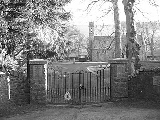
Heriot is a small village in the Moorfoot Hills southeast of Edinburgh, Scotland, within Eildon. The village comprises some 150 dwellings, spread over a geographical area of around 50 square miles (130 km2), most of which is moorland. Connected to the rest of the world primarily through the A7 road, Heriot had a railway station from 1849 until the branch line closures instigated by Beeching caused the track to be uplifted in the 1960s. The Scottish Parliament voted, in 2006, to reinstate the railway, but without a station at Heriot.

Lasswade is a village and civil parish in Midlothian, Scotland, on the River North Esk, nine miles south of Edinburgh city centre, contiguous with Bonnyrigg and between Dalkeith to the east and Loanhead to the west. Melville Castle lies to the north east. The Gaelic form is Leas Bhaid, meaning the "clump at the fort."

Alnwickhill is a suburb of Edinburgh, the capital of Scotland. It is on the southern edge of the city, approximately 4 miles (6.4 km) from the city centre. It neighbours the areas of Liberton and Kaimes.

The Moor Quarter is one of Sheffield's twelve designated quarters, built around and named for The Moor, a pedestrianised thoroughfare. It is bound by Furnival Gate in the north-east, Eyre Street in the south-east, St Mary's Gate to the south, and Moore Street and Charter Row to the north-west.

Gladhouse Reservoir, formerly known as Moorfoot Loch, is a reservoir in Midlothian, Scotland, five miles (8 km) south of Penicuik. It is the most southerly reservoir in Midlothian, as well as being the largest area of freshwater in the Lothians. It is used to supply Edinburgh with drinking water.

The Moorfoot Hills are a range of hills south of Edinburgh in east central Scotland, one of the ranges which collectively form the Southern Uplands.

The Moorfoot Building is a large office building in Sheffield, South Yorkshire, England, in the form of a step pyramid. It is located at the foot of The Moor, close to the Sheffield Inner Ring Road. Before its construction, The Moor continued across St Mary's Gate onto London Road. The building opened in July 1981.
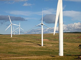
Crystal Rig Wind Farm is an operational onshore wind farm located on the Lammermuir Hills in the Scottish Borders region of Scotland. When phase 1 was completed in May 2004 it was the largest wind farm in Scotland. As a result of 3 extensions it is currently the second largest wind farm in the UK, in terms of nameplate capacity and one of the top five largest in number of turbines.
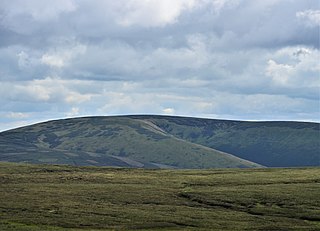
Blackhope Scar is a hill in the Moorfoot Hills range, part of the Southern Uplands of Scotland. It lies to the northeast of the town of Peebles and is the second highest of the Moorfoot Hills after Windlestraw Law.
Paul Moorfoot is an Australian swimmer. He competed in three events at the 1980 Summer Olympics.

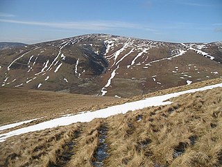
Dun Rig is a hill in the Manor Hills range, part of the Southern Uplands of Scotland. It is the highest hill in the northernmost cluster of the Manor Hills, south of the town of Peebles in the Scottish Borders. A sprawling summit, it is usually climbed as part of the Dun Rig Horseshoe from the Peebles side and provides great views into the Moorfoot Hills, Pentlands, rest of the Manor Hills and the central Borders. It is the historic county top of the former county of Selkirkshire.

Windlestraw Law is a hill in the Moorfoot Hills range, part of the Southern Uplands of Scotland. It is the highest peak of the range, and lies north of the town of Innerleithen in the Scottish Borders. A large and boggy peak, it is usually climbed from either its western slopes or the longer route from Tweeddale to the south.

Bowbeat Hill is a hill in the Moorfoot Hills range, part of the Southern Uplands of Scotland. It lends its name to Bowbeat Onshore Wind Farm built on the hill and commissioned in 2003. The wind farm produces 31.2MW of power using 24 turbines. It is commonly ascended with its neighbouring hills from Gladhouse Reservoir to the north.
Whitehope Law is a hill in the Moorfoot Hills range, part of the Southern Uplands of Scotland. A relatively isolated hill, it is frequently climbed on its own from the B709 road to its south and east. A farm to the south lends its name to the hill.

