Dunkinsville, Ohio

Last updated
Dunkinsville, Ohio
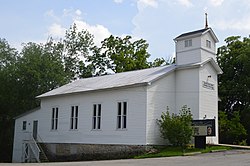
Dunkinsville United Methodist Church.jpg
Dunkinsville United Methodist Church
USA Ohio location map.svg
Red pog.svg
Dunkinsville, Ohio
Usa edcp location map.svg
Red pog.svg
Dunkinsville, Ohio
Coordinates: 38°51′21″N83°28′17″W / 38.85583°N 83.47139°W / 38.85583; -83.47139 Coordinates: 38°51′21″N83°28′17″W / 38.85583°N 83.47139°W / 38.85583; -83.47139
CountryFlag of the United States.svg  United States
State Flag of Ohio.svg  Ohio
County Adams
Elevation
[1]
187 m (614 ft)
Time zone UTC-5 (Eastern (EST))
  Summer (DST) UTC-4 (EDT)
ZIP Code
45660
Area code(s) 937, 326
GNIS feature ID1378030 [1]

Dunkinsville is an unincorporated community in Adams County, in the U.S. state of Ohio. [1]

Contents

History

Dunkinsville was laid out in 1841. [2] A post office was established at Dunkinsville in 1847, and remained in operation until 1909. [3]

Notable residents

Related Research Articles

Bentonville, Ohio human settlement in Ohio, United States of America

Bentonville is a census-designated place in northern Sprigg Township, Adams County, Ohio, United States. As of the 2010 census, it had a population of 327. Although it is unincorporated, it has a post office, with the ZIP code of 45105.

Unity, Adams County, Ohio human settlement in Ohio, United States of America

Unity is an unincorporated community in Adams County, Ohio, United States.

Beasley Fork, Ohio Unincorporated community in Ohio, United States

Beasley Fork is an unincorporated community in Adams County, in the U.S. state of Ohio.

Bradysville is an unincorporated community in Adams County, in the U.S. state of Ohio.

Cedar Mills is an unincorporated community in Adams County, in the U.S. state of Ohio.

Eckmansville is an unincorporated community in Adams County, in the U.S. state of Ohio.

Fairview is an unincorporated community in Adams County, in the U.S. state of Ohio.

Jacksonville is an unincorporated community in Adams County, in the U.S. state of Ohio.

Jaybird is an unincorporated community in Adams County, in the U.S. state of Ohio.

Louden is an unincorporated community in Bratton Township, Adams County, in the U.S. state of Ohio. Its elevation is 784 feet above sea level. Serpent Mound Historical Site is located just east within sight of Louden on State Route 73, formerly known as the Hillsboro-Portsmouth road. Louden Road runs south from State Route 73 within the hamlet.

Louisville is an unincorporated community in Adams County, in the U.S. state of Ohio.

Marble Furnace is an unincorporated community in Adams County, in the U.S. state of Ohio.

May Hill is an unincorporated community in Adams County, in the U.S. state of Ohio.

Tranquility is an unincorporated community in Adams County, in the U.S. state of Ohio.

Mineral Springs is an unincorporated community in Adams County, Ohio.

Sandy Springs is an unincorporated community in Adams County, Ohio, United States, located at 38°36′40″N83°17′49″W.

Selig is an unincorporated community in Adams County, in the U.S. state of Ohio.

Wamsley is an unincorporated community in Adams County, in the U.S. state of Ohio.

Wrightsville, Adams County, Ohio Unincorporated community in Ohio, United States

Wrightsville is an unincorporated community in Adams County, in the U.S. state of Ohio.

Youngsville is an unincorporated community in Adams County, in the U.S. state of Ohio.

References

  1. 1 2 3 U.S. Geological Survey Geographic Names Information System: Dunkinsville, Ohio
  2. Evans, Nelson Wiley; Stivers, Emmons B. (1900). A History of Adams County, Ohio: From Its Earliest Settlement to the Present Time. E B. Stivers. p.  453.
  3. "Adams County". Jim Forte Postal History. Archived from the original on 22 December 2015. Retrieved 12 December 2015.