
Washita County is a county located in the U.S. state of Oklahoma. As of the 2020 census, the population was 10,924. Its county seat is New Cordell. The county seat was formerly located in Cloud Chief. The county was created in 1891.

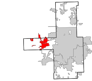
Roger Mills County is a county located in the western part of the U.S. state of Oklahoma. As of the 2020 census, the population was 3,442, making it the fourth-least populous county in Oklahoma. Its county seat is Cheyenne. The county was created in 1891.

Murray County is a county located in the southern part of the U.S. state of Oklahoma. As of the 2020 census, the population was 13,904. The county seat is Sulphur. The county was named for William H. Murray, a member and president of the Oklahoma Constitutional Convention and later a Governor of Oklahoma.

Greer County is a county located along the southwest border of the U.S. state of Oklahoma. As of the 2020 census, the population was 5,491. Its county seat is Mangum. From 1860 to 1896, the state of Texas claimed an area known as Greer County, Texas, which included present-day Greer County along with neighboring areas. In 1896 it was designated as a county in Oklahoma Territory under a ruling by the US Supreme Court. The rural Greer County is home to Quartz Mountain State Park, near the community of Lone Wolf, Oklahoma. It is also home to the Oklahoma State Reformatory, located in Granite. Its population has declined since 1930 due to changes in agriculture and migration to cities for work.

Ellis County is a county located on the western border of the U.S. state of Oklahoma. As of the 2020 census, the population was 3,749, making it the fifth-least populous county in Oklahoma. Its county seat is Arnett.

Dewey County is a county in the western part of the U.S. state of Oklahoma. As of the 2020 census, the population was 4,484. Its county seat is Taloga. The county was created in 1891 as "County D". In an 1898 election, county voters chose the name Dewey, honoring Admiral George Dewey.

Custer County is a county located in the U.S. state of Oklahoma. As of the 2020 census, the population was 28,513. Its county seat is Arapaho. The county was named in honor of General George Armstrong Custer.

Cherokee County is a county located in the U.S. state of Oklahoma. As of the 2020 census, the population was 47,078. Its county seat is Tahlequah, which is also the capital of the Cherokee Nation.
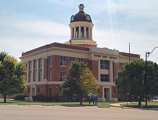
Beckham County is a county located on the western border of the U.S. state of Oklahoma. As of the 2020 census, the population was 22,410. Its county seat is Sayre. Founded upon statehood in 1907, Beckham County was named for J. C. W. Beckham, who was Governor of Kentucky and the first popularly elected member of the United States Senate from Kentucky. Beckham County comprises the Elk City, OK Micropolitan Statistical Area.

Atoka County is a county located in the U.S. state of Oklahoma. As of the 2020 census, the population was 14,143. Its county seat is Atoka. The county was formed before statehood from Choctaw Lands, and its name honors a Choctaw Chief named Atoka. The county is part of Choctaw Nation reservation lands.

Elk City is a city in Beckham County, Oklahoma, United States. The population was 11,561 at the time of the 2020 census, a slight decrease from the 11,693 figure of the 2010 census. Elk City is located on Interstate 40 and Historic U.S. Route 66 in western Oklahoma, approximately 110 miles (180 km) west of Oklahoma City and 150 miles (240 km) east of Amarillo, Texas.

Kaw City is a city in eastern Kay County, Oklahoma, United States. The population was 325 as of the 2020 United States census. Kaw City was named for the Kanza Indians, called the Kaw by locals.

Cheyenne is a town in Roger Mills County, Oklahoma, United States. As of the 2020 census, the town's population was 771. It is the county seat of Roger Mills County.

Strong City is a town in Roger Mills County, Oklahoma, United States. As of the 2020 census, the town’s population was 33.

Grandfield is a city in Tillman County, Oklahoma, United States. The population was 919 as of the 2020 United States census. It is located about 30 driving miles southeast of the county seat of Frederick, and is situated at the intersection of US Route 70 and Oklahoma State Highway 36.

Durham is a city in the U.S. state of North Carolina and the county seat of Durham County. Small portions of the city limits extend into Orange County and Wake County. With a population of 283,506 in the 2020 census, Durham is the fourth-most populous city in North Carolina and the 70th-most populous city in the United States. The city is located in the east-central part of the Piedmont region along the Eno River. Durham is the core of the four-county Durham–Chapel Hill metropolitan area, which had an estimated population of 608,879 in 2023. The Office of Management and Budget also includes Durham as a part of the Raleigh–Durham–Cary, NC Combined Statistical Area, commonly known as the Research Triangle, which had an estimated population of 2,368,947 in 2023.

Hammon is a town in the U.S. state of Oklahoma, the majority of which is in Roger Mills County, but some of which extends into Custer County. It is located at the junction of Oklahoma State Highways 33 and 34.
Sand Springs is a city in Osage, Creek and Tulsa counties in the U.S. state of Oklahoma. A western suburb of Tulsa, it is located predominantly in Tulsa County. The population was 19,874 in the 2020 U. S. Census, an increase of 5.1 percent from the figure of 18,906 recorded in 2010.

Sweetwater is a town in Beckham and Roger Mills Counties in the U.S. state of Oklahoma. It was incorporated in 1998. The population was 102 at the time of the 2020 census, an increase of 17.2% over the 87 reported in the 2010 census.
Augusta Metcalfe is a 1983 National Cowgirl Museum and Hall of Fame inductee. Metcalfe, a genuine product of the West, is widely recognized as one of its foremost painters.


