Reydon, Oklahoma

Last updated

Reydon, Oklahoma
OKMap-doton-Reydon.PNG
Location of Reydon, Oklahoma
Coordinates: 35°38′59″N99°55′25″W / 35.64972°N 99.92361°W / 35.64972; -99.92361
Country United States
State Oklahoma
County Roger Mills
Area
[1]
  Total0.49 sq mi (1.28 km2)
  Land0.49 sq mi (1.28 km2)
  Water0.00 sq mi (0.00 km2)
Elevation
[2]
2,261 ft (689 m)
Population
 (2020)
  Total137
  Density277.89/sq mi (107.19/km2)
Time zone UTC-6 (Central (CST))
  Summer (DST) UTC-5 (CDT)
ZIP code
73660
Area code 580
FIPS code 40-63100 [3]
GNIS feature ID2412546 [2]

Reydon is a town in Roger Mills County, Oklahoma, United States.

Contents

Reydon was established in 1928 after the Atchison, Topeka and Santa Fe Railway put down rails in the area, purchased land from local farmers, and laid out a townsite. The site was two miles north of a settlement called Rankin, and Rankin merchants moved to the site because of the rail connection. However, the name “Rankin” was considered confusing because Rankin, Texas was also along the railline. So the town was named Reydon instead, either in honor of a railroad executive in Chicago, or in honor of the village of Reydon in Suffolk County, England. [4]

The population of the town peaked at 331 in 1950. [4] In December 2003 the New York Times featured Reydon on the front page, in an article regarding dwindling small towns on the Great Plains. [5] [6] The population was 137 at the time of the 2020 census. [7]

Geography

According to the United States Census Bureau, the town has a total area of 0.4 square miles (1.0 km2), all land.

Reydon is located at the northern intersection of State Highways 30 and 47. [8]

Reydon is surrounded by the Black Kettle National Grassland, [9] with Skipout Lake to the southeast. [10]

Demographics

Historical population
CensusPop.Note
1930 216
1940 31144.0%
1950 3316.4%
1960 183−44.7%
1970 21517.5%
1980 25217.2%
1990 200−20.6%
2000 177−11.5%
2010 21018.6%
2020 137−34.8%
U.S. Decennial Census [11]

As of the census [3] of 2000, there were 177 people, 77 households, and 46 families residing in the town. The population density was 398.9 inhabitants per square mile (154.0/km2). There were 102 housing units at an average density of 229.9 per square mile (88.8/km2). The racial makeup of the town was 98.31% White, 0.56% African American, 0.56% Native American, and 0.56% from two or more races. Hispanic or Latino of any race were 3.95% of the population.

There were 77 households, out of which 32.5% had children under the age of 18 living with them, 46.8% were married couples living together, 11.7% had a female householder with no husband present, and 39.0% were non-families. 37.7% of all households were made up of individuals, and 23.4% had someone living alone who was 65 years of age or older. The average household size was 2.30 and the average family size was 3.02.

In the town, the population was spread out, with 27.7% under the age of 18, 6.2% from 18 to 24, 24.9% from 25 to 44, 27.1% from 45 to 64, and 14.1% who were 65 years of age or older. The median age was 39 years. For every 100 females, there were 84.4 males. For every 100 females age 18 and over, there were 80.3 males.

The median income for a household in the town was $25,750, and the median income for a family was $30,000. Males had a median income of $19,583 versus $23,438 for females. The per capita income for the town was $16,721. None of the families and 11.2% of the population were living below the poverty line, including no under eighteens and 36.0% of those over 64.

Related Research Articles

<span class="mw-page-title-main">Roger Mills County, Oklahoma</span> County in Oklahoma, United States

Roger Mills County is a county located in the western part of the U.S. state of Oklahoma. As of the 2020 census, the population was 3,442, making it the fourth-least populous county in Oklahoma. Its county seat is Cheyenne. The county was created in 1891.

<span class="mw-page-title-main">Kenefic, Oklahoma</span> Town in Oklahoma, United States

Kenefic is a town in Bryan County, Oklahoma, United States. The population was 196 at the 2010 census, a 2 percent increase from the total of 192 recorded in 2000. The town was named for William Kenefick, president of the Missouri, Oklahoma and Gulf Railroad (MO&G), which had constructed a rail line through the region. The town name has been spelled both Kenefic and Kenefick throughout its history.

<span class="mw-page-title-main">Randlett, Oklahoma</span> Town in Oklahoma, United States

Randlett is a town in Cotton County, Oklahoma, United States. The population was 289 as of the 2020 United States census. Randlett is located about 22 driving miles south-southwest of the county seat of Walters, and is at the corner where US Route 277 and US Route 281 join US Route 70.

Custer City is a town in Custer County, Oklahoma, United States. Custer City is northeast of Clinton and northwest of Weatherford along Oklahoma 33. The population was 367 at the time of the 2020 census.

<span class="mw-page-title-main">West Siloam Springs, Oklahoma</span> Town in Oklahoma, United States

West Siloam Springs is a town in Delaware County, Oklahoma, United States. The population was 1,000 at the 2020 census, an 18.2 percent increase from the figure of 846 recorded in 2010. A bedroom community for Siloam Springs, Arkansas, it is notable for its Cherokee casino, and is the closest town to Natural Falls State Park.

<span class="mw-page-title-main">Arnett, Oklahoma</span> Town in Oklahoma, United States

Arnett is a town in and the county seat of Ellis County, Oklahoma, United States. The population was 495 at the time of the 2020 census.

<span class="mw-page-title-main">Pocasset, Oklahoma</span> Town in Oklahoma, United States

Pocasset is a town in Grady County, Oklahoma, United States. The population was 183 at the 2020 census, a 17.3% increase from 2010.

<span class="mw-page-title-main">East Duke, Oklahoma</span> Town in Oklahoma, United States

East Duke, now known as Duke, is a town in Jackson County, Oklahoma, United States. The population was 394 as of the 2020 United States census. It is located about 14 miles west of the county seat of Altus, and is located at the intersection of US Route 62 and Oklahoma State Highway 34.

<span class="mw-page-title-main">Cornish, Oklahoma</span> Town in Oklahoma, United States

Cornish is an incorporated town in eastern Jefferson County, Oklahoma, United States. The population was 110 as of the 2020 United States census.

<span class="mw-page-title-main">Sugden, Oklahoma</span> Town in Oklahoma, United States

Sugden is a town in Jefferson County, Oklahoma, United States. The population was 22 as of the 2020 United States census.

<span class="mw-page-title-main">Braman, Oklahoma</span> Town in Oklahoma, United States

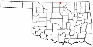
Braman is a town in Kay County, Oklahoma, United States. The population was 217 at the 2010 census, a decline of 11.1 percent from the figure of 244 in 2000.

<span class="mw-page-title-main">LeFlore, Oklahoma</span> Town in Oklahoma, United States

LeFlore is a town in LeFlore County, Oklahoma, United States. It is part of the Fort Smith, Arkansas-Oklahoma Metropolitan Statistical Area. The population was 198 at the 2010 census, an increase of 13.1 percent over the figure of 168 in 2000. Although the legal town name is spelled in the two-word form, the official federal name for the place and the postal name used is Leflore.

<span class="mw-page-title-main">Meeker, Oklahoma</span> Town in Oklahoma, United States

Meeker is a town in Lincoln County, Oklahoma, United States. The population was 1,145 at the 2010 census.

<span class="mw-page-title-main">Cleo Springs, Oklahoma</span> Town in Oklahoma, United States

Cleo Springs is a town in Major County, Oklahoma, United States. The population was 287 at the time of the 2020 Census.

<span class="mw-page-title-main">North Miami, Oklahoma</span> Town in Oklahoma, United States

North Miami is a town in Ottawa County, Oklahoma, United States. The population was 290 at the 2020 census. The town is primarily a bedroom community for several larger towns in the county.

St. Louis is a town in Pottawatomie County, Oklahoma, United States. The population was 121 by the 2020 United States census.

<span class="mw-page-title-main">Strong City, Oklahoma</span> Town in Oklahoma, United States

Strong City is a town in Roger Mills County, Oklahoma, United States. As of the 2020 census, the town’s population was 33.

Pinhook Corners is a census-designated place (CDP) in Sequoyah County, Oklahoma, United States. It is part of the Fort Smith, Arkansas-Oklahoma Metropolitan Statistical Area. The population was 161 at the 2000 census.

<span class="mw-page-title-main">Manitou, Oklahoma</span> Town in Oklahoma, United States

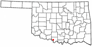
Manitou is a town in Tillman County, Oklahoma, United States. The population was 171 as of the 2020 United States census. It includes the former town of Siboney, absorbed on January 28, 1907.

<span class="mw-page-title-main">Hammon, Oklahoma</span> Town in Oklahoma, United States

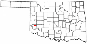
Hammon is a town in the U.S. state of Oklahoma, the majority of which is in Roger Mills County, but some of which extends into Custer County. It is located at the junction of Oklahoma State Highways 33 and 34.

References

  1. "ArcGIS REST Services Directory". United States Census Bureau. Retrieved September 20, 2022.
  2. 1 2 U.S. Geological Survey Geographic Names Information System: Reydon, Oklahoma
  3. 1 2 "U.S. Census website". United States Census Bureau . Retrieved January 31, 2008.
  4. 1 2 "REYDON". Oklahoma Historical Society. Retrieved July 1, 2020.
  5. "Reydon". Oklahoma Historical Society. Retrieved January 1, 2021.
  6. "VANISHING POINT; Bucking Trend, They Stay on Plains, Held by Family and Friends". Peter T. Kilborn, New York Times, December 2, 2003. Retrieved January 1, 2021.
  7. "Reydon (town), Oklahoma". US Census Bureau. Retrieved October 16, 2023.
  8. "Reydon, Oklahoma". Google Maps. Retrieved December 23, 2020.
  9. "Black Kettle National Grasslands". Google Maps. Retrieved January 1, 2021.
  10. "Skipout Lake to Reydon, Oklahoma". Google Maps. Retrieved January 1, 2021.
  11. "Census of Population and Housing". Census.gov. Retrieved June 4, 2015.