Duvic, Louisiana

Last updated

Duvic is an unincorporated community in Plaquemines Parish, Louisiana, United States. [1]

Unincorporated area Region of land not governed by own local government

In law, an unincorporated area is a region of land that is not governed by a local municipal corporation; similarly an unincorporated community is a settlement that is not governed by its own local municipal corporation, but rather is administered as part of larger administrative divisions, such as a township, parish, borough, county, city, canton, state, province or country. Occasionally, municipalities dissolve or disincorporate, which may happen if they become fiscally insolvent, and services become the responsibility of a higher administration. Widespread unincorporated communities and areas are a distinguishing feature of the United States and Canada. In most other countries of the world, there are either no unincorporated areas at all, or these are very rare; typically remote, outlying, sparsely populated or uninhabited areas.

Plaquemines Parish, Louisiana Parish in the United States

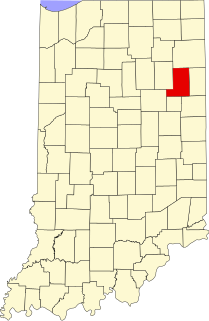
Plaquemines Parish is a parish located in the U.S. state of Louisiana. As of the 2010 census the population is 23,042. The parish seat is Pointe à la Hache. The parish was formed in 1807.

Louisiana State of the United States of America

Louisiana is a state in the Deep South region of the South Central United States. It is the 31st most extensive and the 25th most populous of the 50 United States. Louisiana is bordered by the state of Texas to the west, Arkansas to the north, Mississippi to the east, and the Gulf of Mexico to the south. A large part of its eastern boundary is demarcated by the Mississippi River. Louisiana is the only U.S. state with political subdivisions termed parishes, which are equivalent to counties. The state's capital is Baton Rouge, and its largest city is New Orleans.

Related Research Articles

Cleveland, Illinois Village in Illinois, United States

Cleveland is a village in Henry County, Illinois, United States. The population was 188 at the 2010 census, down from 253 in 2000.

Armington, Illinois Village in Illinois, United States

Armington is a village in Tazewell County, Illinois, United States. The population was 368 at the 2000 census. It is part of the Peoria, Illinois Metropolitan Statistical Area.

South Miami Heights, Florida CDP in Florida, United States

South Miami Heights is a census-designated place (CDP) in Miami-Dade County, within the U.S. state of Florida. The population was 35,696 as of the 2010 census.

Lawson Heights, Pennsylvania CDP in Pennsylvania, United States

Lawson Heights is a census-designated place (CDP) in Unity Township, Westmoreland County, Pennsylvania, United States. The population was 2,339 at the 2000 census.

Post Oak Bend City, Texas Town in Texas, United States

Post Oak Bend City is a town in Kaufman County, Texas, United States. The population was 595 at the 2010 census.

New Mexicos 2nd congressional district

New Mexico's second congressional district to the United States House of Representatives serves the southern half of New Mexico, including Las Cruces, Roswell and the southern fourth of Albuquerque. Geographically, it is the fifth largest district in the nation, and the largest not to comprise an entire state. It is currently represented by Democrat Xochitl Torres Small.

Connecticuts 3rd congressional district

Connecticut's 3rd congressional district is a congressional district in the U.S. state of Connecticut. Located in the central part of the state, the district includes the city of New Haven and its surrounding suburbs.

Forreston is an unincorporated community in Lowndes County, Mississippi.

Rockford, Wells County, Indiana Unincorporated community in Indiana, United States

Rockford is an unincorporated community in Rockcreek Township, Wells County, in the U.S. state of Indiana.

Como, Indiana Unincorporated community in Indiana, United States

Como is an unincorporated community in Jefferson Township, Jay County, Indiana.

Harrisons Landing is an unincorporated community in Charles City County, Virginia, United States.

Glenbrook is an unincorporated community in Benton County, Oregon, United States. Glenbrook lies on Alpine Road west of Alpine and south of Dawson. It is located at 44°18′49″N123°24′23″W.

Franklin Correctional Facility is a medium security state prison in Malone, Franklin County, New York, United States, near Bare Hill Correctional Facility and Upstate Correctional Facility, medium and maximum security prisons, respectively. It has a capacity for 1730 inmates.

Fir Mountain, Saskatchewan

Fir Mountain is a hamlet in Saskatchewan, Canada. Population 2

Adams Grove, Virginia human settlement in United States of America

Adams Grove is an unincorporated community in western Southampton County, Virginia, United States, off Route 615. It lies at an elevation of 89 feet. Its ZIP code is 23844.

Woodgate, Indiana Unincorporated community in Indiana, United States

Woodgate is an unincorporated community in central Honey Creek Township, Vigo County, in the U.S. state of Indiana.

Bosque Santa Clara is a coastal forest of the La Paz Department, El Salvador. It lies to the east of the town of Playa El Pimental.

Fremont is an unincorporated community in Dickenson County, Virginia, in the United States.

Desolate Branch is a stream in McDowell County, West Virginia, in the United States.

Conklin is an unincorporated community in western Webster County, in the U.S. state of Missouri. Conklin is located on Missouri Route 38, approximately six miles northwest of Marshfield. Elkland lies about four miles north on Route 38.

References

Coordinates: 29°18′49″N89°23′07″W / 29.31361°N 89.38528°W / 29.31361; -89.38528

Geographic coordinate system Coordinate system

A geographic coordinate system is a coordinate system that enables every location on Earth to be specified by a set of numbers, letters or symbols. The coordinates are often chosen such that one of the numbers represents a vertical position and two or three of the numbers represent a horizontal position; alternatively, a geographic position may be expressed in a combined three-dimensional Cartesian vector. A common choice of coordinates is latitude, longitude and elevation. To specify a location on a plane requires a map projection.