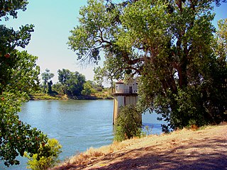
The Sacramento River is the principal river of Northern California in the United States and is the largest river in California. Rising in the Klamath Mountains, the river flows south for 400 miles (640 km) before reaching the Sacramento–San Joaquin River Delta and San Francisco Bay. The river drains about 26,500 square miles (69,000 km2) in 19 California counties, mostly within the fertile agricultural region bounded by the Coast Ranges and Sierra Nevada known as the Sacramento Valley, but also extending as far as the volcanic plateaus of Northeastern California. Historically, its watershed has reached as far north as south-central Oregon where the now, primarily, endorheic (closed) Goose Lake rarely experiences southerly outflow into the Pit River, the most northerly tributary of the Sacramento.

Sacramento County is a county located in the U.S. state of California. As of the 2020 census, the population was 1,585,055. Its county seat is Sacramento, which has been the state capital of California since 1854.

El Dorado County, officially the County of El Dorado, is a county located in the U.S. state of California. As of the 2020 census, the population was 191,185. The county seat is Placerville. The county is part of the Sacramento-Roseville-Arden-Arcade, CA Metropolitan Statistical Area. It is located entirely in the Sierra Nevada, from the historic Gold Country in the western foothills to the High Sierra in the east. El Dorado County's population has grown as Greater Sacramento has expanded into the region. Where the county line crosses US 50 at Clarksville, the distance to Sacramento is 15 miles (24 km). In the county's high altitude eastern end at Lake Tahoe, environmental awareness and environmental protection initiatives have grown along with the population since the 1960 Winter Olympics, hosted at the former Squaw Valley Ski Resort in neighboring Placer County.

Shasta County, officially the County of Shasta, is a county located in the northern portion of the U.S. state of California. Its population is 182,155 as of the 2020 census, up from 177,223 from the 2010 census. The county seat is Redding. The County borders Modoc County, Lassen County, Siskiyou County, Plumas County, Tehama County and Trinity County.
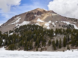
Lassen Peak, commonly referred to as Mount Lassen, is a 10,457 ft (3,187 m) lava dome volcano in Lassen Volcanic National Park in Northern California. Located in the Shasta Cascade region above the northern Sacramento Valley, it is the southernmost active volcano in the Cascade Range of the Western United States, and part of the Cascade Volcanic Arc stretching from southwestern British Columbia to northern California. It supports many flora and fauna among its diverse habitats, which reach high elevations and are subject to frequent snowfall.
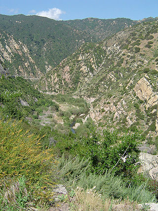
The Santa Monica Mountains are a coastal mountain range in Southern California, next to the Pacific Ocean. It is part of the Transverse Ranges. The Santa Monica Mountains National Recreation Area encompasses this mountain range. Because of its proximity to densely populated regions, it is one of the most visited natural areas in California.

The Warner Mountains are an 85-mile (137 km)-long mountain range running north–south through northeastern California and extending into southern Oregon in the United States. The range lies within the northwestern corner of the Basin and Range Province, extending from the northeastern corner of Lassen County, California, through eastern Modoc County, California, and northward into Lake County, Oregon.

Mount of the Holy Cross is a high and prominent mountain summit in the northern Sawatch Range of the Rocky Mountains of North America. The 14,011-foot (4270.5 m) fourteener is located in the Holy Cross Wilderness of White River National Forest, 6.6 miles (10.7 km) west-southwest of the Town of Red Cliff in Eagle County, Colorado, United States. The summit of Mount of the Holy Cross is the highest point in Eagle County and the northern Sawatch Range.
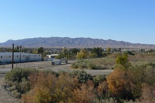
The Sacramento Mountains are a mountain range in the Eastern Mojave Desert and within Mojave Trails National Monument, in San Bernardino County, California.
Eagle Peak is the name of 44 mountain peaks of the United States including:
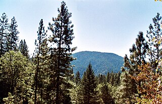
Cobb Mountain is the tallest mountain in the Mayacamas Mountains of California.

Eagle Peak is located in the Warner Mountains in Modoc County, California, United States. The area is protected in the South Warner Wilderness on the Modoc National Forest. The summit is the highest point in the Warner Mountains and Modoc County. Much of the precipitation that falls on Eagle Peak is snow due to the high elevation of the mountain.
The South Warner Wilderness is a federally designated wilderness area 12 miles (19 km) east of Alturas, California, United States. It encompasses more than 70,000 acres (283 km2) of the Warner Mountains. It is within the Modoc National Forest and managed by the US Forest Service. Elevations range from 5,000 feet (1,500 m) to 9,895 feet at Eagle Peak.

The Vaca Mountains are a mountain range in Napa and Solano Counties, California that is one of the California Coast Ranges. They represent the easternmost of the Inner Coast Ranges in north−central California, and divide the Suisun Valley on their west, from the Sacramento Valley on their east.

The following outline is provided as an overview of and topical guide to the U.S. state of California:

The American River is a 30-mile-long (50 km) river in California that runs from the Sierra Nevada mountain range to its confluence with the Sacramento River in downtown Sacramento. Via the Sacramento River, it is part of the San Francisco Bay watershed. This river is fed by the melting snowpack of the Sierra Nevada and its many headwaters and tributaries, including its North, Middle, and South Forks.

Thomes Creek is a major watercourse on the west side of the Sacramento Valley in Northern California. The creek originates in the Coast Ranges and flows east for about 62 miles (100 km) to join the Sacramento River, at a point about 7 miles (11 km) northeast of Corning in Tehama County.

Eagle Peak is a mountain in the Sierra Nevada of Mono County, California. The summit is set in Hoover Wilderness on land managed by Humboldt–Toiyabe National Forest. Eagle Peak is the highest peak on Buckeye Ridge. Other peaks on this ridge include Hunewill Peak and Victoria Peak. The first ascent of Eagle Peak was made September 1905 by George Davis, A. H. Sylvester, and Pearson Chapman of the United States Geological Survey.


