Related Research Articles

The M50 motorway is a C-shaped orbital motorway in Dublin and the busiest motorway in Ireland. The current route was built in various sections over the course of 27 years, from 1983 to 2010. It begins at Dublin Port, running northward through the Dublin Port Tunnel and along a portion of the Airport Motorway. It then turns west at its junction with the M1, circling the northern, western and southern suburbs of Dublin, before merging with the M11 at Shankill in South East Dublin. The road forms part of European route E01.

A rush hour or peak hour is a part of the day during which traffic congestion on roads and crowding on public transport is at its highest. Normally, this happens twice every weekday: once in the morning and once in the afternoon or evening, the times during which most people commute. The term is often used for a period of peak congestion that may last for more than one hour.

The Brooker Highway is a highway in the Australian state of Tasmania. As one of Hobart's three major radials, the highway connects traffic from the city centre with the northern suburbs and is the major road connection to the cities and towns of northern Tasmania. With an annual average daily traffic of 48,000, the highway is one of the busiest in Tasmania. The Brooker Highway has recently been declared part of the National Highway.

The Pacific Motorway is a motorway in Australia between Brisbane, Queensland, and Brunswick Heads, New South Wales, through the New South Wales–Queensland border at Tweed Heads.

A controlled-access highway is a type of highway that has been designed for high-speed vehicular traffic, with all traffic flow—ingress and egress—regulated. Common English terms are freeway, motorway, and expressway. Other similar terms include throughway or thruway and parkway. Some of these may be limited-access highways, although this term can also refer to a class of highways with somewhat less isolation from other traffic.

The Riverside Expressway is part of the Pacific Motorway that runs through Brisbane, Queensland, Australia. It is located on the western side of the Brisbane CBD and is made up of various bridges and overpasses. The North Bank development was formerly proposed to alleviate the visual disruption of the expressway and recapture Brisbane for pedestrians.
TransApex was a road transport plan devised by Brisbane Lord Mayor Campbell Newman in the early 2000s to connect existing motorways and major arterial roads with new transport links and divert cross-city traffic out of the Brisbane central business district. The plan is currently being delivered by Brisbane City Council at an estimated total cost of over $10 billion across five stages. According to the Brisbane City Council website, TransApex is "the biggest urban road project proposed in Australia".

The M7 Clem Jones Tunnel (CLEM7), known during its development as the North–South Bypass Tunnel (NSBT), is a A$3.2 billion motorway grade toll road under the Brisbane River, between Woolloongabba and Bowen Hills in Brisbane, Queensland. The tunnel was progressively opened to traffic from late on 15 March 2010 until just after midnight on 16 March 2010. It was completely open by 12:02 am.

Auchenflower is an inner western riverside suburb of the City of Brisbane, Queensland, Australia. In the 2021 census, Auchenflower had a population of 6,053 people.

Coronation Drive, popularly known as Coro Drive, is a road in Brisbane, Queensland, which connects the Central Business District to the suburb of Toowong. It follows the Brisbane River from the Riverside Expressway, through the suburbs of Milton and Auchenflower, until it terminates in Toowong at Benson Road and High Street.

Transport in Brisbane, the capital and largest city of Queensland, Australia, is provided by road, rail, river and bay ferries, footpaths, bike paths, sea and air.

The M3 Inner City Bypass (ICB) is a 5.6-kilometre (3.5 mi) major motorway standard bypass in Brisbane, Queensland, Australia. Bypassing the Brisbane central business district to the north, it connects Brisbane's Pacific Motorway and Go Between Bridge at Hale Street to Kingsford Smith Drive, Legacy Way Tunnel, Clem Jones Tunnel, AirportLink Tunnel and Lutwyche Road following the Exhibition railway line for the majority of its length.

The Roy A. Battagello River Walk Bike Trail is the current backbone of the "Windsor Loop" bike trail network in Windsor, Ontario. The bike trail travels from the foot of the Ambassador Bridge, to traffic lights at Riverside Drive and Lincoln Avenue. This makes the trail the second-longest trail in the City of Windsor, at 8.0 km.

Ipswich Road is major road in the City of Brisbane, Queensland, Australia. The road has been an important transport route since the 19th century when it connected the towns of Brisbane and Ipswich. In the 1990s, the section from Moorooka in Brisbane to Riverview in Ipswich was replaced by the Ipswich Motorway.

The road transport in Brisbane, Australia, consists of a network of highways, freeways and motorways. Some motorways have tolls applied.

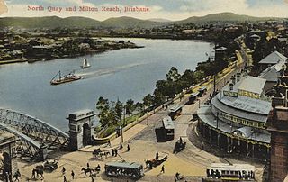
North Quay is a location in the Brisbane central business district and the name of a street in the same area, running along the Brisbane River from an intersection near Makerston Street to the top of the Queen Street mall, linking the Victoria Bridge and the William Jolly Bridge along the river's northern bank. It was the site of Brisbane’s initial settlement, at a point where a stream flowing from Spring Hill provided fresh water, later collected in a reservoir on Tank Street.

The M5 Legacy Way is a 4.6 kilometres (2.9 mi) long tunnel linking the Western Freeway at Toowong and the Inner City Bypass at Kelvin Grove, Brisbane. The project consisted of two bored tunnels carrying two motorway grade lanes of traffic in each direction. It opened on 25 June 2015 and is the fourth of five components of Brisbane City Council's TransApex Project. The tunnels will be tolled for approximately 45 years.
State Highway 74 is a state highway in New Zealand servicing the eastern suburbs of Christchurch. Mostly two-lane, it is composed of limited-access expressways, with part of the highway as the Christchurch-Lyttelton Motorway, and connects the city to its port town of Lyttelton.

Since the mid-1990s, a 27 kilometre bus rapid transit network has been developed in Brisbane, Australia. It comprises grade-separated bus-only corridors, complementing the Queensland Rail Citytrain network. Management of the busway network is the responsibility of Translink as coordinator of South East Queensland's integrated public transport system.
References
- 1 2 Brisbane City Council "TransApex" Archived 27 April 2013 at the Wayback Machine 2012. Retrieved 5/12/12
- ↑ RACQ "TransApex Road Tunnels" Archived 2009-10-06 at the Wayback Machine Page 2. Retrieved 5/12/12.
- ↑ Ursula Heger "Campbell Newman's final tunnel for East-West link could be built sooner" 2010. Retrieved 5/12/12.
- ↑ Ursula Heger and Sarah Vogler "Fourth tunnel could create long-awaited Brisbane inner ring road" 2010. Retrieved 5/12/12.
- ↑ Robyn Ironside "Campbell Newman's tunnel vision will have to wait because his successor, Graham Quirk, can't find the funds" 2011. Retrieved 5/12/12.