
Lismore is a city located in the Northern Rivers region of New South Wales, Australia and the main population centre in the City of Lismore local government area, it is also a regional centre in the Northern Rivers region of the state. Lismore is 734 km (456 mi) north of Sydney and 200 km (120 mi) south of Brisbane. It is situated on a low floodplain on the banks of the Wilsons River near the latter's junction with Leycester Creek, both tributaries of the Richmond River which enters the Pacific Ocean at Ballina, 30 km (19 mi) to the east.

Dromana is a seaside suburb on the Mornington Peninsula in Melbourne, Victoria, Australia, 57 km (35 mi) south of Melbourne's Central Business District, located within the Shire of Mornington Peninsula local government area. Dromana recorded a population of 6,626 at the 2021 census.

Northern Rivers is the most northeasterly region of the Australian state of New South Wales, located between 590 and 820 kilometres north of the state capital, Sydney, and encompasses the catchments and fertile valleys of the Clarence, Richmond, and Tweed rivers. It extends from Tweed Heads in the north to the southern extent of the Clarence river catchment which lies between Grafton and Coffs Harbour, and includes the main towns of Tweed Heads, Byron Bay, Ballina, Kyogle, Lismore, Casino and Grafton. At its most northern point, the region is 102 kilometres (63 mi) south-southeast of the Queensland capital, Brisbane.

Ballina is a town in the Northern Rivers region of New South Wales, Australia, and the seat of the Ballina Shire local government area. It lies 740 km (460 mi) north of Sydney and 185 km (115 mi) south of Brisbane. Ballina's urban population at the end of 2021 was 46,190.

Sutherland Shire is a local government area (LGA) in the southern region of Sydney, in the state of New South Wales, Australia. Sutherland Shire is located approximately 26 kilometres south-southwest of the Sydney central business district, and comprises an area of 370 square kilometres (140 sq mi). As at the 2016 census, Sutherland Shire has an estimated population of 218,464. The area is colloquially known as "The Shire", and has featured in several reality television series.

Cronulla is a suburb of Sydney, in the state of New South Wales, Australia. Boasting numerous surf beaches and swimming spots, the suburb attracts both tourists and Greater Sydney residents. Cronulla is 26 kilometres south of the Sydney central business district, in the local government area of the Sutherland Shire.

Brighton Le Sands, is a suburb in southern Sydney, in the state of New South Wales, Australia. Brighton Le Sands is located 13 kilometres south of the Sydney central business district, on the western shore of Botany Bay. Brighton Le Sands is in the local government area of the Bayside Council and is part of the St George area.
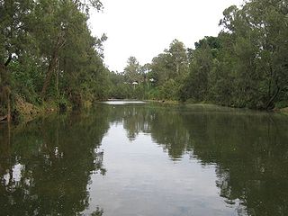
The Richmond River is a river situated in the Northern Rivers region of New South Wales, Australia.

Broulee is a town on the south coast of New South Wales between Batemans Bay and Moruya. At the 2016 census, the town had a population of 1,717. Just off the beach is Broulee Island, currently joined to the mainland, but in past years the connecting spit has been covered by water, at times a very deep navigable channel with a strong current.

Lennox Head is a seaside village in the Northern Rivers region of New South Wales, Australia, situated on the stretch of coast between Byron Bay and Ballina in Ballina Shire local government area. It had a population of 7,741 in the 2016 Australian census.

Ballina is an electoral district of the Legislative Assembly in the Australian state of New South Wales.

Fingal Bay is the easternmost suburb of the Port Stephens local government area in the Hunter Region of New South Wales, Australia. The only population centre is the township of the same name, which itself is named after the adjacent, small, semi-circular bay. At the 2021 census, the population of the town was 1,635.

Brunswick Heads is a small town on the north coast of New South Wales, Australia in Byron Shire. At the 2016 census, the town had a population of 1,737 people.

Ocean Shores is a coastal town in the Northern Rivers region of New South Wales, Australia with Billinudgel to the north and South Golden Beach and New Brighton to the east of the town. Established in 1977, Ocean Shores was originally a land holding owned by Wendell West of Washington with backing from American singer Pat Boone, and was named after Boone's residence in Ocean Shores, Washington. It is located in the Brunswick Valley – a valley including the towns of Mullumbimby and Brunswick Heads. The town has a local shopping complex and a large golf course. At the 2021 census, Ocean Shores had a population of 4,818 people.
The Richmond River massacres were a series of murders of groups of Indigenous Australians and European Australians in the region around the Richmond River in north-eastern New South Wales in the mid-nineteenth century.

The Bundjalung people, also spelled Bunjalung, Badjalang and Bandjalang, are Aboriginal Australians who are the original custodians of a region from around Grafton in northern coastal New South Wales to Beaudesert in south-east Queensland. The region is located approximately 550 kilometres (340 mi) northeast of Sydney and 100 kilometres (62 mi) south of Brisbane that now includes the Bundjalung National Park.

Richmond River Light, also known as Ballina Head Light and Ballina Light, is an active lighthouse located at Ballina Head, a headland in Ballina, New South Wales, Australia. The headland is at the northern side of the entrance to the Richmond River. It used to serve to guide ships into the river port and is used also serves as a leading light into the river, together with a steamer's masthead lantern with a 200 mm lens which is raised on a wooden structure 30 metres (98 ft) from it.

Lighthouse Beach is a surf lifesaving patrolled beach in East Ballina, NSW, Australia. Located in between Shelley Beach and The North Wall, Ballina, this beach is approximately 600m long and 50m wide. It is most notable for its shark attacks.
Federal is a village in the Northern Rivers region of New South Wales, Australia. It is located in the Byron Shire local government area. It is approximately 20 kilometres (12 mi) from the regional centre of Byron Bay. It is 13 kilometres (8.1 mi) to Minyon Falls which is within the Nightcap National Park.

South Ballina is a locality located in the Northern Rivers Region of New South Wales - bounded by the Richmond River to the north, the Tasman Sea to the east, and Keith Hall to the south and west. Across the river to the north, is the town of Ballina and it is a popular spot for recreational fishing. It is on the lands of the Bundjalung Nation and it falls within the Jali Aboriginal Land Council.
