Roxbury is a town in Delaware County, New York, United States. The population was 2,502 at the 2010 census. The town is at the eastern end of the county.

German Flatts is a town in Herkimer County, New York, United States. The population was 13,258 at the 2010 census.
Winfield is a town in Herkimer County, New York, United States. The population was 2,086 at the 2010 census. The town is named after General Winfield Scott and is in the southwest corner of the county, south of Utica.

Florida is a town south of the Mohawk River in Montgomery County, New York, United States. The population was 2,696 in the 2010 United States Census. The town was named after the state of Florida. It is located in the eastern end of Montgomery County and is south of the City of Amsterdam, which it borders.

Mohawk is a town in Montgomery County, New York, United States. The population was 3,844 at the 2010 census.
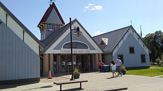
Clifton Park is a suburban town in Saratoga County, New York, United States. According to the United States Census Bureau, the 2010 population was 36,705. The name is derived from an early land patent. The town is in the south part of the county and is located approximately 12 miles (19 km) north of Albany, 7 miles (11 km) northeast of Schenectady, and 10 miles (16 km) south of Saratoga Springs.
Halfmoon is a town in Saratoga County, New York, United States. The population was 21,535 at the 2010 census. The town is apparently named for the shape of the lower elevation land north of the junction of the Hudson and Mohawk Rivers.
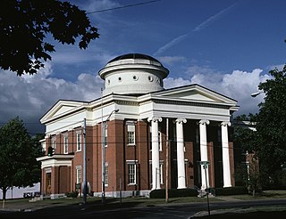
Little Falls is a town in Herkimer County, New York, United States. The population was 1,587 at the 2010 census. The town is named after falls and rapids on the Mohawk River nearby.

Amsterdam is a town in Montgomery County, New York, United States. The population was 5,566 at the 2010 census. The town is named after Amsterdam, the capital of the Netherlands.

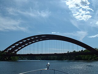
The Mohawk River is a 149-mile-long (240 km) river in the U.S. state of New York. It is the largest tributary of the Hudson River. The Mohawk flows into the Hudson in Cohoes, New York, a few miles north of the city of Albany. The river is named for the Mohawk Nation of the Iroquois Confederacy. It is a major waterway in north-central New York. The largest tributary, the Schoharie Creek, accounts for over one quarter (26.83%) of the Mohawk River's watershed. Another main tributary is the West Canada Creek which makes up for 16.33% of the Mohawks watershed.
Alplaus is a hamlet located in Schenectady County, New York, United States. Its name is derived from the Dutch Aal Plaats, or "Place of the Eels."

Route 8 is the portion of the 148 mile multistate New England Route 8 within the state of Massachusetts. The highway runs 66.643 miles (107.252 km) from the Connecticut state line in Sandisfield, where the highway continues as Connecticut Route 8, north to the Vermont state line in Clarksburg, where the highway continues as Vermont Route 8 and VT 100. Route 8 serves several towns in eastern and northern Berkshire County. The highway is the main highway between the cities of Pittsfield and North Adams, where the route intersects Route 9 and Route 2, respectively. Route 8 also intersects U.S. Route 20 in Becket.

Latham is a hamlet in Albany County, New York, United States. It is located along U.S. Route 9 in the town of Colonie, a dense suburb north of Albany. As of the 2010 census, the population was 20,736.
Crescent Station is a hamlet of the town of Colonie in Albany County, New York that straddles US Route 9.
Dunsbach Ferry is a hamlet of the town of Colonie, in Albany County, New York. The hamlet sits to the east of, and below, the Thaddeus Kosciusko Bridge, where Interstate 87 (I-87) crosses the Mohawk River. There are numerous private and public docks and landings between the Twin Bridges and the Colonie Town Park. Dunsbach Ferry was once an important river crossing and a stop on the Schenectady and Troy Railroad (T&S), later a branch of the New York Central Railroad. The ZIP code is 12047 (Cohoes).

Fort Hunter is a hamlet in the Town of Florida in Montgomery County, New York, west of the capital at Albany, on the south bank of the Mohawk River and on the northeast bank of Schoharie Creek.
The Mohawk Towpath Scenic Byway is a National Scenic Byway in the Capital District region of New York in the United States. It extends from Schenectady to Waterford by way of a series of local, county, and state highways along the Mohawk River and the Erie Canal. The byway is intended to showcase the history of the waterway, from Native American times through the creation of the Erie Canal and the role the waterside communities played in the Industrial Revolution and the westward expansion of the United States. At its east end, the byway connects to the Lakes to Locks Passage, an All-American Road.
West Leyden is a hamlet in Lewis County, New York, United States. The community is located along the East Branch Mohawk River at the intersection of New York State Route 26 and New York State Route 294, 6.6 miles (10.6 km) west-southwest of Boonville. West Leyden has a post office with ZIP code 13489, which opened on December 16, 1826.

West Branch Mohawk River is a river in Oneida County, New York. It begins at the confluence of Egger Brook and Lyman Brook, flows through the hamlet of West Branch, and empties into Mohawk River east of the hamlet.