
Holy Island is an island on the western side of the larger Isle of Anglesey, Wales, from which it is separated by the Cymyran Strait. It is called "Holy" because of the high concentration of standing stones, burial chambers and other religious sites on the small island. The alternative English name of the island is Holyhead Island. According to the 2011 UK Census, the population was 13,659, of whom 11,431 (84%) lived in the largest town, Holyhead.

Amlwch is a port town and community in Wales. It is situated on the north coast of the Isle of Anglesey, on the A5025 which connects it to Holyhead and to Menai Bridge. As well as Amlwch town and Amlwch Port, other settlements within the community include Burwen, Bull Bay (Porthllechog) and Pentrefelin. The town has a beach in Llaneilian, and it has significant coastal cliffs. Tourism is an important element of the local economy. At one time it was a booming mining town that became the centre of a vast global trade in copper ore. The harbour inlet became a busy port and significant shipbuilding and ship repair centre, as well as an embarkation point with boats sailing to the Isle of Man and to Liverpool. The community covers an area of about 15 square kilometres.

Ramsey Island is an island about 1 kilometre off St David's Head in Pembrokeshire on the northern side of St Brides Bay, in southwest Wales, in the community of St Davids and the Cathedral Close. It is 259 hectares in area. Ramsey means Hrafn's island.

Middle Mouse is an uninhabited island situated 1 kilometre off the north coast of Anglesey. It is notable as the northernmost point of Wales. The island measures a maximum of 207 metres by 110 metres, with a maximum area of 3.7 acres and has a maximum altitude of 16 metres (52') above sea level. It is one of a chain of three islands off the north of Anglesey, the others being Ynys Amlwch and Maen y Bugail.

West Mouse is an islet lying 1.1 kilometres (0.68 mi) off the north-west coast of Anglesey, Wales. Its maximum dimensions are 92 by 82 metres, with an area of 1.2 acres (4,900 m2).
Ynys Bery is a small island south of Ramsey Island, Pembrokeshire, Wales, in the community of St David's and the Cathedral Close.
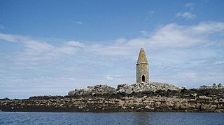
The Skerries, coming from the Old Norse word sker, are a group of sparsely vegetated rocky islets (skerries), with a total area of about 17 hectares lying 3 kilometres (1.9 mi) offshore from Carmel Head at the northwest corner of Anglesey, Wales. The islands are important as a breeding site for seabirds, and they attract divers, who come to visit the numerous shipwrecks. The Skerries Lighthouse sits atop the highest point in the islands.
Ynys Feurig is the name for a set of three small inter-connected low-lying inshore tidal rocky islets, lying off from the west coast of Anglesey, North Wales, just north of the village of Rhosneigr and south of RAF Valley airfield. They are also known by the English name Starvation Island. The islets are accessible from the mainland at mid-to low tide. The clipper Norman Court ran aground nearby, in Cymyran Bay.
Ynys Benlas is a small islet situated in the Inland Sea, part of the Cymyran Strait between Anglesey and Holy Island. It measures approximately 65 metres (east-west) by 35 metres (north-south) at low tide and covers about 0.2 hectares.

Puffin Island is an uninhabited island off the eastern tip of Anglesey, Wales. It was formerly known as Priestholm in English. A hermitage was established here around the 6th century, and there are remains of a 12th-century monastery on the island. The island is also a Special Protection Area for wildlife.
Church Island, also known as Llandysilio Island, is a small island in the Menai Strait on the shores of Anglesey to which it is attached by a short causeway that is reachable only on foot. The dominant feature of the island is with St Tysilio's Church, constructed in the 15th century, its churchyard, and a grade-II listed war memorial. The 20th-century bard Cynan is among several notable people buried in the churchyard. The Anglesey Coastal Path passes the head of the causeway.
Dulas Bay is a small bay on the north east coast of Anglesey, north Wales, forming the boundary between Llaneilian and Moelfre communities. The bay is bordered by three beaches.
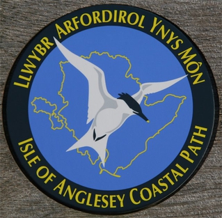
The Anglesey Coastal Path is a 200-kilometre (124 mi) long-distance footpath around the island of Anglesey in North Wales. The route is part of the Wales Coast Path.
Ynys Dulas is a small island located off the north-east coast of Anglesey, Wales. It marks the most eastern part of the parish of Llaneilian.
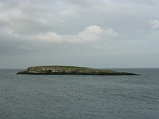
Ynys Moelfre is a small island off the coast of Anglesey, Wales. At low tide it has a maximum length of 261 metres and a maximum width of 121 metres with a maximum area of 6.6 acres (27,000 m2). The nearest settlement to the island is the village of Moelfre, and the two are separated by a shallow channel called Y Swnt, which is never more than 194 metres wide and can at low tide only be waist-deep all the way across. At extreme low Spring tides, it is possible to walk across to the island on dry ground all the way. Due to its proximity to the mainland there are grasses found on the island and a few wild flowers. Species of birds that can be found on the island include gulls, terns, gannets, fulmars, and Great/Arctic skuas. A colony of seals live there and porpoises are occasionally seen also. There are, however, no man-made structures. It is referred to by some locals as Rat Island.

Bull Bay is a village and bay on the northern coast of Anglesey, Wales, close to Amlwch. Its Welsh name, Porth Llechog, means "sheltered bay". The English name is derived from Pwll y Tarw, which is located near the shore close to the bay.

Anglesey is an island off the north-west coast of Wales. It forms the bulk of the county known as the Isle of Anglesey, which also includes Holy Island and some islets and skerries. The county borders Gwynedd across the Menai Strait to the southeast, and is otherwise surrounded by the Irish Sea. Holyhead is the largest town, and the administrative centre is Llangefni. The county is part of the preserved county of Gwynedd. Anglesey is the northernmost county in Wales.
GeoMôn UNESCO Global Geopark is a Geopark covering the entire island of Anglesey in north Wales. It was admitted to the European Geoparks Network and to the UNESCO-assisted Global Network of National Geoparks in May 2009. It was the second Geopark to be designated in Wales, the seventh within the United Kingdom and the thirty-third in Europe. The UNESCO Geopark designation reflects the diversity of the island's geology, which encompasses solid rocks from the Precambrian to the Neogene with some Miocene sediments and extensive Pleistocene glaciation features from the Quaternary period. GeoMôn covers 720 square kilometres and has 125 miles of coastal walks.

Llaneilian is a village and community in Anglesey, Wales. It is located in the north east of the island, 2.2 miles (3.5 km) east of Amlwch, 16.5 miles (26.6 km) north west of Menai Bridge and 12.5 miles (20.1 km) north of Llangefni. The community includes the villages and hamlets of Dulas, Llaneilian, Pengorffwysfa, Cerrig Man and Penysarn, Gadfa and Nebo, and at the 2001 census had a population of 1,192, decreasing slightly to 1,186 at the 2011 Census. The parish is crowned by its hill, Mynydd Eilian, a HuMP, popular with walkers and ramblers, and its beach, Traeth Eilian, which is popular with holidaymakers and for watersport activities. At the north easternmost point is Point Lynas,, while Ynys Dulas lies off the North East coast of the island, east of Dulas Bay.

Carmel Head is a prominent coastal headland on the northwest tip of the island of Anglesey.

