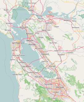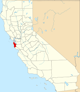
San Mateo County, officially the County of San Mateo, is a county located in the U.S. state of California. As of the 2010 census, the population was 718,451. The county seat is Redwood City.
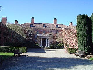
Filoli is a country house set in 16 acres (6.5 ha) of formal gardens surrounded by a 654-acre (265 ha) estate, located in Woodside, California, about 25 miles (40 km) south of San Francisco, at the southern end of Crystal Springs Reservoir, on the eastern slope of the Santa Cruz Mountains. Now owned by the National Trust for Historic Preservation, Filoli is open to the public. The site is both a California Historical Landmark and listed on the National Register of Historic Places.

Fitzgerald Marine Reserve is a marine reserve in California on the Pacific Ocean, located just north of Pillar Point Harbor and Mavericks in the San Mateo County community of Moss Beach. Moss Beach is located approximately 20 miles (32 km) south of San Francisco and 50 miles (80 km) north of Santa Cruz. The reserve is a 32-acre (0.13 km2) holding which extends from Montara light station at the north to Pillar Point on the south. The reserve consists of a three-mile stretch of beach, tidepool habitat, marsh, erosive bluffs, clifftop trail and cypress and eucalyptus forests. The property is owned by the State of California and managed by San Mateo County as a county park and nature preserve. The reserve is administratively assigned to be part of the Monterey Bay National Marine Sanctuary. Adjacent to and possibly within the reserve is an endangered species of butterfly, the San Bruno elfin butterfly.
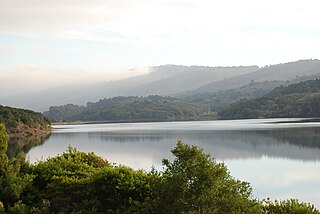
Crystal Springs Reservoir is a pair of artificial lakes located in the northern Santa Cruz Mountains of San Mateo County, California situated in the rift valley created by the San Andreas Fault just to the west of the cities of San Mateo and Hillsborough, and I-280. The lakes are part of the San Mateo Creek watershed.

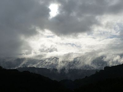
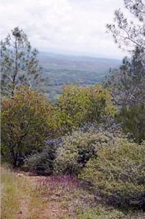
Montara Mountain, positioned between the unincorporated community of Montara, California to the southwest and the city of Pacifica, California to the north, forms the northern spur of the Santa Cruz Mountains, a narrow mountain range running the length of the San Francisco Peninsula that separates San Francisco Bay from the Pacific Ocean. Its highest point rises to 1,898 feet (579 m) above sea level. An unpaved fire road, the North Peak Access Road, accessible from the Pedro Mountain Road in McNee Ranch State Park, provides access to the summit by hikers from the south. From the north, Montara Mountain Trail, Hazelnut Trail and Brooks Creek Trail provide access to the mountain with trailheads in San Pedro Valley County Park.

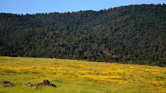
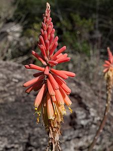
Acanthomintha duttonii is a species of annual plant endemic to San Mateo County, California in the family Lamiaceae. It is commonly called San Mateo thornmint or Dutton's acanthomintha and is found growing on serpentine soils near the Crystal Springs Reservoir in a six-mile (10 km) long strip on the east side of Montara Mountain at elevations of approximately 150 to 300 meters.
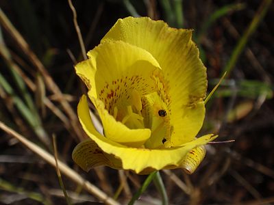
Pentachaeta bellidiflora, the white-rayed pentachaeta or whiteray pygmydaisy, is a Californian wildflower in the genus Pentachaeta of the family Asteraceae. It is included in both the state and federal lists of endangered species.

Cirsium fontinale, the fountain thistle, is a flowering perennial herb in the sunflower family. It is endemic to California. The genus Cirsium is commonly known as the "thistle" genus, Cirsium being the Greek word for 'thistle.'

Hesperolinon congestum, or Marin dwarf flax, is an annual herb, which is known to occur only in San Mateo, San Francisco and Marin County, California, United States. This plant occurs chiefly on serpentine soils, especially in dry native bunch grasses, chaparral or other grasslands at elevations less than 200 meters. The flowers are congested at the tips of the dichotomously branching stems. H. congestum is in flower between April and July. The outlook for this plant depends on survival of only about twenty small colonies, most of which are not actively managed for protection, even though the species is federally and state-listed as threatened. This species is also less commonly known as Marin western flax.

San Francisquito Creek is a creek that flows into southwest San Francisco Bay in California, United States. Historically it was called the Arroyo de San Francisco by Juan Bautista de Anza in 1776. San Francisquito Creek courses through the towns of Portola Valley and Woodside, as well as the cities of Menlo Park, Palo Alto, and East Palo Alto. The creek and its Los Trancos Creek tributary define the boundary between San Mateo and Santa Clara counties.

San Mateo Creek is a perennial stream whose watershed includes Crystal Springs Reservoir, for which it is the only natural outlet after passing Crystal Springs Dam.

Aliso Creek is a 19.8-mile (31.9 km)-long, mostly urban stream in south Orange County, California. Originating in the Cleveland National Forest in the Santa Ana Mountains, it flows generally southwest and empties into the Pacific Ocean at Laguna Beach. The creek's watershed drains 34.9 square miles (90 km2), and it is joined by seven main tributaries. As of 2018, the watershed had a population of 144,000 divided among seven incorporated cities.

Aliso and Wood Canyons Wilderness Park is a major regional park in the San Joaquin Hills of Orange County, California in the United States. Comprising 4,500 acres (1,800 ha) of rugged coastal canyons, open grassland, and riparian woodland, the park borders the suburban cities of Aliso Viejo, Dana Point, Laguna Beach, Laguna Hills and Laguna Niguel.

Laguna Canyon is the name of a canyon that cuts through the San Joaquin Hills in southern Orange County, California, in the United States, directly south of the city of Irvine. The canyon runs from northeast to southwest, and is drained on the north side by tributaries of San Diego Creek and on the south by Laguna Canyon Creek. It is deeper and more rugged on the southwestern end near Laguna Beach.
Pine Hill Ecological Reserve is a nature reserve of 403 acres (1.63 km2) located due east of Folsom Lake in the Sierra Nevada foothills, in El Dorado County, California. The reserve was established in 1979, and is managed by the California Department of Fish and Game.

San Mateo Creek is a stream in Southern California in the United States, whose watershed mostly straddles the border of Orange and San Diego Counties. It is about 22 miles (35 km) long, flowing in a generally southwesterly direction. Draining a broad valley bounded by the Santa Ana Mountains and Santa Margarita Mountains, San Mateo Creek is notable for being one of the last unchannelized streams in Southern California.

The California coastal sage and chaparral, a sub-ecoregion of the California chaparral and woodlands ecoregion, is found in southwestern California and northwestern Baja California in Mexico.

The Bay checkerspot is a butterfly endemic to the San Francisco Bay region of the U.S. state of California. It is a federally threatened species, as a subspecies of Euphydryas editha.

Laguna Creek is a perennial stream that flows northwesterly for 2.6-mile (4.2 km) along the San Andreas Fault from Woodside in San Mateo County, California and, after crossing the Phleger Estate and Filoli, enters Upper Crystal Springs Reservoir, where it is a historic tributary to San Mateo Creek. San Mateo Creek then carries its waters over Crystal Springs Dam northeast to San Francisco Bay.
Cordilleras Creek is a 3.8-mile-long (6.1 km) northward-flowing stream originating in the Pulgas Ridge Open Space Preserve in the foothills of the Santa Cruz Mountains. It forms the border between San Carlos and Redwood City in San Mateo County, California, United States before entering Smith Slough where its waters course to Steinberger Slough and thence to San Francisco Bay.