
Ohangwena is one of the fourteen regions of Namibia, its capital is Eenhana. Major settlements in the region are the towns Eenhana and Helao Nafidi as well as the self-governed village of Okongo and the proclaimed settlements Ongenga and Omungwelume. As of 2020, Ohangwena had 150,724 registered voters.
Sekele is the northern language of the ǃKung dialect continuum. It was widespread in southern Angola before the Angolan Civil War, but those varieties are now spoken principally among a diaspora in northern Namibia. There are also a number of dialects spoken in far northern Namibia.
ǃKungKUUNG (ǃXun), also known as Ju, is a dialect continuum spoken in Namibia, Botswana, and Angola by the ǃKung people, constituting two or three languages. Together with the ǂʼAmkoe language, ǃKung forms the Kxʼa language family. ǃKung constituted one of the branches of the putative Khoisan language family, and was called Northern Khoisan in that scenario, but the unity of Khoisan has never been demonstrated and is now regarded as spurious. Nonetheless, the anthropological term "Khoisan" has been retained as an umbrella term for click languages in general.
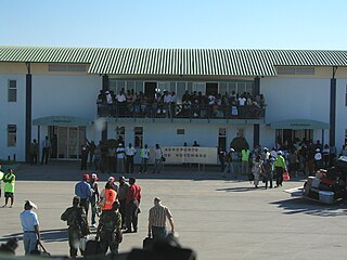
Ondjiva Pereira Airport is an airport serving Ondjiva in Cunene Province, Angola. The airport is 38 kilometres (24 mi) north of the Namibian border.
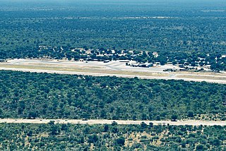
Katima Mulilo Airport, also known as Mpacha Airport, serves Katima Mulilo, the capital of the Zambezi Region in Namibia. The airport is on the B8 road, about 18 km (11 mi) southwest of Katima Mulilo. The Katima Mulilo non-directional beacon is located on the field.
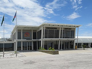
Andimba Toivo ya Toivo Airport formerly known as Ondangwa Airport is an airport serving Ondangwa, a town in the Oshana Region of Namibia. The airport is about 5 km (3 mi) northwest of the center of Ondangwa.
Eenhana is the capital town of the Ohangwena Region, northern Namibia, on the border with Angola. It also used to be a mission station of the Finnish Missionary Society.

Keetmanshoop Airport is an airport serving Keetmanshoop, a city in the ǁKaras Region of Namibia. The airport is located about 5 km (3 mi) northwest of the town. It has customs and immigration services and is home to the Namibia Aviation Training Academy (NATA).
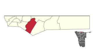
Eenhana is an electoral constituency in the Ohangwena Region of Namibia, on the border to Angola. It had 24,193 inhabitants in 2004 and 15,912 registered voters in 2020. The district centre is the town of Eenhana.
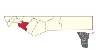
Omulonga is a constituency in the Ohangwena Region of northern Namibia. It had 27,772 inhabitants in 2004 and 13,585 registered voters in 2020. The constituency office is located at Onamukulo, along the Ondobe-Oshigambo district road.

Ondobe is a constituency in the Ohangwena Region of Namibia. It had 32,726 inhabitants in 2004 and 16,286 registered voters in 2020.

Arandis Airport is an airport serving Arandis, a town in the Erongo Region of Namibia. The airport is 5 kilometres (3.1 mi) south of Arandis. The town and airport also provide service to the Rössing Uranium Mine, one of the world's largest open-pit uranium mines.

The Grootfontein Air Force Base is an air base of the Namibian Air Force in Grootfontein, a town in the Otjozondjupa Region of Namibia. The air base is about 4 km (2 mi) south of the center of Grootfontein.
Ekoka ǃKung or Western ǃXuun is a variety of the ǃKung dialect cluster, spoken originally in the area of the central Namibian–Angolan border, west of the Okavango River, but since the Angolan Civil War also in South Africa.
Oshandi is a village situated in the northern Namibia in the Ondobe Constituency of Ohangwena Region. It has a clinic and Anglican church that were established in 1947 by Canadian citizen Mark Dirnardo, who was a carpenter who came up with the idea of creating the hospital and church. The first headman of Oshandi village was Haufuku Kanyanye, who was Oshivambo speaking and the current headman is Paulus Hashoongo who is the native of Oshandi village. Oshandi village is situated on the very edge of Ovamboland.
Maurus Nekaro was a Namibian politician and member of the SWAPO political party. Nekaro served as former governor Smith the governor of Kavango ;)Region, one of Namibia's thirteen regions, from December 2010 until his death on March 4, 2013.
Mukwanangombe Auguste Mukwahepo Immanuel affectionately known as Meekulu Mukwahepo, was a Namibian guerrilla, notable for being the first woman recruit of the People's Liberation Army of Namibia. Mukwahepo committed her life looking after children during the South African Border War, moving from one camp to another whenever the need arose.


