
Kunene is one of the fourteen regions of Namibia. Its capital is Opuwo, its governor is Marius Sheya. The region's name comes from the Kunene River which forms the northern border with Angola. Besides the capital Opuwo, the region contains the municipality of Outjo, the town Khorixas and the self-governed village Kamanjab. Kunene is home to the Himba people, a subtribe of the Herero, as well as to Damara people and Nama people. As of 2020, Kunene had 58,548 registered voters.

Opuwo was a constituency in the Kunene Region of Namibia. Its population in 2010 was 20,119, and its administrative capital was Opuwo.

Opuwo is the capital of the Kunene Region in north-western Namibia. The town is situated about 720 km north-northwest of the capital Windhoek, and has a population of around 12,300 (2023). It is the commercial hub of the Kunene Region.
Katima Mulilo Airport, also known as Mpacha Airport, serves Katima Mulilo, the capital of the Zambezi Region in Namibia. The airport is on the B8 road, about 18 km (11 mi) southwest of Katima Mulilo. The Katima Mulilo non-directional beacon is located on the field.
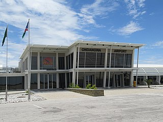
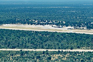
Andimba Toivo ya Toivo Airport formerly known as Ondangwa Airport is an airport serving Ondangwa, a town in the Oshana Region of Namibia. The airport is about 5 km (3 mi) northwest of the center of Ondangwa.

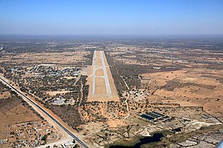
Keetmanshoop Airport is an airport serving Keetmanshoop, a city in the ǁKaras Region of Namibia. The airport is located about 5 km (3 mi) northwest of the town. It has customs and immigration services and is home to the Namibia Aviation Training Academy (NATA).
Rundu Airport is an airport serving Rundu, the capital of the Kavango Region in Namibia. The airport is 6 kilometres (3.7 mi) southwest of the center of Rundu.

Arandis Airport is an airport serving Arandis, a town in the Erongo Region of Namibia. The airport is 5 kilometres (3.1 mi) south of Arandis. The town and airport also provide service to the Rössing Uranium Mine, one of the world's largest open-pit uranium mines.

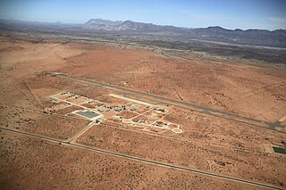
The Grootfontein Air Force Base is an air base of the Namibian Air Force in Grootfontein, a town in the Otjozondjupa Region of Namibia. The air base is about 4 km (2 mi) south of the center of Grootfontein.

Tsumeb Airport is a public airport serving Tsumeb, a town in the Oshikoto Region of northern Namibia. The airport is just east of the town. Tsumeb is the location of a former mining operation and is the closest town to the Etosha National Park.

The Zembapeople are a Bantu ethnic group residing in the border regions of Namibia and Angola. In Namibia, they are predominantly found in the Kunene region, most notably in the Opuwa area. They speak the Zemba language, also known as OtjiZemba or Dhimba. The Zemba are well-known for their distinctive hairstyles, intricate iron and copper jewelry, as well as traditional clothing that often incorporates animal hides. Additionally, they decorate themselves with a blend of ash, ochre paste, and rancid butter to enhance their appearance.

Opuwo Rural is an electoral constituency in the Kunene Region of Namibia. The administrative centre of Opuwo Rural is the settlement of Otuani. As of 2020, it has 7,315 registered voters.
Sesheke Airport is an airport in the town of Sesheke, Western Province, Zambia. It also serves the town of Katima Mulilo, across the Zambezi River in Namibia.
Karibib Air Force Base is an air base near the central Namibian town of Karibib. Since 2016, the headquarters of the Namibian Air Force are located here. Air Force Command had previously been at the Grootfontein Air Force Base.
Omega Airport is a former military airport serving the village of Omega in the Kavango East Region of Namibia.
Otjiwarongo Airport is an airport serving Otjiwarongo, in the Otjozondjupa Region of Namibia.
Ruacana Airport is an airport serving Ruacana and the Ruacana hydroelectric power station in the Omusati Region of Namibia.
C41 is a tarred secondary route in northern Namibia that runs from Opuwo via Okahao to Oshakati. It is 224 kilometres (139 mi) long.
The C43 is a secondary route in Namibia that begins in Bergsig, running for 457 kilometres (284 mi) to the Angolan-Namibian border where it terminates at the Epupa Falls.

