El Campillo, Huelva

Last updated
El Campillo
Calle en El Campillo.jpg
Flag of El Campillo Spain.svg
Escudo de El Campillo.svg
Country Spain
Autonomous community Andalusia
Province Province of HUELVA
Area
  Total90.72 km2 (35.03 sq mi)
Elevation
434 m (1,424 ft)
Population
 (2018) [1]
  Total2,036
  Density22/km2 (58/sq mi)
Time zone UTC+1 (CET)
  Summer (DST) UTC+2 (CEST)
Map of El Campillo, Huelva Map of El Campillo (Huelva).png
Map of El Campillo, Huelva

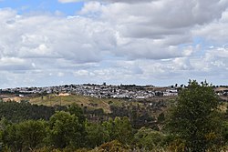
El Campillo, or Campillo, is a municipality in the province of Huelva, Spain. It was reported in the 2005 census with 2,318 inhabitants.

Contents

Demographics

Historical population
YearPop.±%
19992,424    
20002,430+0.2%
20012,402−1.2%
20022,398−0.2%
20032,335−2.6%
20042,293−1.8%
20052,318+1.1%
Source: INE (Spain)

Notable people

Related Research Articles

<span class="mw-page-title-main">San Justo, Spain</span> Place in Castile and León, Spain

San Justo is a municipality in the province of Zamora, part of the autonomous community of Castile and León, Spain. It had a population of 304 in the 2007 census.

<span class="mw-page-title-main">Zalamea la Real</span> Place in Andalusia, Spain

Zalamea la Real is a town and municipality located in the province of Huelva, Spain. According to the 2005 census, it had a population of 3,547 inhabitants and covers a 240 km2 (93 sq mi) area. It sits at an altitude of 412 m (1,352 ft) above sea level, and is 67 km (42 mi) from the capital.

<span class="mw-page-title-main">Campillos</span> Place in Andalusia, Spain

Campillos is a municipality and town in the province of Málaga, part of the autonomous community of Andalusia in southern Spain. It is located northwest of the province in the comarca of Guadalteba and within the judicial district of Antequera. The municipality is approximately 30 kilometers from Antequera and 70 from the provincial capital. It covers an area of 188 km2 extending from grain fields and olive groves and includes several lakes inhabited by flamingos and storks.

El Castillo de las Guardas is a city located in the province of Seville, Spain. According to the 2005 census (INE), the city has a population of 1619 inhabitants.

<span class="mw-page-title-main">Benalúa de las Villas</span> Place in Granada, Spain

Benalúa de las Villas is a city located in the province of Granada, Spain. According to the 2005 census (INE), the city has a population of 1391 inhabitants.

<span class="mw-page-title-main">Campotéjar</span> Place in Granada, Spain

Campotéjar is a village located in the province of Granada, Spain. According to the 2005 census (INE), the city has a population of 1,441 inhabitants.

<span class="mw-page-title-main">Huélaga</span> Municipality in Extremadura, Spain

Huélaga is a municipality located in the province of Cáceres, Extremadura, Spain. According to the 2005 census (INE), the municipality has a population of 191 inhabitants.

<span class="mw-page-title-main">Santiago del Campo</span> Municipality in Extremadura, Spain

Santiago del Campo is a municipality located in the province of Cáceres, Extremadura, Spain. According to the 2006 census (INE), the municipality has a population of 323 inhabitants.

<span class="mw-page-title-main">Villasbuenas de Gata</span> Municipality in Extremadura, Spain

Villasbuenas de Gata is a municipality located in the province of Cáceres, Extremadura, Spain. According to the 2005 census (INE), the municipality has a population of 490 inhabitants.

<span class="mw-page-title-main">Lobón</span> Municipality in Extremadura, Spain

Lobón is a municipality located in the province of Badajoz, Extremadura, Spain. According to the 2012 census (INE), the municipality has a population of 2,869 inhabitants.

<span class="mw-page-title-main">Campillo de Aranda</span> Municipality in Castile and León, Spain

Campillo de Aranda is a municipality located in the province of Burgos, Castile and León, Spain. According to the 2004 census (INE), the municipality has a population of 186 inhabitants.

Villalba de Duero is a municipality located in the province of Burgos, Castile and León, Spain. According to the 2004 census (INE), the municipality has a population of 617 inhabitants.

<span class="mw-page-title-main">Castejón de Monegros</span> Place in Aragon, Spain

Castejón de Monegros is a municipality located in the province of Huesca, Aragon, Spain. According to the 2004 census (INE), the municipality has a population of 683 inhabitants.

<span class="mw-page-title-main">Videmala</span> Place in Castile and León, Spain

Videmala is a municipality located in the province of Zamora, Castile and León, Spain. According to the 2004 census (INE), the municipality has a population of 216 inhabitants.

<span class="mw-page-title-main">Cistérniga</span> Place in Castile and León, Spain

Cistérniga is a municipality located in the province of Valladolid, Castile and León, Spain. According to the 2018 census (INE), the municipality has a population of 9,049 inhabitants.

<span class="mw-page-title-main">Puebla de la Calzada</span> Place in Extremadura, Spain

Puebla de la Calzada is a Spanish municipality in the province of Badajoz, Extremadura. It has a population of 5,685 (2007) and an area of 14.2 km².

Linares de la Sierra is a town and municipality located in the province of Huelva, Spain. According to the 2008 census, the municipality had a population of 305 inhabitants.

<span class="mw-page-title-main">Los Marines</span> Place in Andalusia, Spain

Los Marines is a town and municipality located in the province of Huelva, Spain. According to the 2008 census, the municipality had a population of 349 inhabitants.

<span class="mw-page-title-main">Valdelarco</span> Place in Huelva

Valdelarco is a town and municipality located in the province of Huelva, Spain. According to the 2008 census, the municipality had a population of 240.

<span class="mw-page-title-main">Vegas del Genil</span> Place in Andalusia, Spain

Vegas del Genil is a municipality in the province of Granada, Spain. As of 2009, it had a population of 7537 inhabitants.

References

  1. Municipal Register of Spain 2018. National Statistics Institute.

37°40′59″N6°37′01″W / 37.683°N 6.617°W / 37.683; -6.617