Andalusia is the southernmost autonomous community in Peninsular Spain, located in the south of the Iberian Peninsula, in southwestern Europe. It is the most populous and the second-largest autonomous community in the country. It is officially recognised as a historical nationality and a national reality. The territory is divided into eight provinces: Almería, Cádiz, Córdoba, Granada, Huelva, Jaén, Málaga, and Seville. Its capital city is Seville, while the seat of its High Court of Justice is the city of Granada.

Cádiz is a province of southern Spain, in the southwestern part of the autonomous community of Andalusia. It is the southernmost part of mainland Spain, as well as the southernmost part of continental Europe.
Lepe is a Spanish town in the province of Huelva, in the autonomous community of Andalusia. It is near the Portuguese border. According to the 2022 census, the city has a population of 28,617 inhabitants.

Palos de la Frontera is a town and municipality located in the southwestern Spanish province of Huelva, in the autonomous community of Andalusia. It is situated some 13 km (8 mi) from the provincial capital, Huelva. According to the 2015 census, the city had a population of 10,365. It is most famous for being the place from which Columbus set sail in 1492, eventually reaching the Americas.
Andújar is a Spanish municipality of 38,539 people (2005) in the province of Jaén, in Andalusia. The municipality is divided by the Guadalquivir River. The northern part of the municipality is where the Natural Park of the Sierra de Andújar is situated. To the south are agricultural fields and countryside. The city proper located on the right bank of the Guadalquivir and the Madrid-Córdoba railway. In the past, Andújar was widely known for its porous earthenware jars, called alcarrazas or botijos, which keep water cool in the hottest weather, and were manufactured from a whitish clay found in the neighbourhood.

Encinasola is a village and municipality of Spain belonging to the province of Huelva, in the autonomous community of Andalusia. According to the 2005 census, the municipality has a population of 1,686 inhabitants.

Ayamonte is a town and municipality of Spain belonging to the province of Huelva, Andalusia. It is located near the border with Portugal on the mouth of the Guadiana River. According to the 2015 census, the city had a population of 20,357 inhabitants.
Manuel Alberto Freire de Andrade y Armijo was a Spanish cavalry officer and general officer during the Peninsular War, and later Defense Minister.
Julio Izquierdo Labrado is a Spanish writer and holds a doctoral degree. He received his Doctor of History, in collaboration with Lauro Anaya Pena at the I "Martín Alonso Pinzón" International Prize for Historical Research.
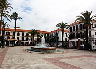
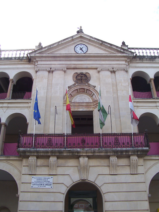
Villablanca is a town and municipality located in the province of Huelva, Spain. According to the 2011 census, the municipality had a population of 2916 inhabitants. The Constitution Square was designed in the 16th century and is located in the towns centre.

The border of Granada was a border region that existed between the Nasrid kingdom of Granada and the kingdoms of Murcia, Jaén, Córdoba and Seville following the integration of those former Muslim territories within the Crown of Castile in the mid-13th century. The delineation of this border region underwent several changes subsequently, but on the death of Alfonso XI in 1350, the Granadine border was fixed geographically, in general terms, until the beginning of the Granada War in the late 15th century. This territory was also referred to as La Banda Morisca.
This is the results breakdown of the local elections held in Andalusia on 28 May 1995. The following tables show detailed results in the autonomous community's most populous municipalities, sorted alphabetically.
This is the results breakdown of the local elections held in Andalusia on 13 June 1999. The following tables show detailed results in the autonomous community's most populous municipalities, sorted alphabetically.
This is the results breakdown of the local elections held in Andalusia on 27 May 2007. The following tables show detailed results in the autonomous community's most populous municipalities, sorted alphabetically.
This is the results breakdown of the local elections held in Andalusia on 22 May 2011. The following tables show detailed results in the autonomous community's most populous municipalities, sorted alphabetically.
This is the results breakdown of the local elections held in Andalusia on 24 May 2015. The following tables show detailed results in the autonomous community's most populous municipalities, sorted alphabetically.
This is the results breakdown of the local elections held in Andalusia on 26 May 2019. The following tables show detailed results in the autonomous community's most populous municipalities, sorted alphabetically.

San Martín del Tesorillo is a municipality located in the province of Cádiz, in the autonomous community of Andalusia, Spain. It was constituted as an independent municipality from Jimena de la Frontera on 2 October 2018.
La Zarza-Perrunal, known until 1991 as Silos de Calañas and Minas de Perrunal, is a municipality located in the Province of Huelva, in the autonomous community of Andalusia, Spain, which includes the localities of La Zarza and Perrunal, since their separation in 2018. Before then, it belonged to the municipality of Calañas. The municipality is part of the Andévalo comarca although it is located at the foot of the Sierra de Aracena.

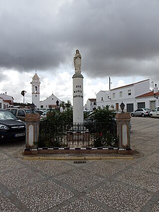
La Torre-La Janera megalithic site is located in the municipalities of Ayamonte and Villablanca in the province of Huelva, Andalusia. It was discovered when in 2018 a farmer intended to prepare the land to cultivate avocados and in view of the archaeological potential of the site the local council demanded a survey to be made. It is considered to be one of the largest megalithic site in Europe with over 500 standing stones.