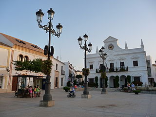
Rociana del Condado

Last updated
Rociana del Condado
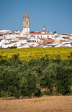
Cultivos de secano -- 2021 -- Rociana del Condado, Espana.jpg
Sunflowers, cereals and olive trees in Rociana del Condado.
Flag of Rociana del Condado Spain.svg
Escudo Rociana del Condado.svg
Country Spain
Autonomous community Andalusia
Province Huelva
Area
  Total74 km2 (29 sq mi)
Elevation
110 m (360 ft)
Population
 (2018) [1]
  Total7,751
  Density100/km2 (270/sq mi)
Time zone UTC+1 (CET)
  Summer (DST) UTC+2 (CEST)
Website http://www.rocianadelcondado.es/es/

Rociana del Condado is a town located in the province of Huelva, Andalusia, Spain.

Contents

Geography

Rociana del Condado belongs to the Judicial District of La Palma del Condado. It is located 37 km from the capital, its area is 70.7 km2 and has a population of 6863 inhabitants. The province's major industries are agriculture and construction. It is perhaps best known for its wine, with over two hundred vineyards and two major cooperatives. The traditional agriculture is diversified: the north are planted and cultivated sunflowers, cereals and olive trees in the center south citrus and almond orchards. [2]

Population

Rociana has a population of 6863 inhabitants according to 2006 census data, of which 3541 are men and 1,322 women. Foreigners are very few and are counted in 738 people, mostly from Romania. The town's patron is the Virgen del Socorro. Among its illustrious sons is the well-known academic Odón Betanzos Palacios. [3]

History

Rociana has been inhabited since the Neolithic. However, the first historical information Rociana appears to come from Roman times. The Romans gave this province with the name of Ponciana. The name of the place was transformed over time; as such, it was called Rociana and later Rociana del Condado, a name that has been preserved until today. The province was invaded by Romans, Visigoths and Muslims. Apparently, after the Muslim invasions and the reign of Mafot Aben, Rociana was a village belonging to the Kingdom of Taifa of Lebre or the Algarve, with its capital at Niebla. In 1262, due to the conquest of Niebla by Alfonso X, Taifa territory became part of the Castilian kingdoms, so the subject population was part of the Christian culture that still reigned in Castile. Following the granting of Royal Jurisdiction Castilian King Alfonso X the Council gave to the city of Niebla, Rociana got all the grants, perks and privileges that were granted royal for the repopulation of newly conquered territories and border territories of Muslims. But in 1368, the city of Niebla was in the hands of a secular government. At this stage Rociana fought constantly against neighboring towns who were trying to expand their territories by invading, among other places, Rociana. Later, from the sixteenth century and under the Old Regime, Rociana del Condado attracted a large population and economic growth through trade with the peninsula and the Americas. In 1833 Rociana got political autonomy from Niebla and Medina Manor due to the arrival of the Law of Lordships, through which all jurisdictional lordships were eliminated. [4]

Related Research Articles

<span class="mw-page-title-main">Huelva</span> City in the autonomous community of Andalusia, Spain

Huelva is a municipality of Spain and the capital of the province of Huelva, in the autonomous community of Andalusia. Located in the southwest of the Iberian Peninsula, it sits between the estuaries of the Odiel and Tinto rivers on the Atlantic coast of the Gulf of Cádiz. According to the 2010 census, the city had a population of 149,410.

<span class="mw-page-title-main">Kingdom of León</span> Country on the Iberian Peninsula (910–1230)

The Kingdom of León was an independent kingdom situated in the northwest region of the Iberian Peninsula. It was founded in 910 when the Christian princes of Asturias along the northern coast of the peninsula shifted their capital from Oviedo to the city of León. The kings of León fought civil wars, wars against neighbouring kingdoms, and campaigns to repel invasions by both the Moors and the Vikings, all in order to protect their kingdom's changing fortunes.

<span class="mw-page-title-main">Palos de la Frontera</span> Town and municipality in Spanish province Huelva

Palos de la Frontera is a town and municipality located in the southwestern Spanish province of Huelva, in the autonomous community of Andalusia. It is situated some 13 km (8 mi) from the provincial capital, Huelva. According to the 2015 census, the city had a population of 10,365. It is most famous for being the place from which Columbus set sail in 1492, eventually reaching the Americas.

<span class="mw-page-title-main">Kingdom of Castile</span> Christian kingdom in Iberia (1065–1833)

The Kingdom of Castile was a polity in the Iberian Peninsula during the Middle Ages. It traces its origins to the 9th-century County of Castile, as an eastern frontier lordship of the Kingdom of Asturias. During the 10th century, the Castilian counts increased their autonomy, but it was not until 1065 that it was separated from León and became a kingdom in its own right. Between 1072 and 1157, it was again united with León, and after 1230, the union became permanent.
<span class="mw-page-title-main">San Pedro del Pinatar</span> Municipality in Murcia, Spain

San Pedro del Pinatar is a small town and municipality in the Region of Murcia, southeastern Spain. The municipality is situated at the northern end of Murcia's Mediterranean coastline, the Costa Cálida, and borders the province of Alicante. It has an area of almost 22 km2, and a population of 25,167 as of 2018.

This is a timeline of notable events during the period of Muslim presence in Iberia, starting with the Umayyad conquest in the 8th century.

<span class="mw-page-title-main">House of Medina Sidonia</span> Spanish noble house originated from the crown of Castile

The House of Medina Sidonia is a Spanish noble house originating from the crown of Castile, whose name comes from the Duke of Medina Sidonia, a hereditary noble title that John II of Castile granted to Juan Alonso Perez de Guzman, 3rd Count of Niebla, on February 17, 1445, as a reward for his services to the crown. The Dukedom of Medina Sidonia is the oldest hereditary dukedom in the kingdom of Spain.

<span class="mw-page-title-main">Cartaya</span> Municipality & Town in Andalusia, Spain

Cartaya is a Spanish locality and municipality in the Province of Huelva,. In 2010 it had 18,415 inhabitants. Its surface area is 226.4 km2 and has a density of 81.34 people per km2.

<span class="mw-page-title-main">La Palma del Condado</span> Municipality in Andalusia, Spain

La Palma del Condado is a town and municipality located in the province of Huelva, Spain. According to the 2005 census, it has a population of 9,925 inhabitants. Circuito Monteblanco is situated here, hosting motorsport and corporate events.

<span class="mw-page-title-main">Niebla, Spain</span> Place in Andalusia, Spain

Niebla is a town and municipality located in the province of Huelva, in Andalusia, southern Spain. It lies on the banks of the Rio Tinto, 30 km from Huelva and 60 km from Seville.

<span class="mw-page-title-main">Muhammad I of Granada</span> First ruler of the Emirate of Granada from c. 1232 to 1273

Abu Abdullah Muhammad ibn Yusuf ibn Nasr, also known as Ibn al-Ahmar and by his honorific al-Ghalib billah, was the first ruler of the Emirate of Granada, the last independent Muslim state on the Iberian Peninsula, and the founder of its ruling Nasrid dynasty. He lived during a time when Iberia's Christian kingdoms—especially Portugal, Castile and Aragon—were expanding at the expense of the Islamic territory in Iberia, called Al-Andalus. Muhammad ibn Yusuf took power in his native Arjona in 1232 when he rebelled against the de facto leader of Al-Andalus, Ibn Hud. During this rebellion, he was able to take control of Córdoba and Seville briefly, before he lost both cities to Ibn Hud. Forced to acknowledge Ibn Hud's suzerainty, Muhammad was able to retain Arjona and Jaén. In 1236, he betrayed Ibn Hud by helping Ferdinand III of Castile take Córdoba. In the years that followed, Muhammad was able to gain control over southern cities, including Granada (1237), Almería (1238), and Málaga (1239). In 1244, he lost Arjona to Castile. Two years later, in 1246, he agreed to surrender Jaén and accept Ferdinand's overlordship in exchange for a 20-year truce.

<span class="mw-page-title-main">Cabra, Spain</span> Municipality in Andalusia, Spain

Cabra is a municipality in Córdoba province, Andalusia, Spain and the site of former bishopric Egabro. It lies along the route between Córdoba and Málaga in the south of Spain. It is an entrance point to the Parque Natural de las Sierras Subbéticas.
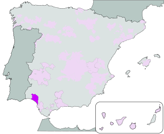
<span class="mw-page-title-main">Condado de Huelva</span> Spanish wine geographical indication

Condado de Huelva is a Spanish Denominación de Origen Protegida (DOP) for wines located in the south-east of the province of Huelva. The wines, known as the Wines of the Discovery of America, are produced there.

<span class="mw-page-title-main">Navas de San Juan</span> Place in Andalusia, Spain

Navas de San Juan is a Spanish village of the province of province of Jaén, Spain. According to the 2005 census (INE), the city has a population of 5,030 inhabitants. It is the biggest village in the region of El Condado. The river called Guadalimar runs for its municipal area.
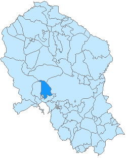
<span class="mw-page-title-main">Almodóvar del Río</span> City in Andalusia, Spain

Almodóvar del Río is a small historic city located in the province of Córdoba, Spain, located in the Valle Medio del Guadalquivir Comarca. In 2022, there were 8093 inhibitants. It belongs to the judicial district of Posadas.

<span class="mw-page-title-main">Taifa of Seville</span> Muslim State ruled by Abbadids (1023–1091)

The Taifa of Seville was an Arab kingdom which was ruled by the Abbadid dynasty. It was established in 1023 and lasted until 1091, in what is today southern Spain and Portugal. It gained independence from the Caliphate of Cordoba and it expanded the territory it ruled in the mid-11th century. The emerging power of Castile led Seville to ask military assistance from the Almoravids, who then occupied Seville.

<span class="mw-page-title-main">Astudillo, Palencia</span> Municipality in Castile and León, Spain

Astudillo is a Spanish municipality in the autonomous community of Castilla y León belonging to the province of Palencia. It is located 29 km (18 mi) northeast of the provincial capital, and has 1,106 inhabitants (2011) with an area of 122.95 km2 (47.47 sq mi).

<span class="mw-page-title-main">Saltes Island</span>

Saltes Island is a fluvial islet in the Huelva River estuary, in the province of Huelva, Andalusia, Spain. It is part of the Odiel Marshes biosphere reserve.

<span class="mw-page-title-main">Mudéjar revolt of 1264–1266</span> Revolt by Muslim communities in Castile

The Mudéjar revolt of 1264–1266 was a rebellion by the Muslim populations (Mudéjares) in the Lower Andalusia and Murcia regions of the Crown of Castile. The rebellion was in response to Castile's policy of relocating Muslim populations from these regions and was partially instigated by Muhammad I of Granada. The rebels were aided by the independent Emirate of Granada, while the Castilians were allied with Aragon. Early in the uprising, the rebels managed to capture Murcia and Jerez, as well as several smaller towns, but were eventually defeated by the royal forces. Subsequently, Castile expelled the Muslim populations of the reconquered territories and encouraged Christians from elsewhere to settle their lands. Granada became a vassal of Castile and paid an annual tribute.
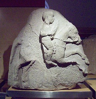
<span class="mw-page-title-main">History of Andalusia</span>

The geostrategic position of Andalusia at the southernmost tip of Europe, between Europe and Africa, between the Atlantic Ocean and the Mediterranean Sea, as well as its mineral and agricultural riches and its large surface area of 87 268 km², formed a combination of factors that made Andalusia a focus of attraction for other civilizations since the beginning of the Metal Age.

References

  1. Municipal Register of Spain 2018. National Statistics Institute.
  2. Pueblos de Huelva: ROCIANA DEL CONDADO (Translation: Villages of Huelva: Rociana del Condado) (In Spain)
  3. Huelvapedia: Datos estadísticos de la población de Rociana del Condado (in Spanish: Huelvapedia: Statistics of the population of Rociana del Condado)(In Spain)
  4. Rociana del Condado, Huelva (Translation: Rociana del Condado, Huelva) (In Spain)

37°18′29″N6°35′55″W / 37.30806°N 6.59861°W / 37.30806; -6.59861