El Harmilia

Last updated
El Harmilia
Commune and town
CountryFlag of Algeria.svg  Algeria
Province Oum El Bouaghi Province
Population
(1998)
  Total7,122
Time zone UTC+1 (CET)

El Harmilia is a town and commune in Oum El Bouaghi Province, Algeria. According to the 1998 census it has a population of 7122. [1]

Communes of Algeria administrative division of Algeria

The municipalities of Algeria form the second level of administrative subdivisions of Algeria. As of 2002, there were 1,541 municipalities in the country.

Oum El Bouaghi Province Province in Algeria

Oum El Bouaghi or Oum el-Bouaghi is a province (wilaya) of Algeria in the Aures region. The capital is Oum el-Bouaghi, which was named Can Robert, Sidi R'Ghis a few years later, and Oum El Bouaghi before independence.

Algeria country in North Africa

Algeria, officially the People's Democratic Republic of Algeria, is a country in the Maghreb region of North Africa. The capital and most populous city is Algiers, located in the far north of the country on the Mediterranean coast. With an area of 2,381,741 square kilometres (919,595 sq mi), Algeria is the tenth-largest country in the world, the world's largest Arab country, and the largest in Africa. Algeria is bordered to the northeast by Tunisia, to the east by Libya, to the west by Morocco, to the southwest by the Western Saharan territory, Mauritania, and Mali, to the southeast by Niger, and to the north by the Mediterranean Sea. The country is a semi-presidential republic consisting of 48 provinces and 1,541 communes (counties). It has the highest human development index of all non-island African countries.

Related Research Articles

Ksibet El Mediouni Tunisian town

Ksibet El Mediouni is a small city located in the region of the Sahel in Tunisia around 10 km south Monastir. Its origins are thought to be linked to the establishment of an observation post of the Almoravids to control Christian incursion on this part of the Tunisian coast.

Jezreel Valley Regional Council is a regional council in northern Israel that encompasses most of the settlements in the Jezreel Valley. It includes 15 kibbutzim, 15 moshavim, 6 community settlements and two Bedouin villages. Despite its name, some of these settlements are not located in the Jezreel Valley proper, but in the vicinity.

Ben Foudhala El Hakania Place in Batna, Algeria

Ben Foudhala El Hakania is a town in north-eastern Algeria.

El Madher Place in Batna, Algeria

El Madher is a town in north-eastern Algeria.

Zanat El Beida Place in Batna, Algeria

Zana El Beida is a town in north-eastern Algeria.

Oued El Ma Place in Batna, Algeria

Oued El Ma is a small town in the Aures region, and administratively is a municipality in the province of Batna. The name Oud El Ma is derived from the Berber name ″Ighzer n'Alma″, with 'Oud' means river that come from the mountains and 'Alma' means the mount of Telmet mountain.

Ouyoun El Assafir Place in Batna, Algeria

Ouyoun El Assafir is a town in the Batna Province, in north-eastern Algeria.

Aïn Djasser District District in Batna Province, Algeria

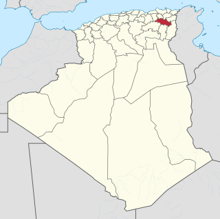
Aïn Djasser District is a district of Batna Province, Algeria.

El Madher District District in Batna Province, Algeria

El Madher District is a district of Batna Province, Algeria.

Seriana District District in Batna Province, Algeria

Seriana District is a district of Batna Province, Algeria.

Théniet El Abed District District in Batna Province, Algeria

Théniet El Abed District is a district of Batna Province, Algeria.

Hajeb El Ayoun Commune and town in Kairouan Governorate, Tunisia

Hajeb El Ayoun is a town and commune in the Kairouan Governorate, Tunisia. As of 2004 it had a population of 9,648. It is also the capital of a district of 35,403 inhabitants.

El Bradâa is a town and commune in the Mahdia Governorate, Tunisia. As of 2004 it had a population of 6,416.

Amiret Touazra is a town and commune in the Monastir Governorate, Tunisia. It has 6,261 inhabitants in 2014.

El Hencha is a town and commune in the Sfax Governorate, Tunisia. As of 2004 it had a population of 6,277.

Sidi El Hani is a town and commune in the Sousse Governorate, Tunisia located at 35.67n, 10.30e. As of 2004 it had a population of 3,058. It gives its name to the largest lake of the governorate, a natural salt lake or salt pan (sabkha) in dry seasons, the Sebkhet de Sidi El Hani which is shared with between one and two other areas depending on precipitation and its maximum extent forms the official boundary with part of a third, Monastir Governorate. The town is 30km south-west of the coast, its straightest connection being by Tunisian Railways, with a secondary connection by road, the P12 road which is a principal road to Kairouan from the A1 a few kilometres to the east. it is 19km from Kairouan and 26 km from Raqqada and.

Aïn Fakroun District District in Oum El Bouaghi Province, Algeria

Aïn Fakroun District is a district of Oum El Bouaghi Province, Algeria.

Aïn Kechra District (Oum El Bouaghi Province) District in Oum El Bouaghi Province, Algeria

Aïn Kechra District is a district of Oum El Bouaghi Province, Algeria.

Souk Naâmane District District in Oum El Bouaghi Province, Algeria

Souk Naâmane District is a district of Oum El Bouaghi Province, Algeria.

El Fedjouz Boughrara Saoudi is a town and commune in Oum El Bouaghi Province, Algeria. According to the 1998 census, it has a population of 3, 658.

References

Coordinates: 35°55′25″N6°37′09″E / 35.923532°N 6.619263°E / 35.923532; 6.619263

Geographic coordinate system Coordinate system

A geographic coordinate system is a coordinate system that enables every location on Earth to be specified by a set of numbers, letters or symbols. The coordinates are often chosen such that one of the numbers represents a vertical position and two or three of the numbers represent a horizontal position; alternatively, a geographic position may be expressed in a combined three-dimensional Cartesian vector. A common choice of coordinates is latitude, longitude and elevation. To specify a location on a plane requires a map projection.