
The Siege of Capua was fought in 211 BC, when the Romans besieged Capua. It is described by Polybius at 9.4-7, and by Livy at 26.4-6.

Ab Kamari is a district in the west of Badghis Province, Afghanistan. Its population was estimated at 36,300 in 2002, the ethnic makeup of which was approximately 80% Tajik with a Pashtun minority. The district capital is Sang Atesh. Other localities include Ab Khuda'i, Alkhan, Anjir, Duzdanak, Gana Gul, Khalifa, and Papal. Ab Kamari is known for its pistachio forests.
Charbhadrasan or Char Bhadrasan is an Upazila of Faridpur District in the Division of Dhaka, Bangladesh.

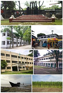
Itna is an Upazila of Kishoreganj District in the Division of Dhaka, Bangladesh.

Mahardah District is a district (mantiqah) administratively belonging to Hama Governorate, Syria. At the 2004 Census it had a population of 143,953. Its administrative centre is the city of Mahardah.
Ek Phnom is a district (srok) of Battambang Province, in north western Cambodia. The name means "only hill" in Khmer.

Celestynów is a village in the administrative district of Gmina Sławno, within Opoczno County, Łódź Voivodeship, in central Poland. It lies approximately 7 kilometres (4 mi) north-west of Sławno, 15 km (9 mi) west of Opoczno, and 58 km (36 mi) south-east of the regional capital Łódź.
Sewerynówka is a village in the administrative district of Gmina Opole Lubelskie, within Opole Lubelskie County, Lublin Voivodeship, in eastern Poland. It lies approximately 9 kilometres (6 mi) east of Opole Lubelskie and 36 km (22 mi) west of the regional capital Lublin.
Jaźwiny is a village in the administrative district of Gmina Czarna, within Dębica County, Subcarpathian Voivodeship, in south-eastern Poland. It lies approximately 3 kilometres (2 mi) north of Czarna, 13 km (8 mi) west of Dębica, and 55 km (34 mi) west of the regional capital Rzeszów.
Stawek is a village in the administrative district of Gmina Latowicz, within Mińsk County, Masovian Voivodeship, in east-central Poland. It lies approximately 7 kilometres (4 mi) north of Latowicz, 21 km (13 mi) south-east of Mińsk Mazowiecki, and 58 km (36 mi) east of Warsaw.
Guty is a village in the administrative district of Gmina Kosów Lacki, within Sokołów County, Masovian Voivodeship, in east-central Poland. It lies approximately 5 kilometres (3 mi) west of Kosów Lacki, 25 km (16 mi) north-west of Sokołów Podlaski, and 85 km (53 mi) north-east of Warsaw.
Kurnatowice is a village in the administrative district of Gmina Kwilcz, within Międzychód County, Greater Poland Voivodeship, in west-central Poland. It lies approximately 6 kilometres (4 mi) north of Kwilcz, 14 km (9 mi) east of Międzychód, and 61 km (38 mi) west of the regional capital Poznań.
Krasowice is a village in the administrative district of Gmina Namysłów, within Namysłów County, Opole Voivodeship, in south-western Poland. It lies approximately 8 kilometres (5 mi) west of Namysłów and 52 km (32 mi) north-west of the regional capital Opole.
Doba is a village in the administrative district of Gmina Giżycko, within Giżycko County, Warmian-Masurian Voivodeship, in northern Poland. It lies approximately 12 kilometres (7 mi) north-west of Giżycko and 80 km (50 mi) north-east of the regional capital Olsztyn.
Kłębowo is a village in the administrative district of Gmina Lidzbark Warmiński, within Lidzbark County, Warmian-Masurian Voivodeship, in northern Poland. It lies approximately 4 kilometres (2 mi) south of Lidzbark Warmiński and 34 km (21 mi) north of the regional capital Olsztyn.
Strachocin is a village in the administrative district of Gmina Stargard, within Stargard County, West Pomeranian Voivodeship, in north-western Poland. It lies approximately 4 kilometres (2 mi) south-east of Stargard and 36 km (22 mi) east of the regional capital Szczecin.

Oryol Governorate or the Government of Oryol, was an administrative division of the Russian Empire and the early Russian SFSR, which existed from 1796 to 1928. Its seat was in the city of Oryol.
Qossiyeh is a Syrian village located in Wadi al-Uyun Nahiyah in Masyaf District, Hama. According to the Syria Central Bureau of Statistics (CBS), Qossiyeh had a population of 645 in the 2004 census.
Pechterna is a village in Lukovit Municipality, Lovech Province, northern Bulgaria.
Purio is a corregimiento in Pedasí District, Los Santos Province, Panama with a population of 494 as of 2010. Its population as of 1990 was 555; its population as of 2000 was 547.
