This article needs additional citations for verification .(April 2024) |
El Pedregal, Spain | |
|---|---|
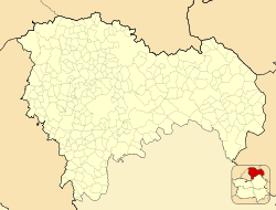 El Pedregal, Spain  El Pedregal, Spain  El Pedregal, Spain | |
| Coordinates: 40°46′52″N1°34′10″W / 40.78111°N 1.56944°W | |
| Country | |
| Autonomous community | Castile-La Mancha |
| Province | Guadalajara |
| Municipality | El Pedregal |
| Area | |
• Total | 23.2 km2 (9.0 sq mi) |
| Elevation | 1,193 m (3,914 ft) |
| Population (2024-01-01) [1] | |
• Total | 63 |
| • Density | 2.7/km2 (7.0/sq mi) |
| Time zone | UTC+1 (CET) |
| • Summer (DST) | UTC+2 (CEST) |
El Pedregal is a municipality located in the province of Guadalajara, Castile-La Mancha, Spain. According to the 2004 census (INE), the municipality had a population of 106 inhabitants.