This article needs additional citations for verification .(May 2024) |
El Recuenco, Spain | |
|---|---|
 | |
 Flag  Coat of arms | |
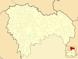 El Recuenco, Spain  El Recuenco, Spain  El Recuenco, Spain | |
| Coordinates: 40°37′0″N2°20′18″W / 40.61667°N 2.33833°W | |
| Country | |
| Autonomous community | Castile-La Mancha |
| Province | Guadalajara |
| Municipality | El Recuenco |
| judicial Party | Guadalajara |
| Government | |
| • Mayor | Enrique Collada Sánchez |
| Area | |
• Total | 75.18 km2 (29.03 sq mi) |
| Population (2024-01-01) [1] | |
• Total | 64 |
| • Density | 0.85/km2 (2.2/sq mi) |
| Time zone | UTC+1 (CET) |
| • Summer (DST) | UTC+2 (CEST) |
El Recuenco is a municipality located in the province of Guadalajara, Castile-La Mancha, Spain, between the mountains of Cuenca, Alcarria and the Alto Tajo.