
San Miguel County is a county in the U.S. state of New Mexico. As of the 2010 census, the population was 29,393. Its county seat is Las Vegas.
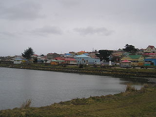
Porvenir is the capital of both the homonymous commune and the Chilean Province of Tierra del Fuego of the Magallanes y la Antártica Chilena Region. It is one of Chile's southernmost towns, and has 4,734 inhabitants, including several thousand soldiers. It is the largest settlement in the Chilean half of the island of Tierra del Fuego.

El Porvenir is a town, with a population of 5,202, and a municipality in the Honduran department of Atlántida. The largest town of the Municipality is El Pino, with a population of 6,304.
Las Lajas is a town, with a population of 11,030, and a municipality in the Honduran department of Comayagua.
El Porvenir is a municipality in the Honduran department of Francisco Morazán.
El Porvenir or Porvenir may refer to:

El Porvenir is a municipio (municipality) and township in the Mexican state of Chiapas.

The San Martín Province is one of 10 provinces of the San Martín Region in northern Peru.

Club El Porvenir is an Argentine football club, located in the Gerli district of Lanús Partido in Greater Buenos Aires. The team currently plays in Primera C, the regionalised fourth division of the Argentine football league system.
Los Ramones is the name of a municipality and its corresponding seat of government and main population center in Mexican state of Nuevo Leon.

San Francisco Ixhuatán is a town, and the surrounding municipality of the same name, in the Mexican state of Oaxaca. It is part of the Juchitán District in the west of the Istmo de Tehuantepec region. The Nahuatl name element Ixhuatán means "town of palm fronds".
El Porvenir District is one of eleven districts of the province Trujillo in Peru.
El Porvenir District is one of fourteen districts of the province San Martín in Peru.
The Fort Hancock–El Porvenir International Bridge is an international bridge which crosses the Rio Grande connecting the United States–Mexico border cities of Fort Hancock, Texas and El Porvenir, Chihuahua. The two-lane international bridge was constructed in 1936 and is 1,855 feet (565 m) long. The Fort Hancock Port of Entry is located on the Texas side of the bridge and connects to Farm to Market Road 1088.
The Sierra del Lacandón is a low karstic mountain range in Guatemala and Mexico. It is situated in the north-west of the department of El Petén and the south-east of Chiapas. Its highest points are located near the Mexican border at coordinates 17.244195°N 91.202145°W and 17.195087°N 91.086102°W The range consists of southeast to northwest trending ridges of folded Cretaceous limestone and dolomite hills rising above the lowlands of the Petén Basin.

Villa Corzo is a city and one of the 119 municipalities of Chiapas, in southern Mexico. The city of Villa Corzo (the municipal seat is located at

Colonia Atlampa is a colonia or neighborhood located in the Cuauhtémoc borough, northwest of the historic center of Mexico City. The boundaries of the area are marked by the following streets: Calzada de Nonoalco or Ricardo Flores Magón Street to the south, Circuito Interior Paseo de las Jacarandas to the north, Avenida Insurgentes Norte to the east and Circuito Interior Instituto Politécnico Industrial to the west. The neighborhood is considered lower class and working class. The name is derived from a Nahuatl phrase meaning "where the water divides."
Zaragoza is a municipality in the Mexican state of Puebla. Zaragoza was named after the city of Zaragoza, Spain, since among the first settlers of the place families were some of the city from Aragon. That is why today in Zaragoza is dedicated to the Virgen del Pilar, patron de la Hispanidad.
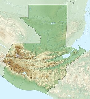
El Porvenir is the modern name for a ruined city of the pre-Columbian Maya civilization located in the Petén department of Guatemala. Ron Canter, in his paper "The Usumacinta River Portages in the Maya Classical Period" argues that El Porvenir was the first point at which the ancient Maya portaged to avoid the unnavigable portions of the Usumacinta River. A fragment of stone found at the site and aptly called the "El Porvenir Fragment" was also discovered that bore the name of Ha' K'in Xook, the sixth ajaw of Piedras Negras, suggesting a connection to the site.

El Porvenir Airport is an airport serving El Porvenir, in Panama. The airport is on an island 2 kilometres (1.2 mi) east of the mainland, in the archipelago bordering the Gulf of San Blas. All approaches and departures will be over the water.

