You can help expand this article with text translated from the corresponding article in Spanish. (June 2023)Click [show] for important translation instructions.
|
Santiago de la Frontera | |
|---|---|
District | |
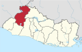
 Santiago de la Frontera Location in El Salvador | |
| Coordinates: 14°10′N89°36′W / 14.167°N 89.600°W | |
| Country | |
| Department | Santa Ana |
| Government | |
| • Mayor | |
| Area | |
| • District | 17.07 sq mi (44.22 km2) |
| Elevation | 1,677 ft (511 m) |
| Population | |
| • District | 5,017 |
Santiago de la Frontera is a district that is a part of the municipality Santa Ana Oeste in the Santa Ana department of El Salvador. [1]