El Salvador is a country in Central America. Situated at the meeting point of three tectonic plates, it is highly seismologically active and the location of numerous earthquakes and volcanic eruptions. The country has a tropical climate.

This is a demography of the population of El Salvador including population density, ethnicity, education level, health of the populace, economic status, religious affiliations and other aspects of the population.

The economy of El Salvador has experienced relatively low rates of GDP growth, in comparison to other developing countries. Rates have not risen above the low single digits in nearly two decades – part of a broader environment of macroeconomic instability which the integration of the United States dollar has done little to improve. One problem that the Salvadoran economy faces is the inequality in the distribution of income. In 2011, El Salvador had a Gini Coefficient of .485, which although similar to that of the United States, leaves 37.8% of the population below the poverty line, due to lower aggregate income. The richest 10% of the population receives approximately 15 times the income of the poorest 40%.

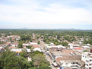
Santa Ana is the second largest city in El Salvador, after the capital of San Salvador. It is located 64 kilometers northwest of San Salvador, the capital city. Santa Ana has approximately 374,830 (2017)) inhabitants and serves both as the capital of the department of Santa Ana and as the municipal seat for the surrounding municipality of the same name. For its administration the municipality is divided into 35 colonias (neighborhoods) and 318 small villages.

La Paz is a department of El Salvador in the south central area of the country. The capital is Zacatecoluca. La Paz has an area of 1,228 km2 and a population of more than 328,000. The department was created in 1852. There are various caves containing rock writing. The department has a church in Zacatecoluca where the Independence Hero Dr Jose Simeon Cañas y Villacorta was born. He was known as "The Liberator of the Slaves in Central America". In 1833, Anastasio Aquino, an indigenous person, proclaimed himself as "The Emperor of the Nonualcos".

Sonsonate is a department of El Salvador in the western part of the country. The capital is Sonsonate.

Usulután is a department of El Salvador in the southeast of the country. The capital is Usulután.

The San Bernardino Mountains are a high and rugged mountain range in Southern California in the United States. Situated north and northeast of San Bernardino and spanning two California counties, the range tops out at 11,503 feet (3,506 m) at San Gorgonio Mountain – the tallest peak in all of Southern California. The San Bernardinos form a significant region of wilderness and are popular for hiking and skiing.

Maximiliano Hernández Martínez was a Salvadoran military officer and politician who served as the president of El Salvador from 4 December 1931 to 28 August 1934 in an acting capacity and again in an official capacity from 1 March 1935 until his resignation on 9 May 1944. He was the leader of El Salvador during World War II. While he served as President Arturo Araujo's vice president and defense minister, a directorate seized power during a palace coup and afterwards named Hernández Martínez president of El Salvador.

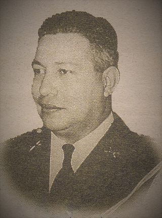
Óscar Osorio Hernández ruled as a member of the Revolutionary Council of Government from December 14, 1948 to September 14, 1950. He was President of El Salvador from September 14, 1950 until September 14, 1956.

Mapulaca is a municipality in the Honduran department of Lempira.
Santa Rosa Guachipilín is a city and municipality in the Santa Ana department of El Salvador situated close to the Lempa River.
Texistepeque is a city and municipality in the Santa Ana department of western El Salvador. It lies in the center of the department, north of Santa Ana and south of Metapán. It was founded by the Poqomam Maya peoples and conquered by the Pipil people of Cuzcatlan until the Spanish conquest. The meaning of its name comes from Pipil Nawat language and means place of eggs or alternatively mountain of eggs; from Nawat teksis (eggs), and tepec or tepet (mountain) which indicates a place name.

Salvadorans, also known as Salvadorians, are citizens of El Salvador, a country in Central America. Most Salvadorans live in El Salvador, although there is also a significant Salvadoran diaspora, particularly in the United States, with smaller communities in other countries around the world.

The Lempa River is a 422-kilometre-long (262 mi) river in Central America.
Cimarron Hydroelectric Power Project a hydroelectric power plant in El Salvador, that was to start construction in 2010. The plant would have been be located in the upper basin of the Lempa River, upstream of the Cerrón Grande Hydroelectric Dam. The proposed location of the dam was between the towns of Agua Caliente, Chalatenango on the left shore and Metapán, Santa Ana, on the right shore. A tunnel would divert water from the Lempa River to a powerhouse and substation to be built near Agua Caliente. With an estimated capacity of 261 megawatts, the project would have increased El Salvador's total generation capacity by almost 25%.
Water resources management in El Salvador is characterized by difficulties in addressing severe water pollution throughout much of the country's surface waters due to untreated discharges of agricultural, domestic and industrial run off. The river that drains the capital city of San Salvador is considered to be polluted beyond the capability of most treatment procedures.

The Spanish conquest of El Salvador was the campaign undertaken by the Spanish conquistadores against the Late Postclassic Mesoamerican polities in the territory that is now incorporated into the modern Central American country of El Salvador. El Salvador is the smallest country in Central America, and is dominated by two mountain ranges running east–west. Its climate is tropical, and the year is divided into wet and dry seasons. Before the conquest the country formed a part of the Mesoamerican cultural region, and was inhabited by a number of indigenous peoples, including the Pipil, the Lenca, the Xinca, and Maya. Native weaponry consisted of spears, bows and arrows, and wooden swords with inset stone blades; they wore padded cotton armour.

Canton El Tablón belonged to the Municipality of Suchitoto, Cuscatlan, El Salvador. El Tablón was one of many cantons in the surrounding area that was flooded as a result of the Cerron Grande Hydroelectric Dam built in El Salvador between 1972-1976 that created the artificial Lake Suchitlán. According to former residents of El Tablon, the area was divided up into four main wikt:caseríos or hamlets, Caserio La Hacienda Vieja, Caserio Los Figueroas, Caserio Valle El Tablón, and Caserio Los Palitos. It is unclear where the name El Tablon originated from, but according to local historians, an aldea or village/hamlet of El Tablón existed prior to 1860 that was formed through a municipal ejido. An ejido was commonly owned municipal land granted by the Spanish Crown to governing bodies in the Spanish Empire. These lands were considered vacant or unused land in some cases belonging to existing indigenous communities.
The Final offensive of 1981, also known as the General offensive of 1981, was the unsuccessful first military offensive conducted by the Farabundo Martí National Liberation Front (FMLN) during the Salvadoran Civil War. The objective of the offensive was to initiate a popular revolution to overthrow the Revolutionary Government Junta (JRG), which had been ruling the country since the 1979 Salvadoran coup d'état. The FMLN hoped that the government would be overthrown by 20 January 1981; the date Ronald Reagan was to be inaugurated as president of the United States.


