Devine is a city in Medina County, Texas, United States. The population was 4,350 at the 2010 census. It is part of the San Antonio Metropolitan Statistical Area.

Florida is a municipality of Puerto Rico located north of Ciales, south of Barceloneta, east of Arecibo, and west of Manatí. Florida is not like other municipalities of Puerto Rico with multiple subdivisions called barrios. It has one barrio called Florida Adentro and two other subdivisions: Florida Zona Urbana and Pajonal comunidad. It is part of the San Juan-Caguas-Guaynabo Metropolitan Statistical Area.

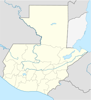
Zacapa is the departmental capital municipality of Zacapa Department, one of the 22 Departments of Guatemala. It is located approximately 112 kilometres (70 mi) from Guatemala City.

Brooklyn is a former city in Alameda County, California, now annexed to Oakland, California.

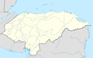
Villa de San Antonio is a municipality in the Honduran department of Comayagua.
San Antonio Aguas Calientes is a municipality in the Guatemalan department of Sacatepéquez.

Tonacatepeque is a municipality in the San Salvador department of El Salvador. It has a population of 90,896 inhabitants according to the 2007 Census. This makes this municipality twelfth largest in terms of population in El Salvador.

Chiclana de la Frontera is a town and municipality in southwestern Spain, in the province of Cádiz, Andalucía, near the Gulf of Cádiz. It belongs to the association of municipalities of the Bay of Cádiz, the provincial capital of Cádiz, Jerez de la Frontera, San Fernando, El Puerto de Santa María, Puerto Real and Rota which form the third largest metropolitan area in Andalusia, behind Seville and Málaga, and the twelfth largest in Spain. It is located 20 kilometres south-east from Cádiz, and borders the municipalities of San Fernando and Puerto Real to the north. In 1877, the municipality's population was 11,677; in 2012, it was 81,473. It has a surface area is 203 square kilometres (78 sq mi) and a population density of 401 inhabitants / km2. The average elevation is 11 metres (36 ft) above sea level. The economy depends largely upon modern industry, especially salt processing and tourism, and the municipality is known for its beaches such as the 6 kilometres (3.7 mi) long Playa de la Barrosa, hotels and golf courses in the resort of Novo Sancti Petri. The municipality contains the largest number of hotel beds in the Province of Cádiz and the Costa de la Luz. The town's newspaper, Chiclana Información, is distributed on Saturday mornings.
San Antonio del Monte is also a subdivision of Garafía in the island of La Palma in the Canary Islands

San Antonio La Paz is a town and municipality in the El Progreso department of Guatemala. The municipality is situated at 1240 metres above sea level and covers an area of 146 km². San Antonio has improved in the past couple of years. San Antonio has two pharmacies and many doctors. Each house in San Antonio has a little of room that is sort of a forest of a little plantation for growing corn, coffee, beans, and other plants. There are trees all over San Antonio of all kind of fruit, apples, mangos, bananas, jocotes, oranges, lemons, limes, and other fruit.
San Isidro de Maino is a district of the province of Chachapoyas in Peru. Its capital is the town of San Isidro de Mayno.

Cerro San Antonio is a town and municipality of the Colombian Department of Magdalena. Founded on June 13, 1750 by Fernando de Mier y Guerra near the Magdalena River. The Libertador Simon Bolivar visited this town on May 23, 1813 during the War of Independence of Colombia from Spain.

The founders of Municipio of Monción were: Joaquin Izquierdo, Anastasio Valle, Luis José Saldá, Tomas Genao, Dionisio Bueno y Siriaco Peralta.

Cuevas Bajas is a town and municipality in the province of Málaga, part of the autonomous community of Andalusia in southern Spain. It belongs to the comarca of Nororma. It is part of the judicial district of Archidona. The municipality is situated 75 kilometers from Málaga and 495 km from Madrid In 2011 it had a population of 1,482 inhabitants. Its surface area is 16.53 km2. Cuevas Bajas has a density of 89.66 inhabitants/km2. The natives are called Cueveños.

Tekantó Municipality is a small (47.25 km²) municipality in the Mexican state of Yucatán. The municipality was formed in 1900 and its municipal seat is the homonymous locality of Tekantó, at the end of highway 80, 54 km east of Merida.
Pajonal is a corregimiento in Penonomé District, Coclé Province, Panama with a population of 13,565 as of 2010. Its population as of 1990 was 10,232; its population as of 2000 was 12,097.
Real Pajonal is a Salvadoran professional football club based in San Antonio Pajonal, Santa Ana Department, El Salvador.
Pajonal is a corregimiento in Penonomé District, Coclé Province, Panama.


