Erica, Emmen

Last updated
Erica
Zw.Havenstraat.2.Erica.jpg
2010-NL-P03-Drenthe-positiekaart-gemnamen.jpg
Red pog.svg
Erica
Location in province of Drenthe in the Netherlands
Netherlands location map.svg
Red pog.svg
Erica
Erica (Netherlands)
Coordinates: 52°42′55″N6°55′33″E / 52.71532°N 6.92596°E / 52.71532; 6.92596 Coordinates: 52°42′55″N6°55′33″E / 52.71532°N 6.92596°E / 52.71532; 6.92596
Country Netherlands
Province Drenthe
Municipality Emmen
Established1863
Area
[1]
  Total24.53 km2 (9.47 sq mi)
Elevation
[2]
16 m (52 ft)
Population
 (2021) [1]
  Total4,740
  Density190/km2 (500/sq mi)
Time zone UTC+1 (CET)
  Summer (DST) UTC+2 (CEST)
Postal code
7887 [1]
Dialing code 0591

Erica (also Nieuw-Slagharen [3] ) is a town in the north-eastern Netherlands. It is located in Emmen, Drenthe. [4] It started as a peat and buckwheat colony.

Contents

History

Erica was established in 1863. [3] The first inhabitant came from Slagharen. [5] :67 A fuel shortage prompted large-scale efforts to drain the peat in the area and cut them for fuel. People were drawn to the area and canals were dug, both to drain the peat and to transport the cuts. Buckwheat was farmed on the drained peats. [3] It was originally called Nieuw-Slagharen, but has been renamed Erica after the heath plant. [6]

Erica started as a linear settlement. In 1867, the Hoogeveense Vaart  [ nl ] was dug, and a second settlement was constructed. Later, the two were merged. [3] Many of the early inhabitants of Erica came from neighbouring Germany and were Roman Catholic, and in 1866, a Catholic church was built. The current church dates from 1933. [7] [8] In 1932, Erica was home to 2,663 people. [5] :89

In 1897, the windmill De Heidebloem was constructed. It was restored in 1978, and is still in use to grind grain. [3] [7] In the 1960s, greenhouse cultivation started in Erica. [9] Erica can reached via the A37 motorway. [10]

Related Research Articles

Vroomshoop Town in Overijssel, Netherlands

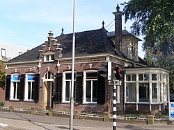
Vroomshoop is a town located at the center of the municipality Twenterand in the Dutch province of Overijssel and was founded around 1859. The earliest inhabitants lived from the peat that was found in the nearby area.

Emmen, Netherlands Municipality and town in Drenthe, Netherlands

Emmen is a municipality and town of the province of Drenthe in the northeastern Netherlands.

Barger-Compascuum Village in Drenthe, Netherlands

Barger-Compascuum is a village in the Dutch municipality of Emmen. It is in a peat-producing region of Drenthe. Veenpark, an open-air museum, is dedicated to the peat history of the region.

Ter Apelkanaal Village in Groningen, Netherlands

Ter Apelkanaal is a town in the Dutch province of Groningen. It is a part of the municipality of Westerwolde, and lies about 17 km (11 mi) northeast of Emmen.

Nieuw-Amsterdam, Netherlands Village in the Dutch province of Drenthe

Nieuw-Amsterdam is a village in the northeast Netherlands, in the Dutch province of Drenthe. It borders the village of Veenoord, the twin village of Nieuw-Amsterdam. Since 1998 Nieuw-Amsterdam and Veenoord are part of the municipality of Emmen.

Schoonebeek Village in Drenthe, Netherlands

Schoonebeek is a village in the Dutch province of Drenthe. It is located in the municipality of Emmen, about 12 km (7 mi) south of that city. Schoonebeek was a separate municipality from 1884 to 1997, when it merged with Emmen. The area is home of the largest onshore oil field in Europe; known as the Schoonebeek oil field.

Wezuperbrug is a village in the Netherlands. It is a part of the Coevorden municipality in Drenthe.

Klazienaveen Place in Drenthe, Netherlands

Klazienaveen is a town to the southeast of Emmen in the Dutch province of Drenthe. It is located approx 5 km (3.1 mi) from the German border. Klazienaveen started as a peat colony owned by Willem Albert Scholten. It has been named after Klaassien Sluis, the wife of Scholten.

Emmer-Compascuum Village in Drenthe, Netherlands

Emmer-Compascuum is a village in the Netherlands and is part of the Emmen municipality in Drenthe.

Nieuw-Dordrecht Village in Drenthe, Netherlands

Nieuw-Dordrecht is a village in the Netherlands and it is part of the Emmen municipality in Drenthe. The village is home to Museum Collectie Brands, a museum which houses the extensive collection of items collected and gathered by Jans Brands.

Nieuw-Schoonebeek Village in Drenthe, Netherlands

Nieuw-Schoonebeek is a village in the Netherlands and is part of the Emmen municipality in Drenthe.

Nieuw-Weerdinge Village in Drenthe, Netherlands

Nieuw-Weerdinge is a village in the Netherlands and is part of the Emmen municipality in Drenthe.

Veenoord Village in Drenthe, Netherlands

Veenoord is a village in the Netherlands and it is part of the Emmen municipality in Drenthe. It forms a single urban area with Nieuw-Amsterdam. Vincent van Gogh stayed in the Scholte Inn during his Drenthe period.

Weiteveen Village in Drenthe, Netherlands

Weiteveen is a village in the Netherlands and is part of the Emmen municipality in Drenthe.

Zwartemeer Village in Drenthe, Netherlands

Zwartemeer is a village in the Netherlands and it is part of the Emmen municipality in Drenthe. It is located on the border with Germany.

Amsterdamscheveld Hamlet in Drenthe, Netherlands

Amsterdamscheveld is a hamlet in the Netherlands and is part of the Emmen municipality in Drenthe.

Oranjedorp Village in Drenthe, Netherlands

Oranjedorp is a village in the Netherlands and it is part of the Emmen municipality in Drenthe.

Nieuw-Roden Village in Drenthe, Netherlands

Nieuw-Roden is a village in the Netherlands and is part of the Noordenveld municipality in Drenthe.

Bourtange moor Bog area in northern Germany and Netherlands

The Bourtanger Moor was a bog in eastern parts in the Dutch provinces of Drenthe and Groningen and the bordering German districts of Bentheim and Emsland. A remaining stretch on the border between Drenthe and the districts Emsland and Betheim is now a nature reserve, the Internationaler Naturpark Bourtanger Moor-Bargerveen.

Musselkanaal Town in Groningen, Netherlands

Musselkanaal is a town in the Dutch province of Groningen. It is located in the municipality of Stadskanaal. It was established by the city of Groningen in the 1840s to exploit the peat. It used to be part of the municipality of Onstwedde, but was merged into Stadskanaal in 1968.

References

  1. 1 2 3 "Kerncijfers wijken en buurten 2021". Central Bureau of Statistics. Retrieved 10 March 2022. Two listings
  2. "Postcodetool for 7887AA". Actueel Hoogtebestand Nederland (in Dutch). Het Waterschapshuis. Retrieved 10 March 2022.
  3. 1 2 3 4 5 Ronald Stenvert (2001). Erica (in Dutch). Zwolle: Waanders. p. 119. ISBN   90 400 9454 3 . Retrieved 9 March 2022.
  4. Stratenatlas van Nederland: alle straten, lanen, pleinen, steegjes en wegen. Spectrum. 1984. ISBN   978-90-274-8313-3.
  5. 1 2 Jan Harm Tuntler (1935). In en om de gemeente Emmen (in Dutch). Ten Kate.
  6. "Erica - (geografische naam)". Etymologiebank (in Dutch). Retrieved 10 March 2022.
  7. 1 2 "Erica". Plaatsengids (in Dutch). Retrieved 10 March 2022.
  8. "Erica". Serc (in Dutch). Retrieved 10 March 2022.
  9. "Glastuinbouw in Erica". Tuinbouw Emmen (in Dutch). Retrieved 10 March 2022.
  10. "Raad Emmen: 'Laatste woord over zonnewand A37 nog niet gezegd'". RTV Drenthe (in Dutch). 7 June 2021. Retrieved 10 March 2022.