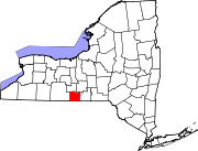
Chemung County is a county in the U.S. state of New York. The population was 84,148 as of the 2020 census. Its county seat is Elmira. Its name is derived from a Delaware Indian village whose name means "big horn" in the Seneca language. The county is part of the Southern Tier region of the state.
Chemung is a town in Chemung County, New York, United States. The population was 2,368 at the 2020 census. The town name is derived from the Chemung River, which means "big horn" in the Seneca language.
Erin is a town in Chemung County, New York, United States. The population was 1,820 at the 2020 census. The town was named by early settlers from Ireland.
Horseheads North is a census-designated place (CDP) in Chemung County, New York, United States. It is part of the Elmira Metropolitan Statistical Area. As of the 2010 census, the population of the CDP was 2,843.
Big Flats is an unincorporated community and census-designated place (CDP) within the town of Big Flats in Chemung County, New York, United States. The population of the CDP was 5,277 at the 2010 census, out of a total population in the town of 7,595.
Big Flats is a town in Chemung County, New York, United States. The population was 7,822 at the 2020 census. The town is on the western border of the county, west of Elmira. It is part of the Elmira Metropolitan Statistical Area. The town contains a hamlet also named Big Flats.
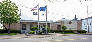
Horseheads is a village in Chemung County, New York, United States. The population was 6,606 at the 2020 census. The name is derived from the number of bleached skulls of pack horses left behind by the Sullivan Expedition.

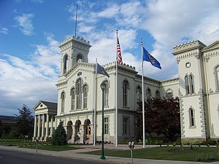
Horseheads is a town in Chemung County, New York, United States. The population was 19,412 at the 2020 census. The name of the town is derived from the number of bleached horses' skulls once found there.

Southport is a town in Chemung County, New York, United States. The population was 9,684 according to the 2020 census. The town is located in the southwestern corner of Chemung County and is southwest of the city of Elmira. It is part of the Elmira Metropolitan Statistical Area.

Pine Plains is a hamlet and census-designated place (CDP) in Dutchess County, New York, United States. The population was 1,142 at the 2020 census. It is part of the Poughkeepsie–Newburgh–Middletown, NY Metropolitan Statistical Area as well as the larger New York–Newark–Bridgeport, NY-NJ-CT-PA Combined Statistical Area.
Coopers Plains is a hamlet and census-designated place (CDP) in the towns of Erwin and Campbell in Steuben County, New York, United States. As of the 2010 census, it had a population of 598.
Breesport is a hamlet and census-designated place in the town of Horseheads in Chemung County, New York, United States. The population was 626 at the 2010 census.
Belleville is a hamlet and census-designated place (CDP) in the town of Ellisburg, Jefferson County, New York, United States. The population was 226 at the 2010 census.
Dalton is a hamlet and census-designated place (CDP) in the towns of Nunda and Portage in Livingston County, New York, United States. The population was 362 at the 2010 census.
Pine Valley is a hamlet and census-designated place in the towns of Catlin and Veteran in Chemung County, New York, United States. The population was 813 at the 2010 census.
Virgil is a hamlet and census-designated place (CDP) in the town of Virgil, Cortland County, New York, United States. The population was 298 at the 2020 census.
Henderson is a hamlet and census-designated place (CDP) in the town of Henderson, Jefferson County, New York, United States. The population of the CDP was 224 at the 2010 census, out of 1,360 in the entire town of Henderson.
Greigsville is a hamlet and census-designated place (CDP) in the town of York, Livingston County, New York, United States. Its population was 209 as of the 2010 census. The community is located at the intersection of New York State Route 36 and New York State Route 63.
Kysorville is a hamlet and census-designated place (CDP) in the town of West Sparta, Livingston County, New York, United States. Its population was 110 as of the 2010 census.
Wadsworth is a hamlet and census-designated place (CDP) in the town of York, Livingston County, New York, United States. Its population was 190 as of the 2010 census. New York State Route 36 passes through the community.